Walking through the thornveld at Okonjima just after dawn, our tracker's antenna picked up a very faint pulse, and, carefully and as quietly as we could, we followed the signal on foot through waist-high grass still silvered with dew. The tracker had picked up the signal of a leopard, and at a respectful distance, one safe enough for both the animal and us, we patiently walked closer to its location in the same way researchers have done here for decades. There are few places in Namibia, perhaps in the whole of Africa, where you can, along with a guide, track big cats, and fewer still that will let a visitor stand quite so close. But Okonjima Nature Reserve, which sits in the Omboroko Mountains, roughly two and a half hours north of Windhoek, is home to the Africat Foundation, one of the country's longest-running big cat conservation organisations, and is one of the best places to have just such an experience. This is not a roadside attraction with a few enclosures and a gift shop. It is a working reserve where rehabilitation, research and tourism sit alongside one another, each funding and informing the other. Why Visit Okonjima Nature Reserve Most safari itineraries in Namibia are fairly similar, in both the featured destinations and pace. Sossusvlei one week, Etosha the next, and a coastal detour if time allows. Okonjima is one of the safari destinations that often gets completely left off. The reserve consists of 22 000 hectares of what was once mountain and bushveld used for farming. The land has been painstakingly returned to wilderness in a process carried out over more than thirty years, and that commitment to conservation can be seen in the density and health of the wildlife now living there. The reserve was purpose-built around
Walking through the thornveld at Okonjima just after dawn, our tracker’s antenna picked up a very faint pulse, and, carefully and as quietly as we could, we followed the signal on foot through waist-high grass still silvered with dew.
The tracker had picked up the signal of a leopard, and at a respectful distance, one safe enough for both the animal and us, we patiently walked closer to its location in the same way researchers have done here for decades.
There are few places in Namibia, perhaps in the whole of Africa, where you can, along with a guide, track big cats, and fewer still that will let a visitor stand quite so close.
But Okonjima Nature Reserve, which sits in the Omboroko Mountains, roughly two and a half hours north of Windhoek, is home to the Africat Foundation, one of the country’s longest-running big cat conservation organisations, and is one of the best places to have just such an experience.
This is not a roadside attraction with a few enclosures and a gift shop. It is a working reserve where rehabilitation, research and tourism sit alongside one another, each funding and informing the other.
Why Visit Okonjima Nature Reserve
Most safari itineraries in Namibia are fairly similar, in both the featured destinations and pace.
Sossusvlei one week, Etosha the next, and a coastal detour if time allows. Okonjima is one of the safari destinations that often gets completely left off.
The reserve consists of 22 000 hectares of what was once mountain and bushveld used for farming. The land has been painstakingly returned to wilderness in a process carried out over more than thirty years, and that commitment to conservation can be seen in the density and health of the wildlife now living there.
The reserve was purpose-built around the Africat Foundation’s conservation work, which began in the 1990s when local farmers, aided by the Hanssen family, who founded Africat, started caring for orphaned and injured carnivores rather than removing them from the land.
That single decision has determined everything that followed, and it gives a visit here a real sense of purpose, one that goes beyond ticking off sightings, as your visit contributes to the continuation of the foundation and its important work.
What Activities Are There to Enjoy
The most popular activity also happens to be the biggest reason why people come here in the first place.
Guests can join guided leopard tracking on foot or by vehicle, following the signals sent from collared animals across the reserve with an experienced tracker narrating the terrain as they go.
Cheetah tracking runs on a similar principle, usually earlier in the day, when the cats are most active, and the light is soft enough to hold onto.
Aside from the tracking, there are guided nature drives through the reserve’s varied terrain, which changes from open plains to rocky outcrops, and there are also night drives that show off a different Okonjima entirely, with aardwolf, porcupine, and the occasional pangolin moving through the dark.
A visit to the AfriCat Information Centre and its viewing hide rounds out the experience nicely, and it is particularly fun for families or anyone short on time.
What Animals Live in the Reserve
Okonjima is best known for its leopard population. In fact, it is home to one of the highest concentrations of wild leopard anywhere in Namibia, largely a result of decades of protection and habitat restoration.
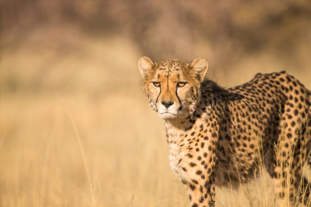
Cheetahs are also regularly seen moving through the open grassland in the reserve’s southern reaches, while brown hyena and caracal can also call the park home, although they are present in smaller, more elusive numbers.
The reserve has kudu, oryx, warthog and a healthy population of smaller mammals, all of which can be seen throughout the ecosystem, and birdlife is something to behold, with the various raptors being a highlight for anyone travelling with binoculars.
About The Africat Foundation and Why You Must Make Time to Visit
The Africat Foundation has treated and released well over a thousand carnivores since it began, and its current focus sits on research, rather than housing the animals long-term.
Radio collaring, population monitoring and community education programmes across northern Namibia form the backbone of its work, much of it funded directly by guest visits to Okonjima, which is a major reason why you should make the time to visit here.
A stop at the Africat Foundation’s headquarters, with its small museum and rehabilitation facility, answers the question every safari guest here eventually asks, which is what happens to an animal once the vehicle drives away, and how can a place like this keep a species like the Namibian leopard from completely disappearing.
For travellers building a Namibia itinerary that already includes Etosha or the Skeleton Coast, Okonjima fits naturally as a stop between Windhoek and the north, and it can give you something the bigger reserves rarely can: proximity, purpose, and a morning spent following one of Africa’s most intriguing animals on foot.
The Africat Foundation is known for its long-running work rehabilitating and researching Namibia’s large carnivores, particularly leopard and cheetah, from its base at Okonjima Nature Reserve.
Okonjima sits roughly two and a half hours’ drive north of Windhoek, making it a practical first or last stop on a Namibia self-drive route.
Yes, guided leopard tracking on foot or by vehicle is one of Okonjima’s signature activities, using radio collar signals to locate specific animals within the reserve.
Both work well. A single tracking activity and a stop at the information centre can be done in half a day, though an overnight stay allows time for a nocturnal drive as well.
Yes, guest activities and accommodation revenue at Okonjima fund the Africat Foundation’s research, rehabilitation and community education programmes across northern Namibia.
About the Authors African Travel Concept Namibia Team
At African Travel Concept Namibia, our team of experienced travel and safari professionals is dedicated to turning first-hand African expertise into clear, reliable advice. We research, review, and refine every article so you have the most current and accurate information when planning your trip.
There is a sound that visitors to Bwabwata mention before anything else when recounting the tales of their trip. It is not the typical safari sounds, like the roar of a lion or the trumpet of an elephant, though both arrive soon enough, but of water. Moving water, over stones, through reeds, past the roots of a jackalberry tree leaning into the current. The local name for this place means the sound of bubbling water, and once you have heard it at dawn, you understand why nobody thought to call it anything else. Most guides to Namibia rush past Bwabwata on the way to somewhere else, leaving it to become an awkward paragraph wedged briefly between Etosha and the Skeleton Coast. That is a mistake, and rather a large one, because it would leave you to assume that this is not a park worth seeing. But this place is unlike any other Namibian destination, one that is built entirely around two rivers, is home to some of the densest buffalo populations left on the continent, and is one of the last places in the country where wild dogs still run. Bwabwata is an adventure destination, one that nomads and solo travellers will get a big kick out of and a place where there’s hardly ever another soul in sight for most of the day. It is not a typical safari destination, and it hardly seems to belong in a country best known for its desert, but Bwabwata, when planned right, is an itinerary highlight. Where is Bwabwata National Park Located? Bwabwata sits in the far northeast of Namibia, in the narrow finger of land once known as the Caprivi Strip and now called the Zambezi region. It is a strange piece of geography, a corridor barely forty kilometres wide stretched
There is a sound that visitors to Bwabwata mention before anything else when recounting the tales of their trip.
It is not the typical safari sounds, like the roar of a lion or the trumpet of an elephant, though both arrive soon enough, but of water.
Moving water, over stones, through reeds, past the roots of a jackalberry tree leaning into the current.
The local name for this place means the sound of bubbling water, and once you have heard it at dawn, you understand why nobody thought to call it anything else.
Most guides to Namibia rush past Bwabwata on the way to somewhere else, leaving it to become an awkward paragraph wedged briefly between Etosha and the Skeleton Coast.
That is a mistake, and rather a large one, because it would leave you to assume that this is not a park worth seeing.
But this place is unlike any other Namibian destination, one that is built entirely around two rivers, is home to some of the densest buffalo populations left on the continent, and is one of the last places in the country where wild dogs still run.
Bwabwata is an adventure destination, one that nomads and solo travellers will get a big kick out of and a place where there’s hardly ever another soul in sight for most of the day.
It is not a typical safari destination, and it hardly seems to belong in a country best known for its desert, but Bwabwata, when planned right, is an itinerary highlight.
Where is Bwabwata National Park Located?
Bwabwata sits in the far northeast of Namibia, in the narrow finger of land once known as the Caprivi Strip and now called the Zambezi region.
It is a strange piece of geography, a corridor barely forty kilometres wide stretched across nearly two hundred kilometres, squeezed between Angola to the north and Botswana to the south.
The Okavango River marks its western edge, the Kwando its eastern one, and the park exists almost entirely because of what happens between those two waterways.
The name itself comes from a small village within the park’s boundaries. In the local language, Bwabwata translates loosely to the sound of bubbling water, a reference to the rapids and channels that thread through the reserve. It is a rare thing in African conservation, a park named not for a chief, a colonial administrator, or a geological feature, but for a noise.
And while the babbling sound of water would leave you thinking this place has always been calm, its history has been anything but peaceful.
The land was first proclaimed a nature reserve in the 1960s, then reclassified as the Caprivi Game Park in 1968.
For the following two decades it functioned as a military zone under the South African Defence Force, closed to almost everyone but soldiers, its wildlife left largely to fend for itself along a tense and heavily patrolled border.
Namibia’s independence in 1990 brought freedom to the park too, as Namibia’s new government commissioned surveys of what remained, found both wildlife and around five thousand resident people, and set about building something unusual: a park where humans and animals were not separated by fences but rather given a peaceful co-existence through very careful planning.
In 2007, the former Caprivi Game Park merged with Mahango Game Reserve and the Buffalo core area to become Bwabwata National Park as it exists today, covering roughly 6 270 square kilometres.
That people-first approach remains central to how the park runs.
Local conservancies manage tourism concessions and campsites within Bwabwata’s boundaries, earning income directly from the wildlife on their land. It is one of the more thoughtful conservation models on the continent, and one worth knowing about before you arrive, because it determines almost everything you will see and do here.
What Animals are in Bwabwata National Park?
Elephant numbers here are difficult to overstate.
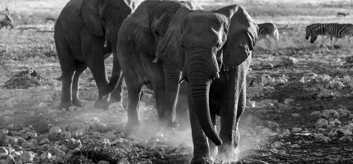
Bwabwata forms a big part of the Kavango-Zambezi Transfrontier Conservation Area, a five-nation initiative larger than Germany and Austria combined, and the park’s rivers are a principal crossing point for huge herds of elephant moving between Botswana, Namibia, Angola and Zambia.
If you stand near the Kwando in the late afternoon, you may watch a hundred or more cross within the hour, slowly, with the matriarchs testing the current before allowing their young calves to walk across.
Buffalo are also frequently seen in the park.
In fact, Bwabwata is widely regarded as the best place in Namibia to see them, with herds numbering in the hundreds moving through what is known as the Buffalo core area and along the floodplains.
Lion, leopard, cheetah and spotted hyaena all tend to follow where the buffalo go, and the park remains one of the last Namibian refuges for African wild dog, a species now rare enough across the continent that any sighting is one that you will be retelling for years afterwards.
The rivers themselves are also full of life.
Sightings of hippopotamus and crocodile are near certainties on any boat trip. Sitatunga, a shy, semi-aquatic antelope with splayed hooves built for wading through papyrus, live almost nowhere else in Namibia in any real numbers but here in Bwabwata.
Red lechwe move through the floodplains in loose herds, roan and sable antelope favour the drier woodland further from the water, and greater kudu, tsessebe, wildebeest and zebra fill in the rest of the picture.
Birders tend to lose track of time in Bwabwata, and with good reason.
There are close to four hundred and fifty species living here, and the Mahango area alone is classed as an internationally important bird area.
Wattled crane, slaty egret, African skimmer, Pel’s fishing owl and the striking southern ground hornbill all turn up with enough regularity that you’ll want to make sure that you pack a good camera and a decent pair of binoculars so that you can get a nice, up close view of them, and maybe a portrait or two.
When is the Best Time to Visit Bwabwata National Park?
The dry season, running roughly from May to October, is when Bwabwata wildlife can be seen in abundance.
Much like the rest of Southern Africa, during the dry winter months, the bush dies back away from the water, and elephants, buffalo and antelope concentrate along the Kwando and Okavango in large numbers, making game drives and boat trips extraordinarily eventful.
June through August brings the coolest, most comfortable temperatures for spending long days outdoors, while September and October turn hot and dusty, with animal sightings at their most concentrated as the land thirsts for the first rejuvenating rains.
The wet months, from November to April, tell a whole different story.
Rain turns the woodland into a deep green, migratory birds arrive in their thousands, and the floodplains fill with life in an almost theatrical fashion after the dustiness of winter.
Wildlife disperses more widely across the park during this period, which means sightings require a bit more effort and a lot more patience, but if you travel during this off-season, the landscape is one that few visitors ever photograph; lush and humid and startlingly alive.
Whichever season you choose, you need to keep in mind that Bwabwata sits within a malaria area, and for that reason you will want to have a chat with a travel doctor about suitable prophylactics well before your departure.
Where to stay in Bwabwata National Park?
Accommodation within Bwabwata tends toward the intimate and luxurious rather than the sprawling and conventional. In a way, this is a reflection of the park’s low-impact, community-partnered approach to tourism.
Nambwa Tented Lodge, set within the Kwando core area on stilts above the floodplain, is one of the most sought-after places to stay in the region. Its tented suites look directly onto water that draws elephant and buffalo throughout the day.
Kazile Island Lodge, positioned on its own island in the Kwando River, will give you a similarly immersive stay with a genuine sense of being removed from anywhere else.
For those travelling toward the western, Mahango side of the park, Mahangu Safari Lodge and the riverside Ngepi Camp both make comfortable, well-placed bases, the latter known for its slightly eccentric charm and a swimming pool that floats directly on the Okavango.
Namushasha River Lodge, a little further east along the Kwando, rounds out the more established options.
Self-drive travellers with a 4×4 are equally well catered for.
There are three community-run campsites, at Ngoabaca near Popa Falls, Nambwa, and Bum Hill, that will put you directly under the same trees the wildlife walks past each morning. These sites are run by the conservancies themselves and will give you a rather more grounded way to experience the park.
Bwabwata National Park deserves a spot on your itinerary, especially if you want to see a different side of the country.
Bwabwata National Park lies in northeastern Namibia, within the Zambezi region, bordered by the Okavango River to the west, the Kwando River to the east, Angola to the north and Botswana to the south.
Bwabwata is named after a village within the park and translates loosely from the local language as the sound of bubbling water, a reference to the rapids and channels along its rivers.
Bwabwata is known for large elephant and buffalo populations, along with lion, leopard, cheetah, spotted hyaena and one of Namibia’s last remaining wild dog populations. Hippo, crocodile, sitatunga and red lechwe are common along the rivers, and close to 450 bird species have been recorded.
The dry season, from May to October, will give you the best wildlife viewing as animals gather near the rivers. The wet season, from November to April, brings migratory birds and lush green scenery, though sightings require more patience.
Yes. Bwabwata offers some of Namibia’s best buffalo and elephant viewing, a genuine wild dog population, rich birdlife and a distinctive community-based conservation model, all with fewer visitors than better-known parks such as Etosha.
About the Authors African Travel Concept Namibia Team
At African Travel Concept Namibia, our team of experienced travel and safari professionals is dedicated to turning first-hand African expertise into clear, reliable advice. We research, review, and refine every article so you have the most current and accurate information when planning your trip.
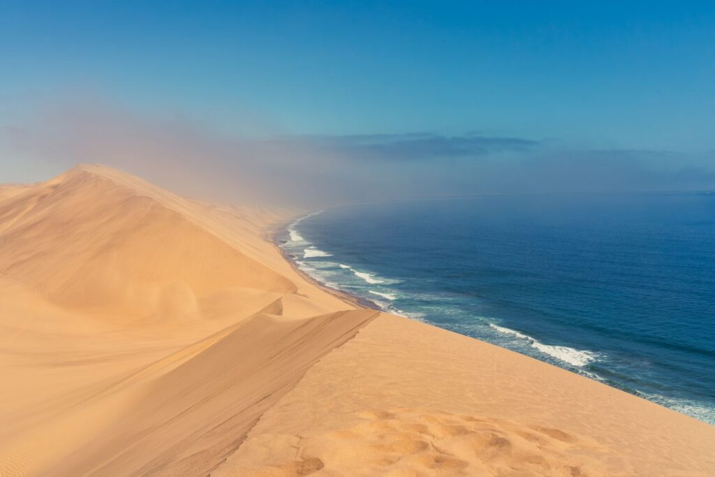
If the name sounds familiar, it might be because you've seen Sandwich Harbour mentioned in one of the destination guides you’ve read while planning your tour. It was probably on a "top ten Namibia" list, buried somewhere between Sossusvlei and the Spitzkoppe. You read the description, glanced at that typical photo of the Namib Desert meeting the ocean, and moved on. It looked interesting, maybe, but not worth the drive, what with the four-wheel-drive required, the road conditions questionable, the facilities minimal, and the fact that there are other far easier places to spend a day. But despite Sandwich Harbour needing a decent vehicle, some road confidence, and the willingness to drive 80 kilometres across salt pans and coastal desert to reach a lagoon where the only footprints in the sand are yours, your trip here will give you a place where wildlife is plentiful, and where the landforms are utterly bewildering. And since it is such a remote spot, you will have the unique honour of being among the few who decided that Sandwich Harbour is worth every effort. Where Sandwich Harbour Sits on the Namibian Map Sandwich Harbour lies roughly 80 kilometres south of Walvis Bay along Namibia's Skeleton Coast, and the name comes with a little bit of history. In the 1780s, the British whaling ships *Sandwich* and *Penguin* sought shelter here, in the natural harbour, during one of the region's terrible storms. It soon became a popular spot for ships and remained in use until the 1950s, when whale populations collapsed. Today, the harbour has minimal infrastructure, and it is used for basic pit stops. The area surrounding the harbour is now a protected national park where human activity is deliberately kept minimal. The location of the harbour occupies a liminal space where salt pans give
If the name sounds familiar, it might be because you’ve seen Sandwich Harbour mentioned in one of the destination guides you’ve read while planning your tour.
You read the description, glanced at that typical photo of the Namib Desert meeting the ocean, and moved on.
It looked interesting, maybe, but not worth the drive, what with the four-wheel-drive required, the road conditions questionable, the facilities minimal, and the fact that there are other far easier places to spend a day.
But despite Sandwich Harbour needing a decent vehicle, some road confidence, and the willingness to drive 80 kilometres across salt pans and coastal desert to reach a lagoon where the only footprints in the sand are yours, your trip here will give you a place where wildlife is plentiful, and where the landforms are utterly bewildering.
And since it is such a remote spot, you will have the unique honour of being among the few who decided that Sandwich Harbour is worth every effort.
Where Sandwich Harbour Sits on the Namibian Map
Sandwich Harbour lies roughly 80 kilometres south of Walvis Bay along Namibia’s Skeleton Coast, and the name comes with a little bit of history.
In the 1780s, the British whaling ships *Sandwich* and *Penguin* sought shelter here, in the natural harbour, during one of the region’s terrible storms.
It soon became a popular spot for ships and remained in use until the 1950s, when whale populations collapsed.
Today, the harbour has minimal infrastructure, and it is used for basic pit stops. The area surrounding the harbour is now a protected national park where human activity is deliberately kept minimal.
The location of the harbour occupies a liminal space where salt pans give way to salt marshes, where dunes stabilise into scrub vegetation, and where the ocean air intersects with arid heat to create something ecologically distinct and unique.
This geography is what makes Sandwich Harbour a home to wildlife that exists nowhere else in Namibia.
What You’ll See when you get to Sandwich Harbour
The wildlife at Sandwich Harbour is almost surreal, especially if you are coming to the area from the desert or from Etosha.
One of the most remarkable encounters you’ll have, if you travel during the right season, is flamingos, which mass here in the thousands. The huge colonies turn sections of the lagoon pink.
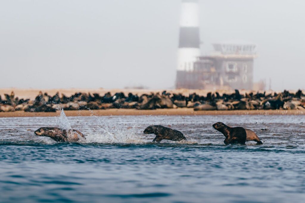
The area is also home to Cape fur seals, who can often be spotted out on rocky outcrops and behave as though humans are simply part of the scenery (because, to them, you mostly are).
You might also catch sight of Jackals hunting in pairs across the tidal flats and oryx moving along the salt pans. Spot-necked otters sometimes appear in the lagoon itself.
The bird population in Sandwich Harbour is also something to see and includes Damara terns, white-winged terns, and African fish eagles.
The landscape itself is one of the biggest reasons why people travel to this remote place.
The salt pans stretch for kilometres, giving the land that distinctive moon-like appearance and the surrounding dunes stabilise into vegetated ridges, giving your eyes a feast. The contrast between the barren flats and greening vegetation is something to behold, and it makes for quite the photographic subject.
The light here also has a particular quality. Without the dust haze of inland areas, you are treated to clarity extending to the horizon, which again is something every landscape photographer can appreciate.
Driving to Sandwich Harbour
The route to Sandwich Harbour is not a casual drive, and don’t let any other guide make you think otherwise.
The road leaves Walvis Bay as a proper gravel highway, but then deteriorates into a salt pan.
Salt pans are fundamentally different from desert sand. They’re harder, more abrasive, and unforgiving to tyres and suspension. They also change a lot, and in places the “road” becomes a series of parallel tracks where other drivers have done their best to find the firmest ground.
In wet conditions, sections become treacherous.
If you are driving yourself, you will need to hire a high-clearance 4×4 vehicle, because a standard SUV will struggle on such terrain, and you don’t want to end up stuck in the middle of nowhere.
Your fuel consumption is also going to be far higher than you’d expect, and that is because of road conditions.
You need to be very attentive when driving here. The terrain looks repetitive until it suddenly doesn’t, and it’s easy to veer into soft ground or miss turnoffs.
Most vehicles travel at 40 to 60 kilometres per hour for the majority of the route.
A guided tour is hands down the best option, even if you just sign up for a day trip. A professional driver knows the current state of the salt pan, they carry recovery equipment, they understand seasonal changes in road conditions, and they can spend the drive sharing knowledge about wildlife and geology rather than concentrating on not getting stuck.
Self-driving is possible if you’re comfortable with four-wheel drive, if you’ve driven salt pans before, and if you’re willing to accept the risk of breakdown far from immediate help.
But most visitors find that guided tours give them the best experience.
The Best Time to Visit Sandwich Harbour
You’ll want to visit Sandwich Harbour during the dry months from May through October.
During this time of the year, the road is safer, and you’ll still have excellent visibility and plenty of wildlife sightings.
Although these are winter months, the temperatures stay mild enough that sitting still on the lagoon shore isn’t uncomfortable.
Summer months bring heat and occasional flooding, and the rains can render sections of the salt pan briefly impassable.
The best time specifically falls between June and September, when conditions are most reliable, and wildlife is actively using the lagoon.
Sandwich Harbour is always going to be off the beaten track.
It sits outside the standard circuit, it demands some courage to see, and it doesn’t come with luxury accommodation or manicured amenities.
Nothing about Sandwich Harbour has been designed for tourists, but that is why it is appealing to those who like to take the road less travelled.
If you’ve been putting this off, take this as your sign to book a tour with an operator who knows the salt pans and knows this coast.
Give yourself a full day and make sure you arrive early. The flamingos will be waiting, the seals won’t care that you’ve come, and the landscape will rewrite what you thought you knew about Namibia.
Approximately 80 kilometres. The journey takes between two and three hours, depending on road conditions and how often you stop to observe wildlife. This is close enough for a long day trip but distant enough to feel genuinely removed from coastal towns. Most visitors leave early in the morning and return by late afternoon.
Only if you rent a high-clearance four-wheel-drive and have genuine experience driving salt pans and sandy terrain. Standard rental cars are unsuitable. Even experienced drivers find guided tours worthwhile because navigating while watching for wildlife is difficult. Local guides also carry satellite communication if a breakdown occurs, which matters when you’re 80 kilometres from town.
Flamingos and seals are virtually guaranteed. Cape jackals are common. Oryx sightings are frequent. Bird life is abundant. That said, wildlife sightings are never guaranteed. Conditions and animal behaviour vary. A good guide maximises your chances by knowing where animals typically congregate and what time of day produces the best sightings.
Yes. Salt pans demand respect and skill. Soft patches exist. Tyres can puncture. Vehicles do get stuck. This isn’t hyperbole. It’s why professional drivers exist. If you’re uncertain about your four-wheel-drive ability, book a tour. It’s not worth arriving stressed and missing the entire experience.
Most tours allow three to four hours at Sandwich Harbour. You’ll drive the perimeter, stop at observation points, and spend time watching wildlife. This is enough time to sit in silence and absorb the landscape. It’s not rushed. It rewards patience and attention.
About the Authors African Travel Concept Namibia Team
At African Travel Concept Namibia, our team of experienced travel and safari professionals is dedicated to turning first-hand African expertise into clear, reliable advice. We research, review, and refine every article so you have the most current and accurate information when planning your trip.
Of all the destinations I travelled to during my 2-week tour, Namib-Naukluft was one of the most intriguing and not for the typical reasons. When I was researching destinations to add to my trip, I wanted to include as many safari-style places as I could. But what I didn’t really appreciate is that the Namibia safari experience is anything but conventional, and nowhere is that more apparent than here. Namib-Naukluft National Park covers 49 768 square kilometres of western and southern Namibia, making it the largest game park in Africa and the fourth largest in the world. The Namib Desert is the park’s most prominent feature, and at approximately 55 million years old, it is recognised by geologists as the oldest desert on the planet. These two facts alone explain why you’ll see this park mentioned on nearly every serious Namibia itinerary, though it doesn’t at all explain why finding comprehensive guides to this place is almost as rare as a rainy day in Windhoek. This guide covers what Namib-Naukluft National Park actually is, what travellers see and experience there, when to visit, and how to plan a safari that does the park justice. A Little Bit of Background on Namib-Naukluft National Park Namib-Naukluft National Park was formed in 1979 through the merger of the Namib Desert Park and the Naukluft Mountain Zebra Park, and was later expanded to include the Sossusvlei area, the Sesriem Canyon, and sections of the Namib Sand Sea. The Namib Sand Sea side of the park was declared a UNESCO World Heritage Site in 2013, and is recognised for its unique dune formations and the rare coastal fog ecosystem that sustains life in one of the driest environments on Earth. The park includes three distinct ecosystems within a single boundary: the gravel plains of the
Of all the destinations I travelled to during my 2-week tour, Namib-Naukluft was one of the most intriguing and not for the typical reasons.
When I was researching destinations to add to my trip, I wanted to include as many safari-style places as I could. But what I didn’t really appreciate is that the Namibia safari experience is anything but conventional, and nowhere is that more apparent than here.
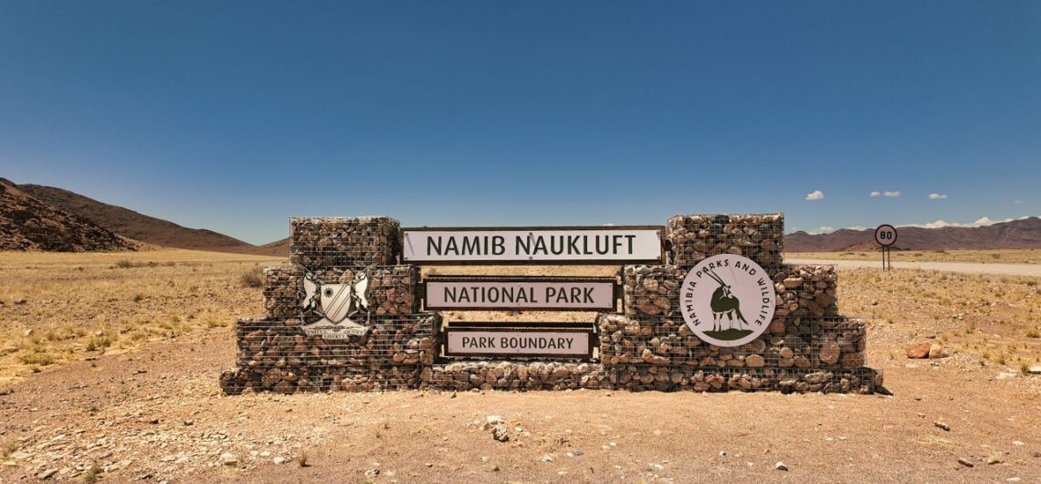
Namib-Naukluft National Park covers 49 768 square kilometres of western and southern Namibia, making it the largest game park in Africa and the fourth largest in the world.
The Namib Desert is the park’s most prominent feature, and at approximately 55 million years old, it is recognised by geologists as the oldest desert on the planet.
These two facts alone explain why you’ll see this park mentioned on nearly every serious Namibia itinerary, though it doesn’t at all explain why finding comprehensive guides to this place is almost as rare as a rainy day in Windhoek.
This guide covers what Namib-Naukluft National Park actually is, what travellers see and experience there, when to visit, and how to plan a safari that does the park justice.
A Little Bit of Background on Namib-Naukluft National Park
Namib-Naukluft National Park was formed in 1979 through the merger of the Namib Desert Park and the Naukluft Mountain Zebra Park, and was later expanded to include the Sossusvlei area, the Sesriem Canyon, and sections of the Namib Sand Sea.
The Namib Sand Sea side of the park was declared a UNESCO World Heritage Site in 2013, and is recognised for its unique dune formations and the rare coastal fog ecosystem that sustains life in one of the driest environments on Earth.
The park includes three distinct ecosystems within a single boundary: the gravel plains of the Naukluft Mountains, the red dune sea of the central Namib, and the rocky outcrops near the Atlantic coast.
Three ecosystems within one park is unusual for a desert reserve, and it is also why wildlife sightings here are more varied and interesting than first-time visitors expect.
Annual rainfall across the park averages less than 100 millimetres, and it falls mostly between January and April.
But it is not the limited rain that makes the park fascinating; rather, it’s the fog.
Coastal fog rolls inland most mornings, providing the only reliable moisture source for much of the park’s plant and animal life. It also happens to give the landscape the most peculiar look, which makes for some extraordinary photos.
The Red Dunes of Namib-Naukluft National Park
One of the reasons I pencilled in a trip to the park was to climb Big Daddy Dune.
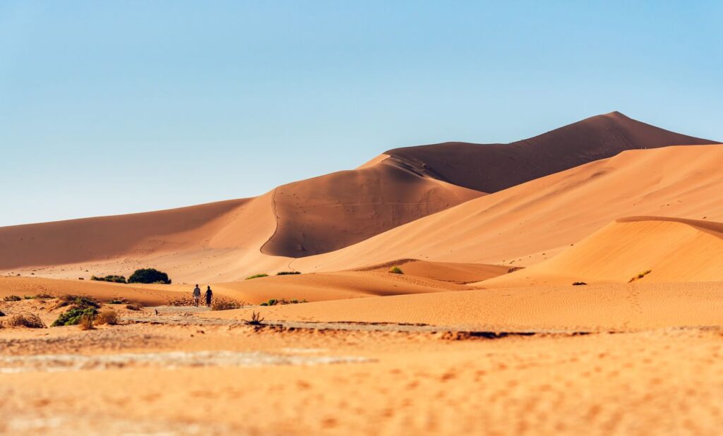
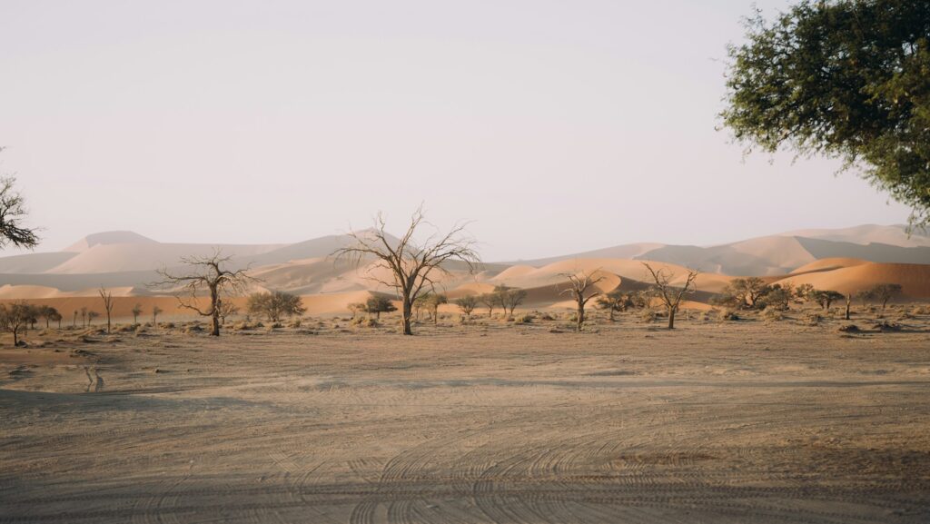
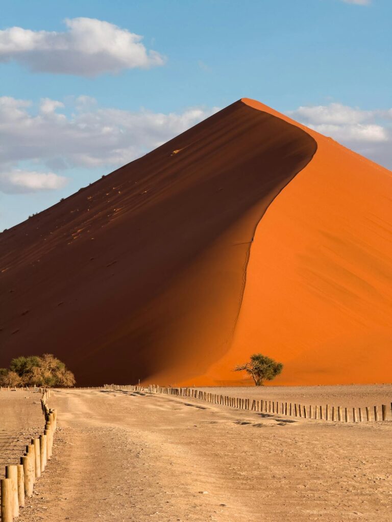
The red dunes of Namib-Naukluft National Park reach heights of 325 metres and are among the tallest dunes on the planet.
The colour comes from iron oxide within the sand grains, oxidised over millions of years, with the most intensely red dunes found furthest from the coast, where the oxidation process has had the longest to work.
Sossusvlei, particularly Big Daddy Dune, and Deadvlei are the most popular tourist attractions within the park.
Sossusvlei is a salt and clay pan that occasionally fills with water after exceptional rainfall, and it is surrounded by some of the park’s highest dunes.
Deadvlei holds the skeletal remains of camel thorn trees, estimated at 600 to 700 years old, preserved by the extreme dryness of the pan rather than fossilised.
You’ll want to visit the places just as the sun starts to come up because by midday you’ll be blinded and overly hot.
Desert Wildlife of Namib-Naukluft National Park
Namib-Naukluft National Park is often marketed as a safari destination, but as I said at the start, it’s anything but conventional.
The park supports 200 documented bird species, 50 mammal species, and numerous reptile species, all of which have become adapted specifically to extreme aridity.
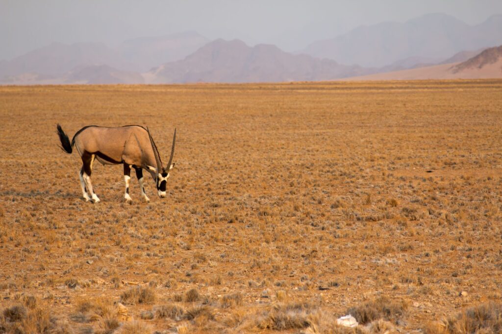
Mammal sightings commonly include oryx, springbok, ostrich, and Hartmann’s mountain zebra, a subspecies found only in Namibia and southwestern Angola.
While spotting wildlife is always exciting, the really interesting creatures are a lot closer to the ground, and in places you might very well never think to look.
The insects and few reptiles of the desert are some of the hardiest creatures on the planet.
The Namib dune gecko, which buries itself in sand to escape daytime heat, the dancing white lady spider, which rolls itself into a wheel shape to escape predators across dune slopes, and the dune lark, the only bird species endemic to the Namib Desert, can be seen here.
Tenebrionid beetles, sometimes called fog-basking beetles, are also an interesting sight and can sometimes be spotted on dune crests at dawn when they collect moisture droplets directly from coastal fog on their wing cases.
This single adaptation allows an entire community of these dune-dwelling insects to survive without any other water source.
It helps to travel through the park with a guide. Not only can they spot things you might miss, but they can often point out the distinctive looping trails these beetles leave across the sand overnight.
The Best Time to Visit Namib-Naukluft National Park
May to September will treat you to the most comfortable daytime temperatures, which usually range between 20 and 25 degrees Celsius, making this the preferred season for dune climbing and extended walking.
Nighttime temperatures during these winter months can fall below freezing, so you’ll want to pack appropriately, especially if you intend to head into the desert at dawn.
The daytime temperatures from October to April will often go well above 35 degrees Celsius on most days, with the heat confining your activities to the early morning and late afternoon.
This period also coincides with the small chance of rainfall, which can occasionally fill Sossusvlei itself, an event so significant that local guides will remember and talk about the specific years it happened.
Should you prioritise photography and if you want to do a lot of walking around, you should plan for the May to September window.
And if you want lower visitor numbers and dramatic cloud formations over the dunes, you should consider the shoulder months of March, April, October, and November.
Getting There
Namib-Naukluft National Park is reached via the C19 road from Walvis Bay or Swakopmund, or via the B1 and C24 from Windhoek, with the drive from Windhoek to Sesriem taking approximately five hours by standard vehicle.
Sesriem Canyon, near the park’s main entrance gate, marks the starting point for most dune and vlei excursions.
The drive is fairly easy, and there are some worthwhile things to see along the way, like the changing landscapes.
Although a self-drive itinerary covers the practical logistics, unless you’ve travelled here before, you might miss out on the knowledge and guidance that comes with booking a guided tour instead.
Knowing which dune to climb on a given morning, which guide holds the right permits for early gate access before sunrise, and which lodge is best to stay at can make a huge difference in your experience of the park.
The best way to explore Namib-Naukluft National Park is with a guided tour. This way, you can be sure that you won’t miss a thing.
Namib-Naukluft National Park covers 49 768 square kilometres, making it the largest game park in Africa and the fourth largest national park in the world. The park is larger than Switzerland and spans three distinct ecosystems, including dune sea, gravel plains, and mountainous terrain.
The Namib Desert is approximately 55 million years old, making it the oldest desert on Earth. Its age is the result of consistently arid conditions sustained by the cold Benguela Current along Namibia’s Atlantic coastline, which has suppressed rainfall in the region for tens of millions of years.
May to September has daytime temperatures between 20 and 25 degrees Celsius, ideal for dune climbing and walking. October to April brings higher temperatures exceeding 35 degrees Celsius on many days, with reduced comfortable activity hours but a small chance of dramatic rainfall events at Sossusvlei.
The tallest dunes within Namib-Naukluft National Park reach 325 metres, including Big Daddy Dune near Sossusvlei. These rank among the tallest dunes in the world and owe their red colour to iron oxide that has built up in the sand over millions of years.
Namib-Naukluft National Park is reached via the C19 road from Walvis Bay or Swakopmund, or via the B1 and C24 routes from Windhoek. The drive from Windhoek to the main Sesriem entrance gate takes approximately five hours by standard vehicle, and a 4×4 is recommended for accessing some of the more remote dune areas within the park.
About the Authors African Travel Concept Namibia Team
At African Travel Concept Namibia, our team of experienced travel and safari professionals is dedicated to turning first-hand African expertise into clear, reliable advice. We research, review, and refine every article so you have the most current and accurate information when planning your trip.
Roughly a kilometre before you reach Cape Cross Seal Reserve, you’ll want to put your windows up, and someone in the vehicle is guaranteed to say something that makes everyone laugh. You won’t see the colony yet; you won’t even hear it properly, but you can smell it, carried on the cold Atlantic wind in a way that is bracingly and unmistakably animal. It is the smell of tens of thousands of living creatures going about their lives with complete indifference to your presence. Cape Cross and the Cape fur seals in Namibia are a true wildlife experience. It might not be as comfortable as enjoying a sundowner on the Etosha plains might be, but as loud, raw and a little smelly as it can be, it is one destination that is going to absolutely blow your mind. About Cape Cross Seal Reserve in Namibia Cape Cross Seal Reserve sits on the Skeleton Coast approximately 120 kilometres north of Swakopmund, on a narrow strip of shoreline where the cold Benguela Current meets the Namibian coastline. The reserve protects one of the largest free-roaming colonies of Cape fur seals in the world, with estimates placing the population at between 80 000 and 100 000 individuals at peak season (hence the whiff). To put that number in some kind of physical context: the colony covers several kilometres of beach! The sound carries further than you’d expect, and the energy of the place, the constant movement, the calling, the jostling, the pups weaving between enormous bulls, is unlike anything else in southern Africa. Something you might not know is that the Cape fur seal, known scientifically as Arctocephalus pusillus, is not actually a true seal. It belongs to the eared seal family, which means it can rotate its rear flippers forward and move
Roughly a kilometre before you reach Cape Cross Seal Reserve, you’ll want to put your windows up, and someone in the vehicle is guaranteed to say something that makes everyone laugh.
You won’t see the colony yet; you won’t even hear it properly, but you can smell it, carried on the cold Atlantic wind in a way that is bracingly and unmistakably animal.
It is the smell of tens of thousands of living creatures going about their lives with complete indifference to your presence.
Cape Cross and the Cape fur seals in Namibia are a true wildlife experience.
It might not be as comfortable as enjoying a sundowner on the Etosha plains might be, but as loud, raw and a little smelly as it can be, it is one destination that is going to absolutely blow your mind.
About Cape Cross Seal Reserve in Namibia
Cape Cross Seal Reserve sits on the Skeleton Coast approximately 120 kilometres north of Swakopmund, on a narrow strip of shoreline where the cold Benguela Current meets the Namibian coastline.
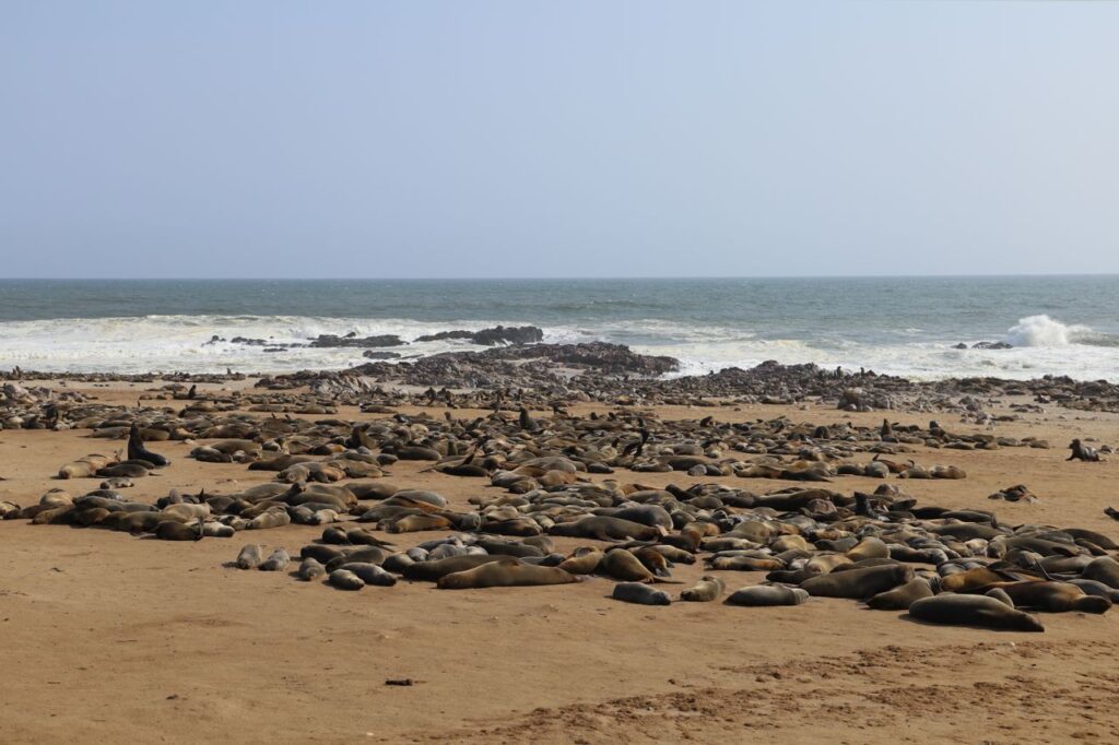
The reserve protects one of the largest free-roaming colonies of Cape fur seals in the world, with estimates placing the population at between 80 000 and 100 000 individuals at peak season (hence the whiff).
To put that number in some kind of physical context: the colony covers several kilometres of beach!
The sound carries further than you’d expect, and the energy of the place, the constant movement, the calling, the jostling, the pups weaving between enormous bulls, is unlike anything else in southern Africa.
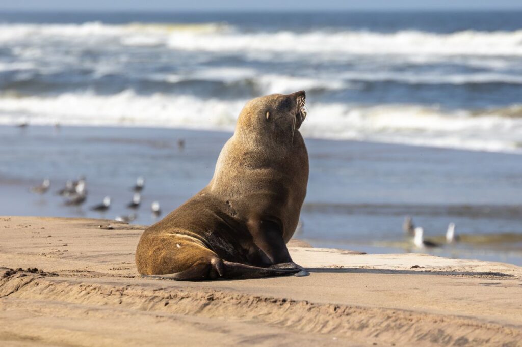
Something you might not know is that the Cape fur seal, known scientifically as Arctocephalus pusillus, is not actually a true seal.
It belongs to the eared seal family, which means it can rotate its rear flippers forward and move on land with considerably more agility than a true seal.
This is important to keep in mind when you are standing at the viewing barriers and a large bull decides to investigate you. They move fast, and several visitors discover this the hard way every year.
The reserve is also historically important.
A replica of the cross erected by Portuguese explorer Diogo Cão in 1486 stands near the entrance, marking one of the earliest recorded European landings on the Namibian coast.
The original cross was removed to a museum in Berlin in the late nineteenth century, and although the cross is not original, the location is, and standing there with the Atlantic behind you and the colony ahead, the sense of time and remoteness is something to behold.
What to Expect from Your Visit
The reserve is accessed via a well-maintained gravel road, and the entrance is easy to find.
A boardwalk and series of viewing barriers run along the colony’s edge, allowing visitors to get close to the seals without disturbing the animals or entering the colony itself.
The word close is worth talking about a little bit.
At Cape Cross, close means very close.
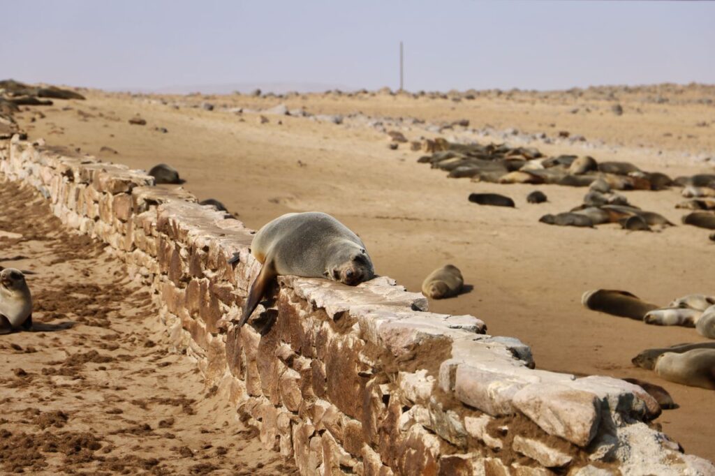
Bulls weighing up to 300 kilograms rest within metres of the viewing barriers, the mothers nurse pups at eye level, and the young males practice their aggressive posturing that will eventually determine their place in the hierarchy. Their posturing is impressive and kind of comedic.
The pups, particularly in the months following the main birthing season, are a study in determined chaos.
The smell, already mentioned, intensifies the closer you get to the colony. It is the result of tens of thousands of animals, fish, guano, and the cold salt air of the Skeleton Coast. It is not subtle, so bringing a buff or light scarf is recommended.
The noise is the other thing that catches visitors off guard.
The colony is never quiet. The bulls produce a deep, resonant bark, and the females call constantly to locate their pups in the crowd. The pups themselves produce a sound somewhere between a bleat and a cry.
Within ten minutes of arriving, most visitors stop noticing it, and within twenty, they are listening for specific calls within the general chorus.
Plan for at least ninety minutes at the reserve. An hour is not enough.
Fascinating Facts about Cape Fur Seals
Cape fur seals are remarkable animals.
A female seal can identify her own pup by call alone within a colony of tens of thousands of animals. She returns from fishing trips of several days, calls once, and the pup answers. They find each other every time.
Bull Cape fur seals in Namibia can weigh up to 300 kilograms and measure over two metres in length. Females are considerably smaller, typically around 75 kilograms, which makes the size difference between the sexes one of the most pronounced of any seal species.
Pups are born between November and December, with the peak of the birthing season falling in late November. This is also the period when the bulls are most actively defending territory, which makes late November and December the most extraordinary time to visit, though it is also the most crowded in terms of animal activity and guests.
Cape fur seals are strong swimmers and can reach speeds of up to 20 kilometres per hour in the water. On land, they are slower but considerably more mobile than most visitors anticipate.
The Benguela Current that runs along this stretch of coastline is rich in fish, particularly anchovy and pilchard, which is why the colony established itself here and why it has remained one of the largest in the world.
The Skeleton Coast got its name from the whale and seal bones that once lined this stretch of shore, left by the whaling and sealing industries of the nineteenth century, and Cape Cross was a significant sealing station during that period. The reserve today is a conservation area, but the history of what happened here should never be forgotten.
How to Reach Cape Cross Seal Reserve
Cape Cross is located on the C34 coastal road, approximately 120 kilometres north of Swakopmund and around 60 kilometres south of Henties Bay. The road is accessible by standard vehicle, though a 4×4 is always a sensible choice on Namibian gravel roads.
The drive north from Swakopmund along the C34 is one of the more cinematic roads in Namibia. The Skeleton Coast is to the left, cold and grey and seemingly never-ending, while the desert presses in from the right.
There are stretches where the road seems to exist at the edge of everything.
From Windhoek, Cape Cross is approximately a four-to-five-hour drive, making it a destination best visited as part of a multi-day coastal itinerary rather than a day trip from the capital.
Entry fees apply and are payable at the reserve gate, and the reserve is open daily, usually from 08h00 to 17h00, though hours can vary seasonally, so you’ll want to confirm with the reserve in advance.
When is the Best Time to Visit Cape Cross to See the Seals?
Cape Cross is worth visiting at any time of year, but two seasons stand out for different reasons.
November to January is the birthing and mating season.
The colony is at its most populated and its most active. The energy of the place during this period is extraordinary, and for that reason alone it is the best time to visit if you want to see thousands of seals.
May to August brings cooler, clearer conditions along the Skeleton Coast.
The colony is quieter in terms of seasonal activity, but the animals are present year-round, and the light in winter along this coastline has a particular quality, flat and silver and cinematic, that makes it wonderful for photographers.
Midday visits in summer can be intensely hot, and the heat can make the smell worse. Early morning visits are the most comfortable.
Plan your Namibia coastal itinerary with Namibia Safaris
Cape Cross is a natural addition to a longer Skeleton Coast or coastal Namibia itinerary, and can be included in a tour that’ll take you to Swakopmund, the Moon Landscape, Walvis Bay, and the dune landscapes of the Namib to the south.
The colony at Cape Cross is one of the largest Cape fur seal colonies in the world, with estimates ranging from 80 000 to 100 000 individuals at peak season. Numbers fluctuate throughout the year, with the highest populations recorded during the November to January birthing and mating season.
November to January is the most dramatic period, coinciding with the birthing season when pups are born, and bulls are actively defending territory. May to August offers cooler, clearer conditions with excellent light for photography. The colony is present and active year-round, so there is no poor time to visit, only different experiences depending on the season.
Cape fur seals are wild animals, and bull males in particular can be territorial and move faster than most visitors expect. The viewing barriers at Cape Cross keep visitors at a safe and respectful distance from the colony. Staying within the designated viewing areas is both a safety requirement and a conservation practice.
Cape Cross is located approximately 120 kilometres north of Swakopmund on the C34 coastal road. The drive takes around one and a half to two hours on gravel road and is accessible by standard vehicle. Most visitors include Cape Cross as a day trip from Swakopmund or as a stop on a longer Skeleton Coast itinerary.
The intensity of the smell at Cape Cross is the result of a colony of up to 100,000 animals living in close proximity, combined with fish, guano, and the cold salt air of the Benguela Current coastline. It is one of the most commonly mentioned aspects of a Cape Cross visit and is generally considered part of the authentic wildlife experience rather than a drawback.
About the Authors African Travel Concept Namibia Team
At African Travel Concept Namibia, our team of experienced travel and safari professionals is dedicated to turning first-hand African expertise into clear, reliable advice. We research, review, and refine every article so you have the most current and accurate information when planning your trip.
I took the road out of Swakopmund, after a few days spent exploring this fascinating small town, and took the road inland, away from the cold Atlantic and the salt-hazed coastline. I drove for about twenty minutes before the town behind me disappeared entirely. The sight that started to appear on the horizon is a little hard to put into words. The ground dropped away into a series of eroded gullies and pale, folded ridges that looked as though they belonged to a planet still figuring itself out. The sky was wide and clear, and somehow it looked so much bigger than usual, and the only sound was the faint rustle of bone-dry grass. I had the overwhelming impression that I had driven off the edge of the known world and landed somewhere simply not of this world. This is the moon landscape in Namibia. And while it is obviously not the moon, it is also not quite like anywhere else on Earth either. What is the Moon Landscape? The moon landscape in Namibia is a stretch of ancient, heavily eroded terrain about 30 kilometres east of Swakopmund, and you’ll find it easily if you follow the Swakop River valley. What visitors see today is the result of millions of years of geological weathering, a process in which the Swakop River carved deeply through the layers of granite and schist, leaving behind a corrugated, crater-pocked landscape of pale grey and ochre ridges that bear an uncanny resemblance to the lunar terrain. The rocks themselves are among the oldest exposed surfaces on Earth. The granite in the area dates to approximately one billion years, making the Moon Landscape not just a visually extraordinary place to explore, but also geologically significant. It’s quite something to stand here, knowing that some of the
I took the road out of Swakopmund, after a few days spent exploring this fascinating small town, and took the road inland, away from the cold Atlantic and the salt-hazed coastline.
I drove for about twenty minutes before the town behind me disappeared entirely.
The sight that started to appear on the horizon is a little hard to put into words.
The ground dropped away into a series of eroded gullies and pale, folded ridges that looked as though they belonged to a planet still figuring itself out.
The sky was wide and clear, and somehow it looked so much bigger than usual, and the only sound was the faint rustle of bone-dry grass.
I had the overwhelming impression that I had driven off the edge of the known world and landed somewhere simply not of this world.
This is the moon landscape in Namibia. And while it is obviously not the moon, it is also not quite like anywhere else on Earth either.
What is the Moon Landscape?
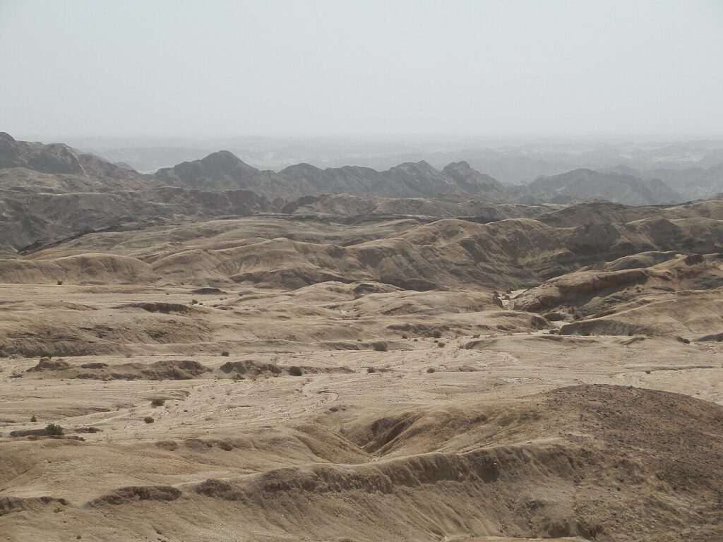
The moon landscape in Namibia is a stretch of ancient, heavily eroded terrain about 30 kilometres east of Swakopmund, and you’ll find it easily if you follow the Swakop River valley.
What visitors see today is the result of millions of years of geological weathering, a process in which the Swakop River carved deeply through the layers of granite and schist, leaving behind a corrugated, crater-pocked landscape of pale grey and ochre ridges that bear an uncanny resemblance to the lunar terrain.
The rocks themselves are among the oldest exposed surfaces on Earth.
The granite in the area dates to approximately one billion years, making the Moon Landscape not just a visually extraordinary place to explore, but also geologically significant. It’s quite something to stand here, knowing that some of the rocks beneath your feet are older than the dinosaurs!
When planning your visit, don’t make the same mistake that many make, in thinking that the Moon Landscape is a single viewpoint or a single stop.
It is a whole area of rock, with the most dramatic sections visible from a well-positioned lookout point roughly 30 kilometres from Swakopmund. Most visitors stop here to take some photos and enjoy the view, while the more curious ones follow the road farther, where the landscape continues to twist, turn, and change shape.
The Welwitschia Connection
The Swakop River valley is not just a place to see a bunch of ancient, moon-like rocks.
It is also home to one of the most accessible concentrations of Welwitschia mirabilis plants in Namibia, and this is where your Moon Landscape excursion can become something so much more than a scenic drive.
Welwitschia mirabilis is a living fossil, a desert plant so ancient and so unlike anything else on Earth that it occupies its own taxonomic family entirely.
Individual plants in the Swakop River valley are estimated to be between 500 and 1 500 years old. They grow slowly, they grow low, and they are completely unbothered by the passage of time.
Seeing billion-year-old rock formations and thousand-year-old plants in a single half-day drive is not your average getaway, and yet it seems to perfectly fit the personality of Namibia.
You can read a full guide to Welwitschia mirabilis, including the science behind its extraordinary longevity and where else to find it across Namibia, here.
What to Expect from Your Moonscape Visit
The Swakop River valley is best seen in the early morning.
The mist that rolls in from the Atlantic overnight tends to linger here longer than it does on the coast, softening the ridgelines and giving the pale rocks a luminous, slightly ethereal quality, especially when paired with that gorgeous morning light.
By mid-morning it burns off, and the scenery sharpens, becoming harsher on the eyes and a lot more dramatic.
That said, both versions of the landscape are worth seeing, and if you plan your trip to leave from Swakopmund, you’ll have more than enough time to experience both and head off to your next destination before the sun sets.
The lookout point at the moonscape is modest in infrastructure, but it will treat you to a generous view.
There is space to stop, to walk a short distance along the ridge, and to simply stand and admire the valley spread out below. You don’t have to rush the experience; I spent a good amount of time taking it all in because I knew I would probably not pass this way again.
If you’d like to go further, you can arrange guided excursions into the valley floor, where the Welwitschia plants grow in clusters among the river gravel, and the sense of geological scale becomes even more pronounced.
The valley floor is not accessible by standard vehicle in all conditions, so checking road conditions before heading down is worthwhile.
Often, travel companies include this area in their itineraries because it is so close to Swakopmund.
The Moon Landscape as Part of a Swakopmund Itinerary
Swakopmund is one of Namibia’s most loved towns, a place of cool air, good coffee, colonial architecture, and the sort of laid-back good vibes energy you’d expect from any other coastal town.
It sits at the meeting point of the Namib Desert and the Atlantic Ocean, and it functions naturally as a base for several of the surrounding region’s most interesting excursions.
The Moon Landscape is the most atmospheric of these, and it pairs naturally with a morning at the Swakop River Welwitschia Plains, a visit to the Living Desert for an introduction to the Namib’s smaller inhabitants, or an afternoon on the dunes near Walvis Bay.
Together these excursions will give you a good sense of the Namib’s extraordinary range, from the coastal fog belt to the ancient interior, within just a day or two of relaxed exploration.
The Moon Landscape fits neatly into a morning before the road continues, a last look at something strange and beautiful before venturing off into the more remote parts of the country.
Your stop might not take all that long, but it sure is going to stay with you forever.
Some Practical Information
The Moon Landscape lookout is accessible by standard vehicle along the C28 road east of Swakopmund, and the drive takes approximately 30 minutes from the town centre.
There is no entrance fee for the lookout point itself, and guided half-day excursions into the Swakop River valley, including Welwitschia viewing, are available through tour operators in Swakopmund and can be arranged as part of a wider itinerary.
The best time to visit is early morning, both for the quality of the light and for the cooler temperatures.
Midday in the valley can be considerably warmer than the coast, especially during the intense summer months.
There is no shade at the lookout point, and within the area in general, so you’ll want to make sure that you bring enough water and have appropriate sun protection.
Plan Your Namibia Itinerary with Namibia Safaris
Namibia Safaris designs itineraries that move through the country with the kind of care that only comes from knowing it well. Swakopmund and the Moon Landscape feature across several of our routes, as a natural rest point between the dramatic dune landscapes of the south and the wide open wildlife country of the north.
For travellers who want to see Namibia at the right pace, with the right context, and without missing the places that do not always make the front page of the brochure, we’re a natural first choice.
The Moon Landscape is an ancient, eroded river valley approximately 30 kilometres east of Swakopmund, carved by the Swakop River through billion-year-old granite and schist. The resulting terrain of pale ridges, gullies, and crater-like formations bears a strong resemblance to lunar terrain, which is where the name originates.
The Moon Landscape is reached via the C28 road heading east out of Swakopmund. The drive takes approximately 30 minutes, and the road is accessible by standard vehicle. The main lookout point is well signposted and has space to park.
Yes, particularly for travellers who appreciate landscapes that are geological rather than purely scenic. The combination of extraordinary rock formations, ancient Welwitschia plants, and the quality of the light in the Swakop River valley makes it one of the more quietly memorable excursions in the Swakopmund area.
Yes. The Swakop River valley is one of the most accessible places in Namibia to see Welwitschia mirabilis in the wild. Several plants in the area are estimated to be between 500 and 1,500 years old. Guided excursions into the valley floor offer the best viewing opportunities.
Early morning is strongly recommended. The Atlantic mist that settles over the valley overnight creates an atmospheric, softened quality to the light that burns off by mid-morning. Temperatures are also considerably more comfortable in the early hours than at midday.
About the Authors African Travel Concept Namibia Team
At African Travel Concept Namibia, our team of experienced travel and safari professionals is dedicated to turning first-hand African expertise into clear, reliable advice. We research, review, and refine every article so you have the most current and accurate information when planning your trip.
Somewhere on the gravel road between Khorixas and the Skeleton Coast, I noticed the atmosphere and the landscape starting to change. The light became flat and white. The air began to carry that faint smell of dust and dry grass. And then, without ceremony, a small sign appeared at the roadside, announcing that I was passing into an ancient place. It was winter and the conditions were perfect for a Namibian road trip. This is a country I have wanted to travel to my whole life, and while the world seemed to be becoming more topsy-turvy than usual, I decided to book that trip. I had the feeling in my bones that it was now or never. In my first week in the country, I hit all the hot spots. I spent a few days in Windhoek, and realised that it is so much smaller than I had imagined. A few days was really all I needed to see it all. Then I headed out into the wild and unknown (at least, unknown to me). I went west first, travelling down the Skeleton Coast and visiting Swakopmund, and then I drove east to Damaraland to see one of Namibia’s most fascinating sights. What is the Petrified Forest in Namibia, Exactly? The name of this place sets up an expectation the site does not quite meet. There is no forest, at least not in the conventional sense. No trees are standing upright, stripped of their colour, frozen mid-growth. What there is, scattered across roughly 300 by 800 metres of open Damaraland scrubland, are the trunks. Enormous, horizontal, broken into pieces by time and weather but otherwise astonishingly intact. Some stretch to 34 metres in length, the largest reach six metres in circumference, the annual growth rings are still visible, and the
Somewhere on the gravel road between Khorixas and the Skeleton Coast, I noticed the atmosphere and the landscape starting to change.
The light became flat and white. The air began to carry that faint smell of dust and dry grass. And then, without ceremony, a small sign appeared at the roadside, announcing that I was passing into an ancient place.
It was winter and the conditions were perfect for a Namibian road trip. This is a country I have wanted to travel to my whole life, and while the world seemed to be becoming more topsy-turvy than usual, I decided to book that trip. I had the feeling in my bones that it was now or never.
In my first week in the country, I hit all the hot spots. I spent a few days in Windhoek, and realised that it is so much smaller than I had imagined. A few days was really all I needed to see it all.
Then I headed out into the wild and unknown (at least, unknown to me). I went west first, travelling down the Skeleton Coast and visiting Swakopmund, and then I drove east to Damaraland to see one of Namibia’s most fascinating sights.
What is the Petrified Forest in Namibia, Exactly?
The name of this place sets up an expectation the site does not quite meet.
There is no forest, at least not in the conventional sense. No trees are standing upright, stripped of their colour, frozen mid-growth.
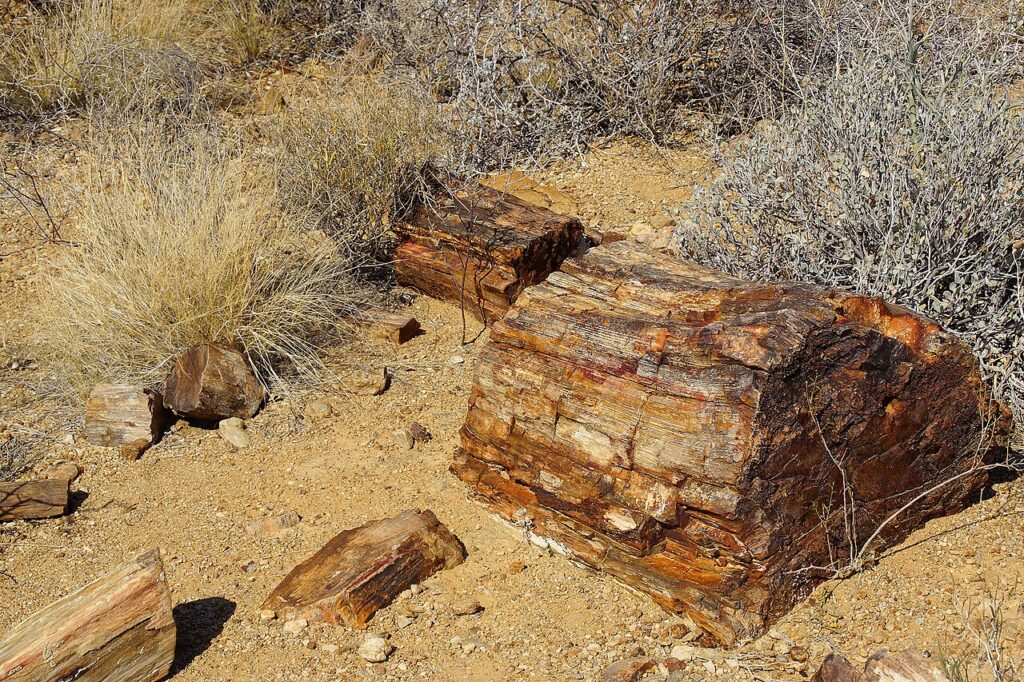
What there is, scattered across roughly 300 by 800 metres of open Damaraland scrubland, are the trunks. Enormous, horizontal, broken into pieces by time and weather but otherwise astonishingly intact.
Some stretch to 34 metres in length, the largest reach six metres in circumference, the annual growth rings are still visible, and the bark texture is still there.
These trees are completely petrified, meaning they have turned entirely into stone.
Around 50 individual trunks are exposed at the official site near Khorixas, with several hundred more thought to lie partially buried in the surrounding desert terrain.
They belong to an ancient group of cone-bearing plants called Gymnosperms, the ancestors of modern conifers and cycads, and they are believed to have floated here on a prehistoric floodwater event during the Permian period, carried down from what is now Angola, before being buried under alluvial sediment.
Deprived of oxygen, they could not decompose.
Instead, over millions of years, each cell was individually replaced by silica in a process called silicification. The result is wood that is, technically, quartz. The same hardness as a crystal.
In 1950, after souvenir hunters began helping themselves to fragments, the site was declared a National Monument. It is now a protected heritage site, and the minimum fine for removing even a small piece of petrified wood is 5 000 Namibian dollars.
The trunks have survived 280 million years. The rules are there to make sure they survive the next hundred.
What it’s Like to Walk Through the Forest
I’m not going to be cliché and say it’s a humbling experience. But it sure is one of the most interesting places you’ll ever see.
A guided walk is compulsory; you cannot explore here as you would in, say, Kolmanskop.
The guides at the Petrified Forest are knowledgeable, never in a hurry, and incredibly proud of what they are showing you.
They will point out the growth rings, they will tell you which trunks have been partially excavated and which are still emerging from the earth, and they will show you the places where the stone has fractured along the original grain of the wood.
Give yourself at least an hour here but aim for more.
The walk is approximately 800 metres and mostly flat, which makes it accessible, but the heat in Damaraland is not to be underestimated. Early morning visits are considerably more comfortable, and the quality of the light at that hour does something rather lovely to the colour of the stone.
The site also lies within a semi-desert environment rich in unusual flora.
Alongside the petrified trunks, visitors will find Welwitschia mirabilis plants growing in the surrounding scrub.
These are among the most extraordinary plants on Earth, ancient, slow-growing desert survivors that can live for over a thousand years. They look like nothing else you’ll see, in Namibia or elsewhere.
You can read up more about the Welwitschia plant, including what makes them so remarkable and where else they appear across Namibia, here.
How to Get There and What to Know Before You Go
The Petrified Forest is located approximately 40 kilometres west of Khorixas on the C39 road, in Namibia’s Kunene Region, in Damaraland.
The road is gravel but generally in good condition and accessible by standard vehicle, though a 4×4 is always preferable on Namibian gravel roads if you are driving yourself.
Entry fees are approximately 250 Namibian dollars per person, and this includes a government-appointed guide. The site has covered parking, which is a small but welcome detail on a hot Damaraland morning.
There are several privately run roadside sites in the area advertising petrified trees. These are not the official National Monument. They vary considerably in quality and conservation standards. For the full context, proper guiding, and the most significant trunks, the official site is the one to visit.
The Petrified Forest as Part of a Damaraland Itinerary
The Petrified Forest is often treated as a stop on a longer route through Damaraland.
The region is one of Namibia’s most scenically beautiful spots, a landscape of flat-topped mountains, open plains, and, during the off-season in particular, a lovely silence that makes the experience even more peaceful.
Within easy reach of the Petrified Forest are Twyfelfontein, the UNESCO World Heritage Site where thousands of San rock engravings cover the sandstone hillside, and the Organ Pipes, a dramatic formation of parallel dolerite columns rising from a dry riverbed a short distance away.
The Burnt Mountain, a geological oddity of scorched-looking shale hills, is also nearby. These sites, along with a visit to the Petrified Forest, can be visited during a half-day or full-day loop from a Damaraland base.
From Damaraland, most itineraries continue north to Etosha National Park, making the Petrified Forest a natural last morning stop before the road turns towards the floodlit waterholes and open plains of Etosha, where I spent the next part of my holiday on safari.
That said, it would be a mistake to treat the Petrified Forest as merely a tick on the way to somewhere else.
While it is not dramatic in the conventional sense and there are no animals and no sweeping views. The stones, the light, and the bewildering knowledge that you are standing next to something that has existed since before the dinosaurs make it one of the Namibia destinations you’ll never forget.
Plan your visit with Namibia Safaris
Namibia Safaris builds itineraries that move through the country with care, connecting visitors with the landscape’s most meaningful sites in a way that allows them to get into the experience fully.
For those who want to see Namibia properly, not quickly, the team at Namibia Safaris is the right place to start.
Yes, particularly for travellers with an interest in geology, natural history, or simply in places that feel genuinely unlike anywhere else. It is not a high-energy destination, but it is a quietly profound one. The scale of the trunks, the visible wood grain preserved in solid stone, and the quality of the guiding make it a memorable stop on any Damaraland route.
The trees are estimated to be approximately 260 to 280 million years old, dating to the Permian period. They belong to an ancient plant group called Gymnosperms and are believed to have been transported to their current location by a prehistoric flood event, possibly originating in what is now Angola.
Yes. Guided tours are compulsory at the official National Monument site near Khorixas. This is not an inconvenience. The guides are knowledgeable, and the context they provide transforms the visit from a walk among stones into something informative.
The site is accessible by standard vehicle via the C39 gravel road, approximately 40 kilometres west of Khorixas. The road is generally in reasonable condition. That said, a 4×4 is recommended for any extended travel in Damaraland, where road conditions can vary.
Most visitors spend between 45 minutes and one and a half hours at the site. The guided walk covers approximately 800 metres of mostly flat terrain. Early morning visits are recommended for cooler temperatures and better photographic light.
About the Authors African Travel Concept Namibia Team
At African Travel Concept Namibia, our team of experienced travel and safari professionals is dedicated to turning first-hand African expertise into clear, reliable advice. We research, review, and refine every article so you have the most current and accurate information when planning your trip.
Having travelled through the Namib, specifically to see the spectacularly beautiful Sossusvlei and Deadvlei, I found myself back on Google, looking for other attractions in the area to fill the last day that I had in the desert. Sesriem popped up, and since it was so close to where I was staying, I decided to set out early to see what the fuss was all about. Sesriem Canyon is situated in the same area as Big Daddy Dune, Dune 45, and, of course, Sossusvlei. Cut by the Tsauchab River through layer upon layer of sedimentary conglomerate and sandstone, it is one of Namibia's most atmospheric places, though it is less photographed than the dunes and less visited than Fish River Canyon. That makes it the perfect place for anyone who wants a unique experience or a spot to sit a while and just be. Where is Sesriem Canyon? Sesriem Canyon sits within the Namib-Naukluft National Park in western Namibia, about 60 kilometres from the small town of Sesriem, which serves as the gateway settlement and park entrance. It is located at the point where the Tsauchab River, which also feeds the famous saltpans of Sossusvlei, carved its way through ancient rock over millennia. The canyon runs for roughly one kilometre in length and drops to a depth of approximately 30 metres in places. Its name is a direct piece of colonial-era history. The word "sesriem" is Afrikaans for six thongs, referring to the six lengths of ox-hide rope that early settlers needed to tie together in order to lower a bucket far enough to reach the water pooled at the canyon floor. Today, Sesriem Canyon is one of the least visited spots in Namibia, which makes it a bit of a must-see if you want to be one of the
Having travelled through the Namib, specifically to see the spectacularly beautiful Sossusvlei and Deadvlei, I found myself back on Google, looking for other attractions in the area to fill the last day that I had in the desert.
Sesriem popped up, and since it was so close to where I was staying, I decided to set out early to see what the fuss was all about.
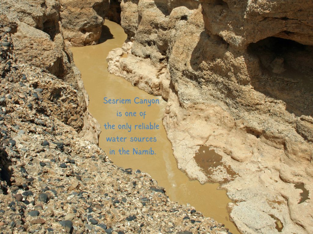
Cut by the Tsauchab River through layer upon layer of sedimentary conglomerate and sandstone, it is one of Namibia’s most atmospheric places, though it is less photographed than the dunes and less visited than Fish River Canyon.
That makes it the perfect place for anyone who wants a unique experience or a spot to sit a while and just be.
Where is Sesriem Canyon?
Sesriem Canyon sits within the Namib-Naukluft National Park in western Namibia, about 60 kilometres from the small town of Sesriem, which serves as the gateway settlement and park entrance.
It is located at the point where the Tsauchab River, which also feeds the famous saltpans of Sossusvlei, carved its way through ancient rock over millennia.
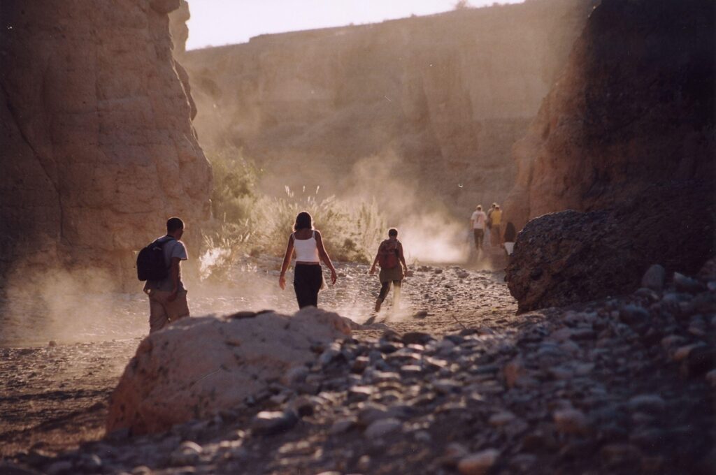
The canyon runs for roughly one kilometre in length and drops to a depth of approximately 30 metres in places.
Its name is a direct piece of colonial-era history. The word “sesriem” is Afrikaans for six thongs, referring to the six lengths of ox-hide rope that early settlers needed to tie together in order to lower a bucket far enough to reach the water pooled at the canyon floor.
Today, Sesriem Canyon is one of the least visited spots in Namibia, which makes it a bit of a must-see if you want to be one of the few who get to explore this fascinating attraction.
What will you see in Sesriem Canyon?
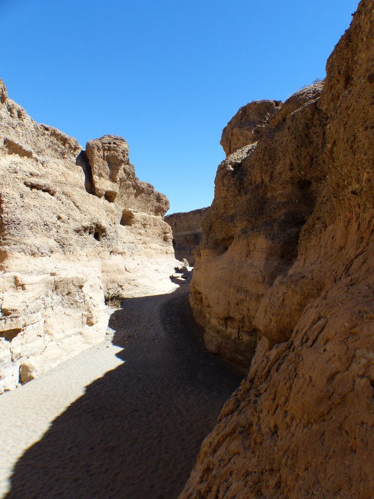
The canyon walls are the first thing that will leave you entranced.
Smooth in places, fractured in others, the rocks have warm tones of ochre, rust, and cream, and the colours change throughout the day as the sun moves overhead. In the early morning, shadows pool in the lower sections, and the rock takes on a cool, almost violet quality. By mid-afternoon, the same walls are bright and bleached.
At the canyon’s deepest point, a natural pool of water forms after good rains.
This was the very same water source that made Sesriem a viable resting point for desert travellers for generations, and it still holds water for much of the year, even in dry seasons. The pool is not deep enough to swim in, but it is remarkable simply for existing at all in such an arid environment.
If you look closely at the canyon walls, you will see something that takes a moment to understand. The conglomerate rock is embedded with rounded pebbles, tumbled smooth by a river that was far more powerful than the seasonal trickle of the Tsauchab today.
These are the remnants of ancient flood events, pressed into stone and held there for millions of years.
I forgot to mention, Sesriem Canyon is a great place for a hike, and you don’t need to be super fit to make the most of your trip here. This walk can be more of a meander, and there’s no pressure to do the whole thing. If you are short on time, you can walk a short way, enjoy the sights, sit a while, and then head back to your car.
How To Get There
Sesriem Canyon is accessed through the Sesriem gate of the Namib-Naukluft National Park.
The gate is located approximately 340 kilometres south of Windhoek via the C26 and C27 roads, or around 380 kilometres via the tarred B1 and C14 route, which is the more comfortable option in a standard vehicle.
The canyon itself is just one kilometre from the Sesriem gate, and it is accessible on a good gravel road. A 4×4 is not needed to reach the canyon, though, since you are probably also planning on seeing Sossusvlei and Dead Vlei, and since your tour will continue from here, you might want to get yourself a 4×4 if you are self-driving.
Many visitors choose to stay at one of the lodges or campsites within or adjacent to the park, which allows early gate access to Sossusvlei before sunrise, which is something you should plan for, since the heat can get extreme later in the day.
Tips for Planning a Sesriem Canyon Visit
You don’t need much planning to see the best of Sesriem Canyon, but you should keep these tips in mind:
Go early or go late. The canyon is at its most beautiful in the soft light of early morning and late afternoon, when the shadows lengthen, and the rock colours become richer due to the contrast. The middle of the day is harsh on both the eyes and the body, as temperatures in the Namib regularly exceed 40 degrees Celsius in summer (and they are not much better in winter).
Wear closed shoes. The canyon floor requires some careful footing, and the rocks can be uneven and sharp in places. It is a manageable walk for most, but sandals are not a practical choice (neither are brand-new hiking boots because you don’t want to end up with blisters).
Bring far more water than you think you need. The Namib is one of the driest places on earth, and the combination of the intense heat and dry air means dehydration happens quickly and without you even realising. Bring lots of water and keep sipping it throughout your walk.
Book accommodation inside the park if your budget allows. The Sesriem gate closes at sunset, and guests staying outside the park cannot re-enter after closing time. Lodges within the park boundaries will give you the benefit of staying past the gate hours, which means you can linger in the canyon in the evening long after day visitors have left.
Visit Sesriem Canyon and Sossusvlei on the same day. They are less than 65 kilometres apart within the park and pair naturally as a full-day itinerary. Many guided Namibia safaris include these places in a single, unhurried day.
The Flora, Fauna, And What to Do in Sesriem Canyon
The canyon is home to a surprising number of plants and animals, given its apparent severity, both the dryness and the heat would kill most plants and wildlife.
Fig trees grow from cracks in the rock, with their roots threading into fissures where the moisture lingers longest. Reeds and sedges cluster around the pool at the canyon’s base, and because they are green and slightly incongruous, they stand out against the stone.
Rock hyrax are a near certainty. These small, round mammals, which are impossibly cute and improbably the closest living relatives of the elephant, sun themselves on the canyon ledges with an endearing lack of concern for passing visitors. And if you look up at the canyon walls, you might just spot swifts or cliff-nesting birds, their calls echoing off the rock in ways that give the narrow space an unexpected acoustic quality.
Desert-adapted animals, including klipspringer and Hartmann’s mountain zebra, have been recorded in the wider area, and the occasional jackal passes through in the early hours.
The rest of the Namib-Naukluft National Park is also home to a healthy leopard population, though sightings at Sesriem itself are rare.
Walking is the main thing to do while visiting Sesriem Canyon.
The path along the canyon rim and down into the gorge itself takes between 45 minutes and two hours, depending on how far you walk and how long you’d like to stay.
There is no formal guided trail required, though having a knowledgeable guide to lead you is going to add considerably to the experience, particularly when it comes to reading the geology and seeing those smaller details that are easy to miss.
Photography is one of the reasons many people are drawn here.
The play of light on ancient stone, the geometry of shadow and rock, and the scale of the canyon walls against human figures produce interesting images without requiring any technical acrobatics.
PLAN YOUR SESRIEM CANYON TOUR WITH NAMIBIA SAFARIS
Yes, and more so if you are already visiting Sossusvlei. Sesriem Canyon is one kilometre from the park gate and takes very little additional time to include. It is a genuinely ancient, atmospheric place and one that many visitors find more quietly moving than the dunes, precisely because it is less crowded and less expected.
The cooler months between May and October are considered the most comfortable for visiting. Summer temperatures in the Namib can exceed 40 degrees Celsius during the day, making early morning the only truly pleasant time to explore the canyon in warmer months. After good rains, the canyon pool holds water and the surrounding landscape takes on an unusual, brief greenness.
No. The canyon is accessible on a standard gravel road, and a 4×4 vehicle is not required. However, if you plan to continue to the Sossusvlei saltpan beyond the 2×4 parking area, you will need either a 4×4 or a place on the park shuttle service.
Most visitors spend between one and two hours at the canyon. The main walking route along the canyon floor and rim is manageable for most fitness levels, though the terrain is uneven in places. Comfortable, closed shoes are recommended, along with more water than seems necessary.
Yes, and this is the most common way to do both. The canyon and Sossusvlei are within the same national park, less than 65 kilometres apart. Many guided Namibia tours include both in a single day, with Sossusvlei and Dead Vlei in the early morning and Sesriem Canyon on the return. It makes for a full but unhurried itinerary.
About the Authors African Travel Concept Namibia Team
At African Travel Concept Namibia, our team of experienced travel and safari professionals is dedicated to turning first-hand African expertise into clear, reliable advice. We research, review, and refine every article so you have the most current and accurate information when planning your trip.
The Sossusvlei area of Namibia is easily one of the most beautiful places in all of Africa, and one of the best ways to explore the region is to book a guided Sossusvlei tour. But before you click on a book now button, read this guide that covers everything from where to find it on the map to how to time your visit, what to look for, and why it has earned a permanent place on Namibia travel itineraries. * Arriving just in time to watch the sun set, I trudged my way along the sands and began the climb to the top of Big Daddy Dune. The area is covered in dunes, but Big Daddy lives up to his name and towers above me, as I slowly but determinedly make my way to the top. The wind is blowing, and the sand is getting everywhere. The sun sets slowly in this part of Namibia, but the climb is a challenge, and I really want to see the view and get back down again before the light disappears. After 50 minutes, I finally get to the top. It’s winter, and the light is especially magnificent. The sun is starting to go down, and I am in my element, snapping as many photos as the fading light will allow me. It’s truly something awe-inspiring to stand where I am. This particular part of the Namib Desert is between 55 and 80 million years old, but the dune itself, as well as the sands that make up Sossusvlei, are always in motion. It’s a paradox of sorts. I am standing on the oldest sands on the planet, but on a dune that is newly formed or at least changed, year after year. There’s a metaphor here, but I’ll let you reflect on
The Sossusvlei area of Namibia is easily one of the most beautiful places in all of Africa, and one of the best ways to explore the region is to book a guided Sossusvlei tour. But before you click on a book now button, read this guide that covers everything from where to find it on the map to how to time your visit, what to look for, and why it has earned a permanent place on Namibia travel itineraries.
*
Arriving just in time to watch the sun set, I trudged my way along the sands and began the climb to the top of Big Daddy Dune.
The area is covered in dunes, but Big Daddy lives up to his name and towers above me, as I slowly but determinedly make my way to the top.
The wind is blowing, and the sand is getting everywhere. The sun sets slowly in this part of Namibia, but the climb is a challenge, and I really want to see the view and get back down again before the light disappears.
After 50 minutes, I finally get to the top. It’s winter, and the light is especially magnificent. The sun is starting to go down, and I am in my element, snapping as many photos as the fading light will allow me.
It’s truly something awe-inspiring to stand where I am.
This particular part of the Namib Desert is between 55 and 80 million years old, but the dune itself, as well as the sands that make up Sossusvlei, are always in motion. It’s a paradox of sorts. I am standing on the oldest sands on the planet, but on a dune that is newly formed or at least changed, year after year.
There’s a metaphor here, but I’ll let you reflect on the feeling later, when you are on your own Sossusvlei tour.
Sossusvlei is a timeless addition to the Namibia travel itinerary. You’ll see it mentioned in blogs, guides, must-see lists and best of rankings.
When I reached the summit, I realised exactly why this is a phenomenal spot. To fully make the most of your time here, you need to know the ins and outs of this ancient place.
Where is Sossusvlei?
Sossusvlei sits within the Namib-Naukluft National Park in western Namibia, roughly 350 kilometres from Windhoek via the C24 and D854 roads.
The name itself is a mix of the Afrikaans and Nama words for “dead-end marsh,” a reference to the clay pan in the valley that occasionally, after significant rainfall, fills with water. This happens rarely enough that seeing it in action counts as something close to having the absolute best luck.
The few plants that you’ll come across here are kept alive by the fog that occasionally drifts in from the Atlantic, and most of the wildlife has become desert-adapted.
The wider region falls within the Namib Desert, which is widely regarded as one of the oldest deserts on earth, with an estimated age of 55 to 80 million years.
Its dunes are not static, although, when standing at the top, I found it hard to imagine that they shift, stack, and reshape themselves under the influence of wind, becoming some of the tallest sand formations on the planet.
The slow shape-shifting sands really make you think about the passage of time. We don’t notice time passing in nature, but to the earth, a million years pass in the blink of an eye.
What Will You See in Sossusvlei?
The dunes are the most obvious attraction.
Big Daddy (also known as Dune 7 in some maps) is the most famous. It rises to around 325 metres, and it will give you the finest view across the white clay pan of Sossusvlei and the neighbouring pan of Deadvlei. It is worth the effort, and while in some conditions it can be a tough walk, for most, the walk is rather easy, especially if you take your time.
Aside from Big Daddy, the other popular dune is Dune 45, so named because it stands 45 kilometres from Sesriem along the main road, and is one of the most photographed in Namibia. At approximately 170 metres high, it is climbable, though the ascent is more of a negotiation with gravity than a leisurely stroll, making it the harder option.
Sossusvlei is also home to Deadvlei, which is perhaps the single most arresting scene in the entire park.
Deadvlei is characterised by a cracked white clay floor scattered with the skeletal and fossilised remains of camel thorn trees, some estimated to be 900 years old, set against rust-burnt orange dunes.
The trees died when the watercourse shifted centuries ago, but because the air is so dry, they never decomposed. They simply stayed preserved and beautiful, and today they are one of the most photographed scenes in Namibia.
I spent a good hour or two walking around Deadvlei. You have to walk around a kilometre from the parking area to get to this preserved piece of land, but I promise, it is worth it.
The Flora and Fauna of Sossusvlei
Sossusvlei is in one of the driest parts of the Namib, but it is not all sand and no foliage. The vegetation is sparse, yes, but it’s there, and it has a purpose.
The camel thorn acacia (Vachellia erioloba) is the most iconic tree you’ll see while exploring here, a species capable of surviving on almost nothing. It provides a little shade for the critters and creatures that need a break from the heat.
Nara melons, with their thick, spiky skins, can be seen pushing through the sand and provide both moisture and nourishment for the creatures that find them.
The area also has a few animals, like the Oryx (gemsbok), which can on occasion be seen moving through the dunes with a kind of unhurried authority. Their ability to regulate body temperature in extreme heat makes them uniquely suited to living in the desert, and a sighting against the dunes at golden hour is a cherry on top moment.
Springbok, ostrich, and brown hyena are also present and often seen on a Sossusvlei tour, and those who’ve come to see birds will enjoy spotting Namaqua sandgrouse, dune larks, and grey-backed sparrow-larks.
How To Get There
The closest town with both comfortable and luxurious accommodation and fuel is Sesriem, which sits at the main entrance gate of Namib-Naukluft National Park.
Most visitors will fly into Windhoek’s Hosea Kutako International Airport and drive south-west to the park. The road trip takes approximately four to five hours on reasonably surfaced roads, though a 4×4 or high-clearance vehicle is strongly recommended for the final stretch to the dune car park. A 2×2 vehicle will not be able to take you to the dunes; the road is just enough to leave those cars struggling.
You won’t be able to just set out on a Sossusvlei tour at just any time. You’ll have to wait for the park gates to open.
To get the best lighting (and the best temperatures), you will want to head to the gate one hour before sunrise, and then after that you’ll follow the 60-kilometre route to the pan. The road is paved as far as the main parking area.
A shuttle service operates from the car park to Deadvlei for those who prefer not to walk the additional five kilometres in the heat.
Tips For Planning a Sossusvlei Tour
And now for the nitty-gritty part of your Sossusvlei tour planning, the tips you need for getting everything just right.
Go early. The first hour of light is the reason photographers plan their entire Namibia trip around their visit to Sossusvlei. The dune colours change from pale gold through amber to deep rust as the sun rises, and the shadows are long and theatrical.
Stay inside the park if your budget allows. Sossusvlei Lodge and Little Kulala both sit within or adjacent to the park boundary, meaning you access the gate before it opens to outside visitors. That head start is going to matter enormously if you are travelling during the busy high season.
Bring more water than you think you need. This is a genuine desert. The temperatures in summer can exceed 45°C in direct sunlight, and you’ll easily drink a litre of water per hour when you are walking around here. There’s also not a single shop near the dunes, so it’s best to be as prepared as you possibly can be.
Visit in the cooler months. May through August will give you the most comfortable conditions. June and July mornings can be surprisingly cold at the dune base before the sun takes hold. Travelling during the Namibian winter months will allow you to spend a lot more time enjoying the sights and sounds of the great outdoors.
Give Deadvlei its own time. Many visitors arrive in the late morning when the crowds are at their thickest, and this can ruin the experience if you want solitude or if you just aren’t the biggest fan of crowds. I visited in the late afternoon, when the dune shadows fall long across the white pan, and I had an entirely different experience. Fellow travellers were few and far between, and I didn’t feel as though I had to rush to give someone else a chance to enjoy the scene.
A full-day visit allows time for Dune 45, Big Daddy, and Deadvlei comfortably. Most guided Sossusvlei tours run from sunrise to early afternoon, covering all major sites within five to six hours. Staying overnight in Sesriem or within the park enables a sunrise start without rushing.
May through August is widely considered the best time for a Sossusvlei tour. Temperatures are cooler, mornings are crisp, and the dunes photograph beautifully in the lower winter sun. Summer (November to February) is possible but extremely hot, with midday temperatures regularly exceeding 40°C.
The main road from Sesriem is paved, so a standard vehicle can reach the primary parking area without difficulty. However, the last section to the Sossusvlei pan itself is soft sand, and a 4×4 is required for that stretch. A park shuttle operates for visitors without 4×4 vehicles.
It is a natural anchor for any Namibia tour. Combining Sossusvlei with Etosha National Park, the Skeleton Coast, and the Fish River Canyon gives a rounded picture of the country’s extraordinary geography. Many Namibia safari itineraries are structured around a three-to-four-week loop that includes all four.
Yes, and it is encouraged. Dune 45 is the most popular climb and accessible to most fitness levels. Big Daddy is steeper and more demanding, but you’ll be treated to sweeping views over Deadvlei. Climbing is best done in the early morning before the sand heats up and the summit wind picks up.
About the Authors African Travel Concept Namibia Team
At African Travel Concept Namibia, our team of experienced travel and safari professionals is dedicated to turning first-hand African expertise into clear, reliable advice. We research, review, and refine every article so you have the most current and accurate information when planning your trip.
While even the most rural destinations in Africa have shops here and there, when you are out on the roads of Namibia, the word remote takes on a whole new meaning. Forgetting to pack something and only realising when you are halfway between Windhoek and the Fish River Canyon can make or break your whole trip because there won’t be a shop in sight for kilometres around, and even if you do happen to find a store, it is more than likely only stocking the very basics. Namibia is an adventure destination and one place that many travellers choose to visit because it can give you a challenge that most other destinations simply cannot. Because of this, you cannot underestimate what you should be on your packing list for Namibia. You instead need to go into your planning with all of the necessary knowledge, based not on the basics but on the region you’ll be travelling to. This is not a list for the overpacker, nor for the under-prepared. Think of it as your complete guide, written with both comfort and practicality in mind, because in Namibia, what you carry with you matters a lot more than you think. The Namibia Packing Essentials Before we get region-specific, there is a core set of items that belongs in every bag, no matter which corner of this country you are headed to. These are the non-negotiables on any packing list for Namibia: High-SPF sunscreen (reapply generously and often) and SPF lip balm Wide-brim hat and polarised sunglasses Reusable water bottle or hydration bladder, plus extra water reserves Dust protection: a Buff or neck gaiter, bin liners for your luggage, and dust covers for your camera gear Lightweight layers that can be added and removed throughout the day Quick-dry clothing and sturdy, closed-toe
While even the most rural destinations in Africa have shops here and there, when you are out on the roads of Namibia, the word remote takes on a whole new meaning.
Forgetting to pack something and only realising when you are halfway between Windhoek and the Fish River Canyon can make or break your whole trip because there won’t be a shop in sight for kilometres around, and even if you do happen to find a store, it is more than likely only stocking the very basics.
Namibia is an adventure destination and one place that many travellers choose to visit because it can give you a challenge that most other destinations simply cannot.
Because of this, you cannot underestimate what you should be on your packing list for Namibia. You instead need to go into your planning with all of the necessary knowledge, based not on the basics but on the region you’ll be travelling to.
This is not a list for the overpacker, nor for the under-prepared. Think of it as your complete guide, written with both comfort and practicality in mind, because in Namibia, what you carry with you matters a lot more than you think.
The Namibia Packing Essentials
Before we get region-specific, there is a core set of items that belongs in every bag, no matter which corner of this country you are headed to.
High-SPF sunscreen (reapply generously and often) and SPF lip balm
Wide-brim hat and polarised sunglasses
Reusable water bottle or hydration bladder, plus extra water reserves
Dust protection: a Buff or neck gaiter, bin liners for your luggage, and dust covers for your camera gear
Lightweight layers that can be added and removed throughout the day
Quick-dry clothing and sturdy, closed-toe shoes or boots
Basic first aid kit, power bank, offline maps (Maps.me is excellent), and a reliable torch or headlamp
Neutral and khaki colours for any wildlife areas
These items should form the backbone of your Namibia packing list, and everything else will be built on top of these essentials.
Region-by-Region Packing Guide
Despite its reputation as a desert and dune destination, Namibia has plenty of variety.
But what each destination does have in common, aside from probably being quite far away from malls and large convenience shops, is harsh terrains and harsh climates.
Namibia is dry and hot just about all year round. This makes your clothing choices about the same wherever you go.
But clothing, as you know, is not the only thing you think about when planning a vacation. Based on the region you’ll be spending most of your holiday in, here are the packing checklists to keep in mind:
Southern Namibia and Fish River Canyon
The South is a fascinating place to travel through.
The area has scorching midday heat followed by surprisingly cool evenings, and terrain that changes as you drive through it, from red rock to ancient orange canyon walls, which make it one of Namibia’s top hiking destinations, with the Fish River Canyon in particular being a popular place.
You’ll need to pack:
Hiking boots with good ankle support or sturdy trail shoes
Quick-dry hiking trousers and long-sleeve shirts for sun protection
A fleece or lightweight jacket for the chilly evenings
Trekking poles, if you will be hiking in the canyon (the descent can be demanding)
Energy snacks and considerably more water than you think you will need
The south is exceptionally isolated, which means fuel and water planning are also essential. If you are travelling on your own, you must not leave without plenty of reserves.
Namib Desert, Sossusvlei and Naukluft
This is arguably the most iconic stretch of your Namibia holiday, and to stay comfortable and safe throughout your time here, you need to think about the heat when packing.
Most days reach above 35 degrees Celsius, while late evening and early dawn can drop into the single digits. Most who visit this area do so to climb the dunes, so you’ll want to make sure you pack clothing that you can layer on.
And since you are in the desert, you need to think about the fine, powdery sand that tends to find its way into absolutely everything.
Be sure to pack:
Old trainers or gaiters for dune climbing (sand will fill them regardless, but you’d rather have your old shoes get sandy)
Light long-sleeve tops and loose trousers to protect against the sun and windblown sand
A warm fleece and beanie for those sunrise dune hikes
A Buff for wind and sand protection
Large bin liners to line your luggage and sealed dry bags for electronics
Extra sunscreen and a small daypack for dune walks
A small tip worth knowing is to pack a spare pair of throw-away socks for after the big dune days. Big Daddy and its counterparts are spectacular, but the sand will be utterly unforgiving on your footwear.
Swakopmund, Walvis Bay and the Skeleton Coast
First-time visitors are often startled by the coast because it is just so different from the rest of the country.
The waters of the Atlantic Ocean are frigid, the fog rolls in and blankets the beach in an eerie white shroud, and the wind can be relentless. This is not the Namibia that makes the cover of postcards.
It is stranger, and altogether more fascinating, and as such, you need to pack accordingly:
A proper windbreaker or warm jacket
Scarf, long trousers, and several layers
Beanie or close-fitting cap
Swimming costume for coastal activities or boat trips
Binoculars for birdwatching and seal colonies
Motion sickness remedies if you are planning any boat excursions
It can feel 10 to 20 degrees cooler here than in the desert interior. If you have just come from Sossusvlei, you will feel caught completely off guard if you don’t pack something warmer.
Central Namibia and Windhoek
The capital sits on a highland plateau and has a more temperate feel compared to the extremes of the desert and coast.
Packing for the city is far simpler than packing for one of the country’s wilderness destinations:
Casual layers and comfortable walking shoes
Smart-casual options if you plan to dine out
Windhoek is the best place to pick up anything you have forgotten. The city has everything you need, and all of its pharmacies, outdoor shops, and supermarkets are well-stocked. Many travellers treat the city as a base or a restock point before heading into the wilder regions.
Damaraland, Twyfelfontein, Spitzkoppe and Kaokoland
Rugged, remote, and so very otherworldly, this region is one place that you need to be well-prepared for.
The roads are rough, the terrain is bewilderingly dramatic, and access to supplies of all kinds is limited. This is where your packing list for Namibia gets serious, and should include:
Sturdy hiking shoes with good grip
Sun-protective long-sleeve clothing
Warm layers for cool evenings
A reliable torch (power supply is often limited or solar only)
Binoculars for desert-adapted wildlife, including the famous desert elephants
Respectful clothing for cultural visits
A 4×4 vehicle is a non-negotiable if you are self-driving. The dust and rocky tracks will test both your vehicle and your driving skills. It is important that you do a full vehicle check before you set out, as you don’t want to get stuck somewhere without a spare tyre (or the skill to fix it).
Etosha National Park
Etosha National Park is Namibia’s premier safari destination. Your time spent here will be divided between time spent driving around, looking for all sorts of wildlife, and lazy afternoons at the lodge or camp, just relaxing and doing your own thing.
For your Etosha trip, pack for a safari:
Neutral colours like khaki, beige, and olive green. It’s not that bright colours scare away wildlife, but they don’t really fit in with the relaxed vibe.
Long-sleeve shirts and trousers for sun and insect protection
A fleece or warm layer for early morning drives, when temperatures drop sharply
Binoculars and a camera with a good zoom lens
A headlamp for evening waterhole visits
Snacks and drinks for long drives between waterholes
When on safari, you need to stay in your vehicle at all times except in designated areas. For this reason, you should give extra thought to your snacks,and you should add a couple of water bottles too, as a cool drink won’t necessarily hydrate you.
Northern Namibia: Caprivi Strip, Zambezi Region and Kavango
If you are heading north, you should consult your GP or a travel health clinic well before your departure. Along with malaria-carrying mosquitoes, tsetse flies are also present in certain areas.
What Not to Pack for Namibia
As important as what you bring is what you leave behind. Not only is it unnecessary to pack everything plus the kitchen sink, but since you won’t have unlimited space in your vehicle or aboard a light aircraft, overpacking just makes no sense.
You won’t need:
Bright colours and white clothing for safari days
High heels or impractical footwear of any kind
Excess cotton (it holds moisture, takes forever to dry, and it can leave you feeling miserable in the heat)
More luggage than you can lift yourself
A well-planned packing list for Namibia is the beginning of an extraordinary holiday to one of the last truly wild places on Earth.
And one of the most important things you can pack is the right guide. Let our team take care of the itinerary while you focus on the essentials.
Water is your single most critical resource. Carry more than you expect to need, particularly in the desert regions and the south. Beyond hydration, dust protection and layering for temperature extremes will serve you well across the entire country.
It depends on your itinerary. Much of Namibia, including Windhoek, Etosha, the Namib Desert, and the south, carries low to negligible malaria risk. However, the northern regions, particularly the Zambezi Strip and Kavango, have higher transmission rates, especially from November through to May or June. Always consult your doctor before departure.
Stick to earthy, neutral tones: khaki, beige, stone, olive, and soft greens. Avoid white, bright colours, and dark blue or black in certain northern areas. Natural fibres and neutrals are the most practical and comfortable choice.
There is no formal dress code, but covering your shoulders and knees is respectful and culturally appropriate. Modest, lightweight clothing is both practical and considerate. Your guide will always provide specific guidance ahead of any community visit.
Windhoek is well-equipped, with pharmacies, outdoor retailers, and supermarkets that carry most travel essentials. Outside the capital, options become increasingly limited. If you are heading directly into remote areas, ensure your packing list for Namibia is complete before you leave the city.
About the Authors African Travel Concept Namibia Team
At African Travel Concept Namibia, our team of experienced travel and safari professionals is dedicated to turning first-hand African expertise into clear, reliable advice. We research, review, and refine every article so you have the most current and accurate information when planning your trip.