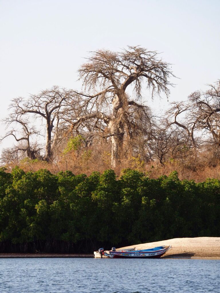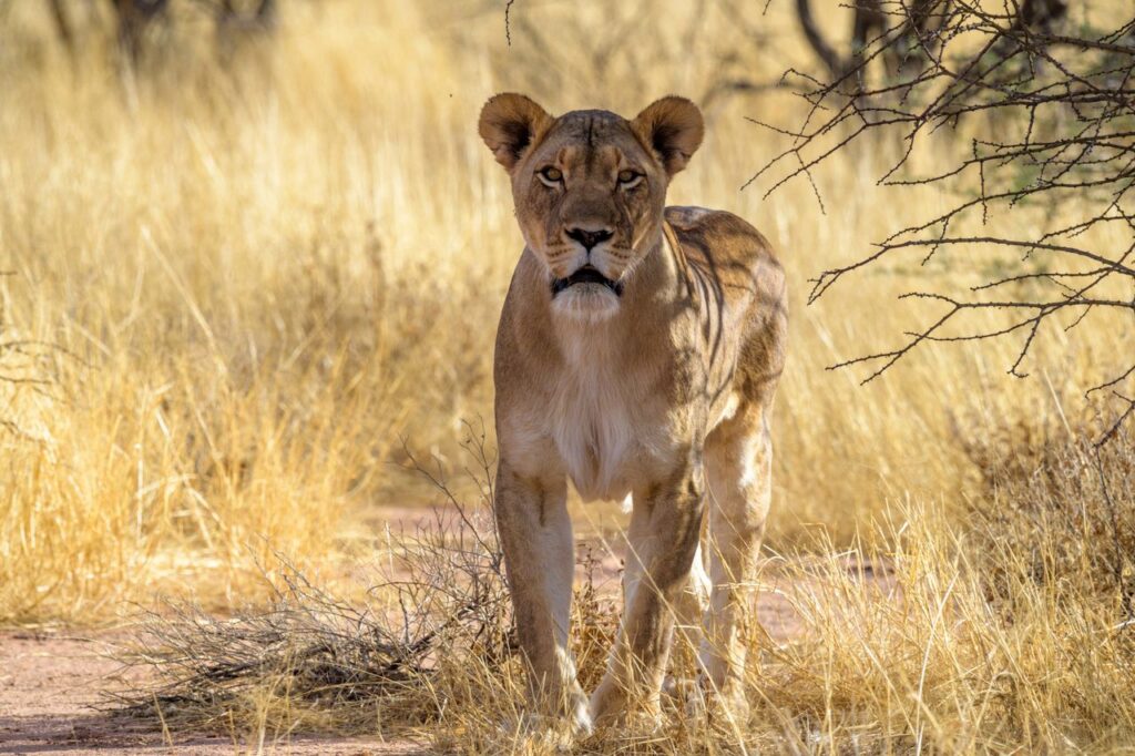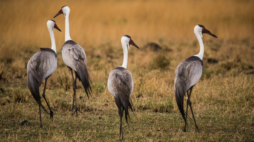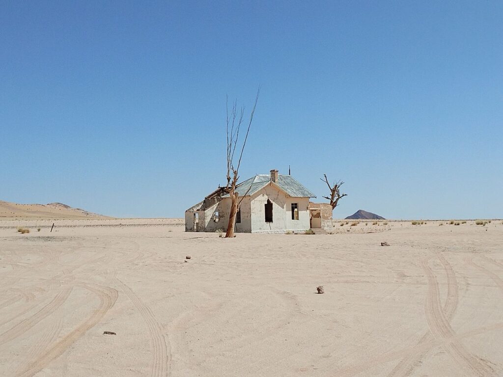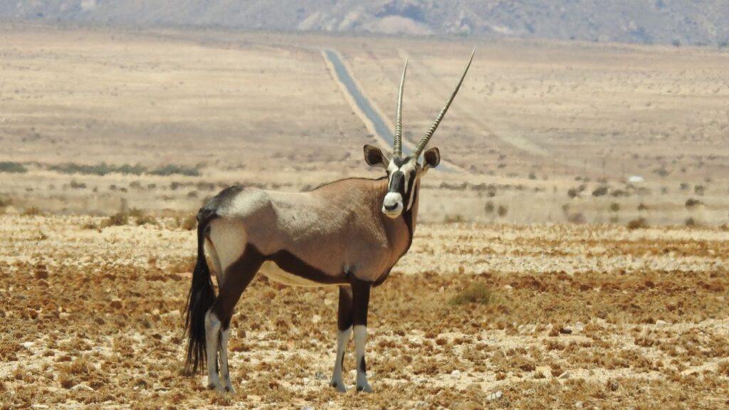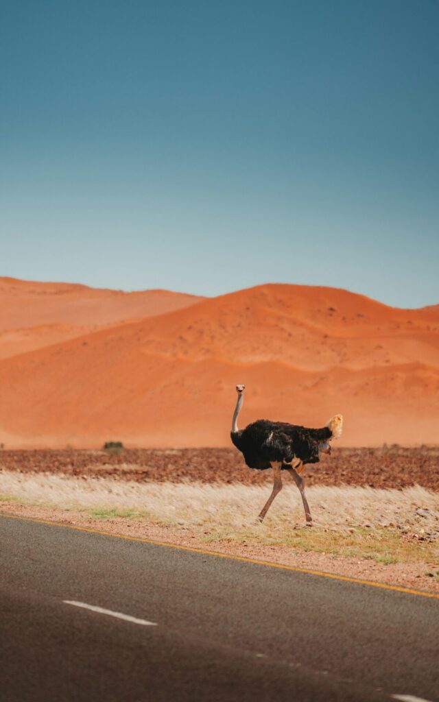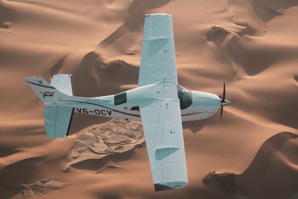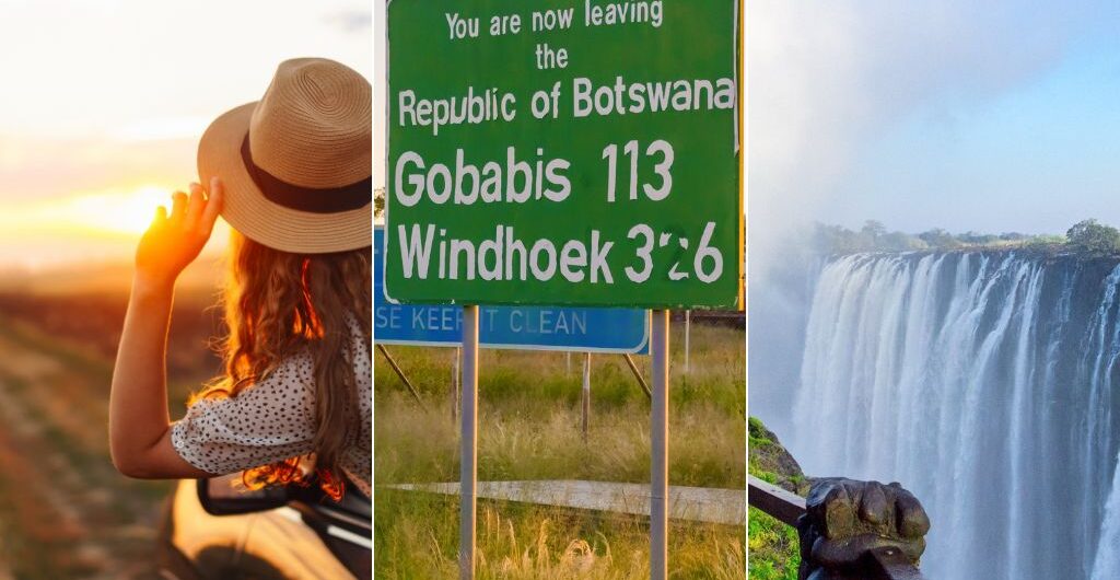
While even the most rural destinations in Africa have shops here and there, when you are out on the roads of Namibia, the word remote takes on a whole new meaning.

Forgetting to pack something and only realising when you are halfway between Windhoek and the Fish River Canyon can make or break your whole trip because there won’t be a shop in sight for kilometres around, and even if you do happen to find a store, it is more than likely only stocking the very basics.

Namibia is an adventure destination and one place that many travellers choose to visit because it can give you a challenge that most other destinations simply cannot.

Because of this, you cannot underestimate what you should be on your packing list for Namibia. You instead need to go into your planning with all of the necessary knowledge, based not on the basics but on the region you’ll be travelling to.

This is not a list for the overpacker, nor for the under-prepared. Think of it as your complete guide, written with both comfort and practicality in mind, because in Namibia, what you carry with you matters a lot more than you think.
Packing List for Namibia

The Namibia Packing Essentials

Before we get region-specific, there is a core set of items that belongs in every bag, no matter which corner of this country you are headed to.

These are the non-negotiables on any packing list for Namibia:

  • High-SPF sunscreen (reapply generously and often) and SPF lip balm
  • Wide-brim hat and polarised sunglasses
  • Reusable water bottle or hydration bladder, plus extra water reserves
  • Dust protection: a Buff or neck gaiter, bin liners for your luggage, and dust covers for your camera gear
  • Lightweight layers that can be added and removed throughout the day
  • Quick-dry clothing and sturdy, closed-toe shoes or boots
  • Basic first aid kit, power bank, offline maps (Maps.me is excellent), and a reliable torch or headlamp
  • Neutral and khaki colours for any wildlife areas

These items should form the backbone of your Namibia packing list, and everything else will be built on top of these essentials.

Packing for Ecotours in Namibia

Region-by-Region Packing Guide

Despite its reputation as a desert and dune destination, Namibia has plenty of variety.

But what each destination does have in common, aside from probably being quite far away from malls and large convenience shops, is harsh terrains and harsh climates.

Namibia is dry and hot just about all year round. This makes your clothing choices about the same wherever you go.

But clothing, as you know, is not the only thing you think about when planning a vacation. Based on the region you’ll be spending most of your holiday in, here are the packing checklists to keep in mind:

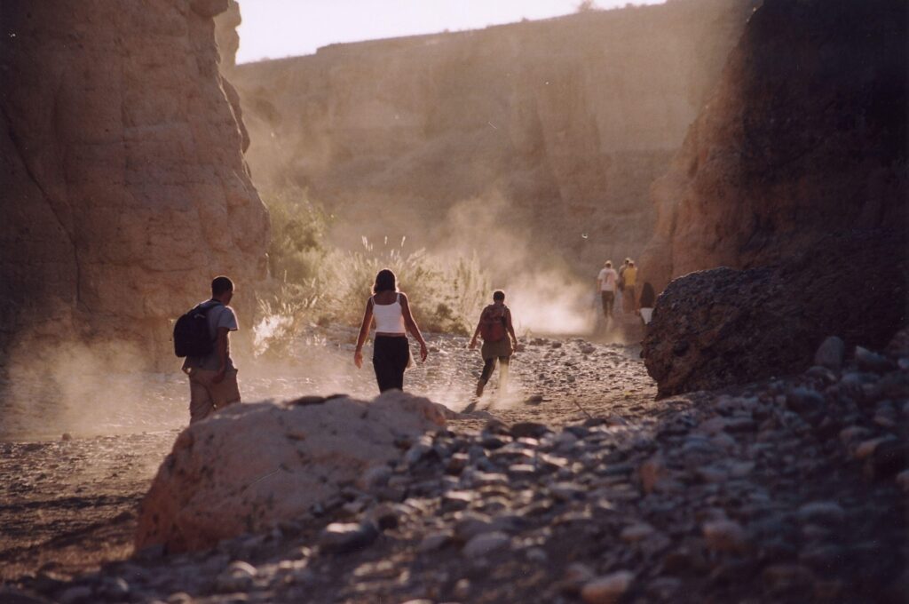
Southern Namibia and Fish River Canyon

The South is a fascinating place to travel through.

The area has scorching midday heat followed by surprisingly cool evenings, and terrain that changes as you drive through it, from red rock to ancient orange canyon walls, which make it one of Namibia’s top hiking destinations, with the Fish River Canyon in particular being a popular place.

You’ll need to pack:

  • Hiking boots with good ankle support or sturdy trail shoes
  • Quick-dry hiking trousers and long-sleeve shirts for sun protection
  • A fleece or lightweight jacket for the chilly evenings
  • Trekking poles, if you will be hiking in the canyon (the descent can be demanding)
  • Energy snacks and considerably more water than you think you will need

The south is exceptionally isolated, which means fuel and water planning are also essential. If you are travelling on your own, you must not leave without plenty of reserves.

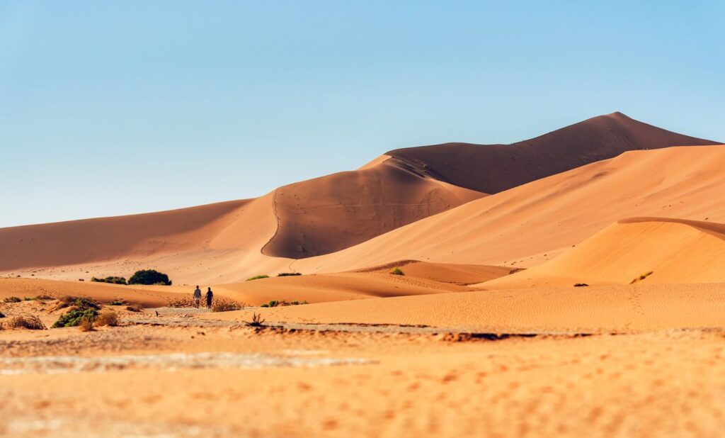
Big Daddy Dune in Namibia

Namib Desert, Sossusvlei and Naukluft

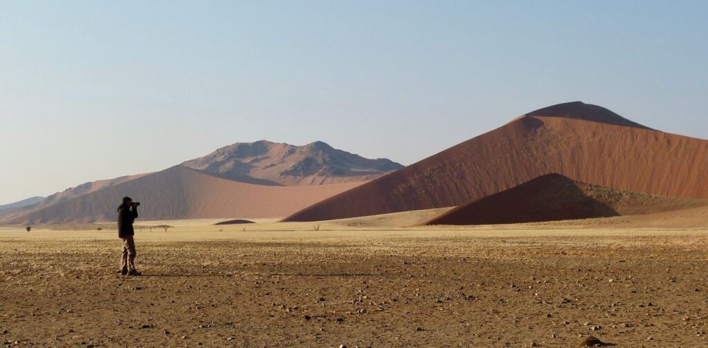
This is arguably the most iconic stretch of your Namibia holiday, and to stay comfortable and safe throughout your time here, you need to think about the heat when packing.

Most days reach above 35 degrees Celsius, while late evening and early dawn can drop into the single digits. Most who visit this area do so to climb the dunes, so you’ll want to make sure you pack clothing that you can layer on.

And since you are in the desert, you need to think about the fine, powdery sand that tends to find its way into absolutely everything.

Be sure to pack:

  • Old trainers or gaiters for dune climbing (sand will fill them regardless, but you’d rather have your old shoes get sandy)
  • Light long-sleeve tops and loose trousers to protect against the sun and windblown sand
  • A warm fleece and beanie for those sunrise dune hikes
  • A Buff for wind and sand protection
  • Large bin liners to line your luggage and sealed dry bags for electronics
  • Extra sunscreen and a small daypack for dune walks

A small tip worth knowing is to pack a spare pair of throw-away socks for after the big dune days. Big Daddy and its counterparts are spectacular, but the sand will be utterly unforgiving on your footwear.

Facts About Walvis Bay

Swakopmund, Walvis Bay and the Skeleton Coast

First-time visitors are often startled by the coast because it is just so different from the rest of the country.

The waters of the Atlantic Ocean are frigid, the fog rolls in and blankets the beach in an eerie white shroud, and the wind can be relentless. This is not the Namibia that makes the cover of postcards.

It is stranger, and altogether more fascinating, and as such, you need to pack accordingly:

  • A proper windbreaker or warm jacket
  • Scarf, long trousers, and several layers
  • Beanie or close-fitting cap
  • Swimming costume for coastal activities or boat trips
  • Binoculars for birdwatching and seal colonies
  • Motion sickness remedies if you are planning any boat excursions

It can feel 10 to 20 degrees cooler here than in the desert interior. If you have just come from Sossusvlei, you will feel caught completely off guard if you don’t pack something warmer.

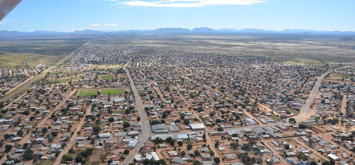
Windhoek, One of the Best Digital Nomad Friendly Cities in Africa for 2026

Central Namibia and Windhoek

The capital sits on a highland plateau and has a more temperate feel compared to the extremes of the desert and coast.

Packing for the city is far simpler than packing for one of the country’s wilderness destinations:

  • Casual layers and comfortable walking shoes
  • Smart-casual options if you plan to dine out

Windhoek is the best place to pick up anything you have forgotten. The city has everything you need, and all of its pharmacies, outdoor shops, and supermarkets are well-stocked. Many travellers treat the city as a base or a restock point before heading into the wilder regions.

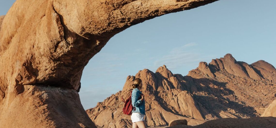
Damaraland, Twyfelfontein, Spitzkoppe and Kaokoland

Rugged, remote, and so very otherworldly, this region is one place that you need to be well-prepared for.

The roads are rough, the terrain is bewilderingly dramatic, and access to supplies of all kinds is limited. This is where your packing list for Namibia gets serious, and should include:

  • Sturdy hiking shoes with good grip
  • Sun-protective long-sleeve clothing
  • Warm layers for cool evenings
  • A reliable torch (power supply is often limited or solar only)
  • Binoculars for desert-adapted wildlife, including the famous desert elephants
  • Respectful clothing for cultural visits

A 4×4 vehicle is a non-negotiable if you are self-driving. The dust and rocky tracks will test both your vehicle and your driving skills. It is important that you do a full vehicle check before you set out, as you don’t want to get stuck somewhere without a spare tyre (or the skill to fix it).

Elephant and Impala in Etosha National Park

Etosha National Park

Etosha National Park is Namibia’s premier safari destination. Your time spent here will be divided between time spent driving around, looking for all sorts of wildlife, and lazy afternoons at the lodge or camp, just relaxing and doing your own thing.

For your Etosha trip, pack for a safari:

  • Neutral colours like khaki, beige, and olive green. It’s not that bright colours scare away wildlife, but they don’t really fit in with the relaxed vibe.
  • Long-sleeve shirts and trousers for sun and insect protection
  • A fleece or warm layer for early morning drives, when temperatures drop sharply
  • Binoculars and a camera with a good zoom lens
  • A headlamp for evening waterhole visits
  • Snacks and drinks for long drives between waterholes

When on safari, you need to stay in your vehicle at all times except in designated areas. For this reason, you should give extra thought to your snacks, and you should add a couple of water bottles too, as a cool drink won’t necessarily hydrate you.

Northern Namibia: Caprivi Strip, Zambezi Region and Kavango

The far north is a different Namibia entirely.

It’s green, has a riverine ecosystem, and is teeming with birdlife; it also carries a higher malaria risk, particularly between November and May.

Your packing list for Namibia for this area of the country should include:

  • Lightweight long-sleeve clothing for evenings, when mosquitoes are most active
  • Quick-dry fabrics throughout
  • Strong insect repellent
  • Malaria prophylaxis as recommended by your doctor before travel
  • A rain jacket during the wetter months

If you are heading north, you should consult your GP or a travel health clinic well before your departure. Along with malaria-carrying mosquitoes, tsetse flies are also present in certain areas.

Packing for a Namibia Tour

What Not to Pack for Namibia

As important as what you bring is what you leave behind. Not only is it unnecessary to pack everything plus the kitchen sink, but since you won’t have unlimited space in your vehicle or aboard a light aircraft, overpacking just makes no sense.

You won’t need:

  • Bright colours and white clothing for safari days
  • High heels or impractical footwear of any kind
  • Excess cotton (it holds moisture, takes forever to dry, and it can leave you feeling miserable in the heat)
  • More luggage than you can lift yourself
Walking in Sossusvlei

A well-planned packing list for Namibia is the beginning of an extraordinary holiday to one of the last truly wild places on Earth.

And one of the most important things you can pack is the right guide. Let our team take care of the itinerary while you focus on the essentials.

Water is your single most critical resource. Carry more than you expect to need, particularly in the desert regions and the south. Beyond hydration, dust protection and layering for temperature extremes will serve you well across the entire country.

It depends on your itinerary. Much of Namibia, including Windhoek, Etosha, the Namib Desert, and the south, carries low to negligible malaria risk. However, the northern regions, particularly the Zambezi Strip and Kavango, have higher transmission rates, especially from November through to May or June. Always consult your doctor before departure.

Stick to earthy, neutral tones: khaki, beige, stone, olive, and soft greens. Avoid white, bright colours, and dark blue or black in certain northern areas. Natural fibres and neutrals are the most practical and comfortable choice.

There is no formal dress code, but covering your shoulders and knees is respectful and culturally appropriate. Modest, lightweight clothing is both practical and considerate. Your guide will always provide specific guidance ahead of any community visit.

Windhoek is well-equipped, with pharmacies, outdoor retailers, and supermarkets that carry most travel essentials. Outside the capital, options become increasingly limited. If you are heading directly into remote areas, ensure your packing list for Namibia is complete before you leave the city.

About the Authors African Travel Concept Namibia Team

At African Travel Concept Namibia, our team of experienced travel and safari professionals is dedicated to turning first-hand African expertise into clear, reliable advice. We research, review, and refine every article so you have the most current and accurate information when planning your trip.

There are mountains that you point out when you are driving past, and then there are mountains that stop you mid-sentence.

Spitzkoppe, Namibia, is one of those mountains that doesn’t just stop you from saying whatever it was that you had in mind; it also forces you to stop your car so that you can stare in awe at the sight of this majestic rocky outcrop.

Rising some 1 728 metres above sea level from the flat, ochre plains of the Erongo region, this ancient granite giant has been commanding attention for a very long time.

Millions of years, in fact. Long before anyone thought to photograph it, paint it, or build a travel itinerary around it, Spitzkoppe was already the most striking thing for kilometres in every direction.

Spitzkoppe, one of Namibia’s Most Sacred Sites

Is Spitzkoppe Worth It?

Spitzkoppe, Namibia, sits between Usakos and Swakopmund in the Erongo region, rising from one of the most ancient and quietly beautiful stretches of Damaraland.

Its German name means “pointed dome,” and the locals sometimes call the main peak the Matterhorn of Namibia because of its sharp, dramatic profile.

The granite that forms the rock is astoundingly old, stretching back over 700 million years to when volcanic forces pushed magma into the crust during the breakup of the supercontinent Gondwana. Erosion over millions of years has stripped away the softer rock around it, leaving these bald inselbergs standing sentinel above the plains.

At sunrise, the granite shifts through shades of gold and deep rose. By midday, the light becomes sculptural and severe, carving out every ridge and shadow. At night, in one of Namibia’s finest dark sky zones, the Milky Way stretches overhead in a full, luminous arc that is genuinely difficult to describe to someone who has not stood beneath it.

The beauty and magnitude of this natural attraction certainly make a trip to see it worth every second.

Stargazing in Spitzkoppen

6 Fascinating Facts About Spitzkoppe

Namibia is home to some pretty amazing places, and Spitzkoppe is high on the list of destinations worth spending a day exploring. To make your trip to these rocks that little bit more interesting.

The area is immense, and the grandeur of it all can do a number on one’s senses.

At sunrise, the granite changes colours, turning shades of gold and red; by midday, the light becomes exceptionally harsh and sculptural, highlighting the rock’s sharp edges and deep shadows; and at night, the usually clear sky opens into a canopy so crystalline that the Milky Way looks close enough to touch.

If you are the kind of traveller who really appreciates and seeks out a destination that is quiet and free from overcrowded spectacles, Spitzkoppe Namibia is just the place to find solitude.

1. It Is Older Than Almost Everything You Have Ever Seen

The granite of the Spitzkoppe mountain range is dated at more than 700 million years old, part of an ancient volcanic complex that erupted when the supercontinent Gondwanaland was still pulling itself apart.

To put that into some kind of perspective: the dinosaurs had not yet arrived when this rock was already ancient.

Over the millennia, the softer sediment surrounding these peaks was gradually stripped away by wind and erosion, leaving behind the dramatic, sculptural inselbergs we see today.

Inselberg, incidentally, is the German word for “island mountain”, and it is a fitting description. In many ways, Spitzkoppe does not look as though it should be a part of the landscape, but rather it looks like something placed on top of it.

2. It Has a Rather Famous Swiss Cousin

Spitzkoppe is often called the “Matterhorn” of Namibia due to its distinctive form, which can be spotted from a great distance.

The sharp, pointed summit slicing upward from the flat desert floor echoes the iconic silhouette of its Swiss counterpart.

The main peak rises 1 728 metres above sea level and surmounts its surroundings by at least 700 metres.

It can be spotted from the B2 highway between Swakopmund and Windhoek and is, without question, one of the most photographed landscapes in the country.

The smaller sister peak, Klein Spitzkoppe, reaches up 1 584 metres and is surrounded by the Pontok Mountains, creating a cluster of peaks that look absolutely otherworldly at sunrise.

Spitzkoppe Namibia Photo Tour

3. It Is an Outdoor Gallery with a 4 000-Year Head Start

Long before Spitzkoppe, Namibia appeared in any travel guide, the San people were already here.

Their rock paintings, some estimated to be between 2 000 and 4 000 years old, are scattered across the area and depict animals and cultural stories.

There are at least 37 different rock art sites to be found around Spitzkoppe, and these sites can only be seen with a tour guide.

4. Hollywood Has Used It as a Backdrop (Twice, at Least)

If the rock arch at Spitzkoppe looks vaguely familiar, it’s because photos of the mountain were used as a background in the film 2001: A Space Odyssey, and 10 000 BC was also shot around the Spitzkoppe rocks.

The alien-like quality of the landscape, especially the pink-hued granite, has a cinematic quality even in person.

The pink tones are created by the presence of minerals such as feldspar and quartz, which are especially striking during sunrise and sunset.

Spitzkoppe Star Trails

5. Only 600 Climbing Parties Have Ever Reached the Summit

The first ascent of the challenging west side was in 1946, and up to today, only 600 roped parties have succeeded in reaching the peak.

During the summer months, it is not at all possible to climb Spitzkoppe due to the unbearable heat.

Legend has it that as early as 1904, the peak was reached by a soldier of the Imperial Schutztruppe who soloed the route and supposedly made a fire on the summit, but it remains a mystery as to what he burnt, as there is no natural fuel on the upper parts of the peak.

He reportedly never returned, which adds a suitably ghostly footnote to the history of Spitzkoppe, Namibia.

6. The Night Sky Here Is Absolutely Extraordinary

Namibia is recognised as one of the world’s top Dark Sky zones, and Spitzkoppe sits well within that designation, giving visitors an unparalleled opportunity to view the entire Milky Way and a sky filled with millions of stars.

With almost no light pollution for hundreds of kilometres, the Milky Way appears here as a full, sweeping arc, so bright and so clear that you can see every constellation and all of the space dust. Those who have spent a night here often describe the stargazing as the most impressive of their lives, which is a significant statement from people who have generally seen quite a lot of the world.

Spitzkoppe, Namibia

Spitzkoppe is an iconic granite inselberg located in the Erongo region of Namibia, situated between the towns of Usakos and Swakopmund. Rising 1 728 metres above sea level and surmounting its surroundings by at least 700 metres, it is one of the most visually striking and photographed landmarks in the country. Its distinctive pointed summit has earned it the nickname the Matterhorn of Namibia, and it is visible from the B2 highway between Swakopmund and Windhoek.

Spitzkoppe has a range of experiences for different kinds of travellers. Rock climbing is possible, though it is challenging and limited to cooler months. Guided tours take visitors through at least 37 San rock art sites scattered across the area, some estimated to be between 2 000 and 4 000 years old. The reserve also offers camping, hiking among the boulders, photography, and exceptional stargazing under some of Namibia’s darkest skies.

Yes. While the technical summit climb is reserved for experienced and well-equipped mountaineers, the broader Spitzkoppe area is accessible and rewarding for visitors of all fitness levels. Gentle walks among the boulders, guided rock art tours, sunrise viewing, and overnight camping are all popular options that require no climbing experience. The reserve is set up to welcome a range of visitors, from seasoned adventurers to those simply seeking stillness and scenery.

The cooler, drier months between April and October are widely considered the best time to visit Spitzkoppe. Summer temperatures can be extreme, making hiking and climbing uncomfortable and, in some cases, unsafe. Mornings and evenings during the cooler season offer the most beautiful light, particularly at sunrise and sunset when the pink granite glows warmly against the desert sky. Stargazing is rewarding year-round, though clear winter nights tend to offer the most vivid skies

Spitzkoppe is approximately 130 kilometres from Swakopmund and around 260 kilometres from Windhoek, making it a comfortable day trip or overnight stop from either direction. The turn-off from the B2 highway is well signposted, and the road into the reserve is generally accessible by sedan vehicle, though a higher clearance vehicle is recommended for exploring further into the area. Self-drive visitors are welcome, and the reserve has a small entrance fee payable at the gate.

About the Authors African Travel Concept Namibia Team

At African Travel Concept Namibia, our team of experienced travel and safari professionals is dedicated to turning first-hand African expertise into clear, reliable advice. We research, review, and refine every article so you have the most current and accurate information when planning your trip.

Camping in Namibia is, in just one word, amazing. 

Home to stunning scenery and with long stretches of absolute nothingness, not a single soul in sight and no city lights, Namibia has become one of the best places in Africa to camp.

Although the country has plenty of undeniably beautiful, convenient, comfortable and luxurious lodges, camping remains a popular choice when it comes to accommodation.

And while this style of accommodation might sound as though you are simply roughing it, sleeping in a tiny two-man tent pitched out under a tree somewhere in the middle of nowhere, you are a bit off the mark if that is what you are imagining.

Whether you are planning a self-drive road trip, following sun-bleached gravel roads or joining a guided tour through the country’s most iconic reserves, Namibia is a great place to fall asleep beneath the clearest starry skies.

Camping in Namibia

The 8 Best Places to Go Camping in Namibia

In a country as wildly varied as Namibia, the camp you choose will shape everything about how you experience this amazing place.

These are the 8 best places to camp.

Okonjima Plains Camp View Rooms in the Otjozondjupa Region

Okonjima is the kind of place that will give you a totally new perspective on what a camp can be. 

Set within the Okonjima Nature Reserve, which is home to the AfriCat Foundation, the Plains Camp View Rooms have been built amidst the thornveld, giving travellers uninterrupted views t through floor-to-ceiling windows out across the open plains, just the place to watch the sun moving across the sky.

What makes Okonjima so special is its conservation work. 

As a guest, you are so much more than the average holidaymaker, as this camp supports big cat conservation efforts in the reserve.

While staying at the camp, you can become a part of something meaningful, with leopard and cheetah tracking experiences being a part of the appeal and also an activity that can have you contributing to the continued protection of these incredible animals.

You’ll wake early, follow a tracker into the bush, and then return for breakfast with a story that will stay with you for a lifetime.

Palmwag Camping2Go in the  Kunene Region

For those who want to sleep somewhere truly few people have been, Palmwag is just the place. 

Located within the vast Palmwag Concession, close to Uniab River,  in the remote and utterly beautiful Kunene Region, this is desert camping at its most elemental, a place where desert-adapted elephant, black rhino, and lion move freely and where humans seldom tread. 

The Camping2Go concept is well planned and will give you everything you need. The camp is fully equipped and ready to enjoy, so despite the camp being very much off the beaten track, it’s comfortable and convenient. 

The silence that you’ll experience in the camp is something you can almost feel on your skin, making it a real soul-reviving kind of destination.

Sossusvlei Desert Quiver Camp in the Namib-Naukluft Park

There are camps that place you near an iconic landscape, and then there are camps that place you inside it. 

Sossusvlei Desert Quiver Camp belongs firmly to the second category.

Positioned at the edge of the Namib Desert with the red/gold dunes of Sossusvlei within easy reach, this camp will give you comfortable, well-appointed accommodation that perfectly matches the scenery around it. 

The pre-dawn drive to Big Daddy or Deadvlei, in the coolness before the world wakes up, is one of the best ways to start a day while staying here. And you can also visit the beautiful Sesriem Canyon or sign up for an exciting Hot Air Balloon excursion while staying here.

After you’ve climbed the dunes and slid down the other side, you’ll return to the camp just as the heat builds and the light turns to gold, and you will understand exactly why Namibia’s dune sea is spoken of the way it is.

Waterberg Camp in the Waterberg Plateau Park, NWR

The Waterberg Plateau rises dramatically from the surrounding plains, a sandstone fortress draped in ancient rock fig trees and dense vegetation that will have you convinced, after all your desert explorations, that you are anywhere but in Namibia. 

The camp here is set at the base of the plateau, and it will give you a feeling of being sheltered and secluded in a way that many desert camps cannot. 

It is home to a sanctuary for rare and endangered species, including white rhino, roan antelope, and Cape vulture, making it a perfect stop for wildlife enthusiasts who want something more than the Etosha experience. 

Mornings here are filled with birdsong and cool air, while the evenings are lit with the soft amber glow of lantern light against the red rock face.

Halali Camp in Etosha National Park, NWR

Of the three NWR rest camps within Etosha, Halali is really something special. 

Situated centrally within the park, it sits closest to the famous floodlit waterhole that draws animals throughout the night in a procession so extraordinary that it is difficult to tear yourself away from what you are seeing. 

Elephants often arrive just as darkness settles, and it is not uncommon to see lions circling the edge of the light, and smaller creatures move in and out of the frame, often quickly, so as to avoid being seen by the nearby predators. 

The camp itself is well-maintained and comfortable, with enough facilities to make a multi-night stay thoroughly enjoyable. 

But it is the waterhole, and the ritual of gathering there each evening with a drink in hand and nowhere else to be, that makes Halali one of those places you’ll treasure the most.

Mowani Mountain Camp in Damaraland

Mowani is, quite simply, one of the most beautiful camps in Namibia. 

Built among ancient granite boulders in the Uibasen-Twyfelfontein Community Conservancy in  Damaraland, the camp looks as though it grew from the rock itself, all curved walls, canvas, and warm wood, in a landscape that belongs to another era. 

Days here are spent tracking desert elephant on foot or by vehicle, visiting the extraordinary rock engravings at Twyfelfontein, or simply sitting with a cold drink watching as the colours of the land change throughout the day. 

As far as camping in Namibia goes, while staying here, you are going to feel like the last person left on the planet; it is just that out of the way, but the experience is anything but rough. 

Mowani will treat you to a luxury retreat, although not one that will be too much of an extravagant or excessive affair.

Zambezi Mubala Camp in the Zambezi Region

The Zambezi Region is Namibia’s greenest secret, a lively river corridor in the far northeast that is worlds away from the desert landscapes the country is best known for. 

Mubala Camp sits right on the banks of the Zambezi River, a tranquil spot that you will be more than happy to see after a long day on the road.

Mokoro excursions, birdwatching along the reeds, sunset cruises with a glass of something cold in hand, and the peaceful and constant sound of the river running past your tent at night, are a real tonic for the weary traveller.

If your itinerary allows for it, the Zambezi region is worth every extra kilometre.

Desert Hills Glamping Camp in the Namib Desert

For those who want the poetry of sleeping in the desert without sacrificing the comforts that make rest restorative, Desert Hills Glamping Camp is just the place.

Set among the rust-coloured hills of the Namib with sweeping views and a meditative silence, this camp will give you nature plus a whole lot of modern comfort. 

The glamping tents are filled with comfortable furniture and the most indulgent beds, the stargazing is extraordinary, and the feeling that you are completely alone in one of the world’s oldest deserts is something you simply won’t experience anywhere else. 

It is the kind of place you book for one night and immediately wish you had stayed for three.

Digital Nomading in Namibia

Settling on the Right Camp for Your Namibia Holiday

The most meaningful Namibia itineraries are the ones built around how you want to feel, not just what you want to see. 

If long, unhurried mornings and the sound of nothing but wind matter to you, head for one of the more remote desert camps. 

If wildlife is your priority, book yourself a stay in or near Etosha for at least a few nights. 

And if you are self-driving, think carefully about the distances between each stop so that the road trip itself will be a part of the pleasure rather than something to endure.

A specialist who knows Namibia well will help you sequence it all in a way that feels considered rather than rushed. The camps in this guide each offer something distinct, and the best itinerary is simply the one that gives you enough time to truly arrive in each one.

Camp Doros Luxury Accommodation in Namibia

Namibia does not do ordinary, and honestly, neither should you. 

The best moments in Namibia are rarely the ones you planned. They are the elephant that wandered past at dusk, the unexpected rainbow over the Waterberg, the morning you decided to stay an extra hour at Deadvlei because you simply could not leave yet.

We will help you plan the kind of trip that leaves room for all of that.

Namibia is widely regarded as one of Africa’s safest travel destinations, and camping here is generally very secure, particularly within established reserves and national parks. As with any wilderness environment, basic precautions apply: follow camp guidelines, stay aware of wildlife in the area, and ensure your vehicle and equipment are in good condition before you set out.

Not all camps require a 4×4, but having one opens up a significantly wider range of options. Many of the country’s most beautiful and remote camps are only accessible via gravel roads or dry riverbeds, and a high-clearance 4×4 will give you both access and peace of mind. For the main routes and NWR rest camps, a robust 2×4 with good ground clearance can suffice.

The dry season from May to October is considered the most comfortable and rewarding time to camp, with cooler temperatures, clearer skies, and excellent wildlife visibility. July and August are particularly popular, so booking well in advance is essential during these months.

Absolutely. Namibia is one of the most self-drive-friendly countries in Africa, and many travellers plan and book their own itineraries independently. NWR campsites can be reserved directly through their website, and private camps each manage their own reservations. That said, working with a local travel specialist often adds a layer of insight and ease that independent booking alone cannot always provide.

Think in layers for the temperature swings between day and night, which can be considerable. A good-quality sleeping bag, sun protection, a headlamp, and a basic first aid kit are non-negotiable. Bring more water than you expect to use, a detailed road map or offline GPS, and enough snacks for long drives between stops. And do not forget a warm layer for those early morning game drives when the air is still cold and the light is gold.

About the Authors African Travel Concept Namibia Team

At African Travel Concept Namibia, our team of experienced travel and safari professionals is dedicated to turning first-hand African expertise into clear, reliable advice. We research, review, and refine every article so you have the most current and accurate information when planning your trip.

There is arguably no better place in Africa for a road trip than Namibia.

This fascinating country, while marketed as a rough and remote destination, is a lot easier to drive through than you think.

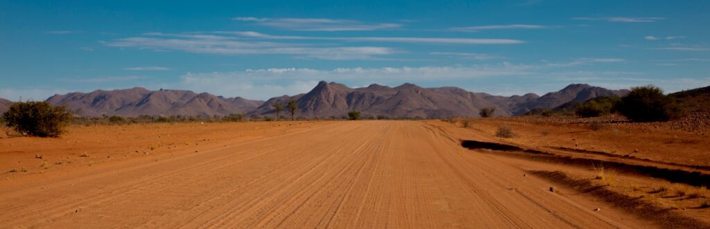
The roads stretch out endlessly ahead, the sky fills the entire windscreen, and the landscape, depending on the direction you’re travelling in, can change from ochre desert to green highland to salt pan, all in the space of a single afternoon.

If you like to move at your own pace, stop when something catches your eye, and feel the scale of southern Africa unfold around you, a self-drive Namibia road trip is one of the most exciting ways to see the country.

With well-maintained roads and next to no traffic, self-driving in Namibia can be a comfortable experience, but it does, however, require a little preparation.

Tips for the Ultimate Self Drive Namibia Road Trip

Namibia’s Wild and Windy Roads

Namibia has an excellent road network by African standards, but the conditions vary considerably depending on where you are headed.

The B-roads, which are the main tarred routes connecting major towns and cities, are well-maintained, generally straightforward to drive and pretty much never congested.

These connect Windhoek to destinations such as Swakopmund, Luderitz, and the Etosha National Park entrance gates.

The C and D-roads are gravel, and these cover the majority of the country.

Gravel roads in Namibia are typically wide and navigable, but they require a slower, more deliberate driving style.

Corrugations, loose gravel, and unexpected dips are common, and speeds should rarely exceed 80 kilometres per hour.

Some routes, particularly those leading into the Namib Desert, Damaraland, and the Kaokoveld, are a little more challenging and are best suited to high-clearance or 4×4 vehicles.

What is the Right Vehicle for a Self-Drive in Namibia?

The vehicle you choose will depend entirely on where you plan to go.

For a route that stays largely on tarred roads, a standard sedan or compact 4×2 is perfectly adequate. Windhoek to Swakopmund, Windhoek to Etosha via the B1, and the coastal routes can all be managed comfortably in a regular hire car.

For gravel roads and more remote destinations, a high-clearance vehicle is strongly recommended.

If your itinerary includes Sossusvlei, the Skeleton Coast, Damaraland, or Fish River Canyon via scenic routes, a 4×4 with a rooftop tent or a well-equipped camper gives you both the capability and the flexibility to camp where the mood takes you.

Namibia is one of the finest 4×4 self-drive destinations in Africa, and having the right vehicle really will make all the difference.

The Rules of the Road and Safety in Namibia

Namibia drives on the left-hand side of the road, which will be immediately familiar to South African travellers and those arriving from the UK or Australia and rather unusual to US travellers.

Speed limits are 120 km/h on open tar roads, 80 km/h on gravel, and 60 km/h in towns and urban areas. These are enforced, and fines apply.

When self-driving, you should always fuel up at every opportunity, particularly when heading into more remote areas, as the distances between filling stations can be extreme. It is wise never to pass a petrol station with less than half a tank. 

Wildlife walking on and across roads is fairly common, especially at dawn and dusk, so you should always reduce your speed and stay alert, even more so when you are travelling on rural roads. 

Seatbelts are compulsory for all passengers, and the use of a mobile phone while driving is prohibited without a hands-free kit.

Finally, you should carry a physical map or download offline navigation, as data coverage in rural Namibia is limited and GPS connectivity can be unreliable in remote areas.

Elephant at the Etosha Salt Pan

The Best Self-Drive Namibia Road Trip Routes

One of the most popular Namibia self-drive circuits will start in Windhoek and have you travelling to Etosha National Park, the Skeleton Coast, Swakopmund, Sossusvlei, and Fish River Canyon before looping back to the capital.

This route covers most of the country’s most iconic landscapes and can be done comfortably in 10 to 14 days, though more time always rewards.

For those seeking something quieter, the route through Damaraland to Twyfelfontein, Brandberg, and the remote Kaokoveld will give you a more intimate encounter with the landscape and its communities. The Caprivi Strip in the northeast is a greener, water-rich contrast to the desert south and is excellent for wildlife.

Most reputable tour companies can help you design a self-drive itinerary that suits your timeframe, interests, and comfort level, with accommodation pre-booked and route notes provided so you can focus entirely on the road ahead.

Driving Through the Kalahari Desert

10 Essential Tips for Self-Driving in Namibia 

Driving in Namibia is really easy when you have a couple of basic tips, and if you don’t take any chances, like attempting to drive off-road.

Book Early and Book a 4×4

Namibia’s road network is largely unpaved, and to see most of the beautiful destinations, you’ll need to navigate gravel tracks that range from gently corrugated to a little rough.

While a 2WD vehicle can manage some routes, it will slow your journey considerably and make for an uncomfortable ride. 

A 4×4 will give you better ground clearance, more reliable traction on loose sand and gravel, and an overall more comfortable experience. The additional rental cost and fuel consumption are well worth the peace of mind. 

Namibia is a popular self-drive destination, and well-equipped 4×4 vehicles are in high demand, especially over peak season between June and October. 

Securing your vehicle several months in advance gives you the best choice and the most competitive rates.

Read the Fine Print on Mileage 

Some rental agreements cap the number of kilometres included per day. 

If your itinerary covers the full country, as many Namibia road trips do, an unlimited mileage package will almost always be the more economical choice.

Slow Down When Passing Oncoming Traffic

You may drive for hours without seeing another soul, but when you do encounter oncoming traffic, you should slow down significantly and ease as far left as you safely can. 

Gravel roads throw up rocks at speed, and neither party wants an unnecessary dent or cracked glass. 

The official speed limit on gravel roads is 80km/h, though in practice, many roads will have you travelling at half that. 

Take your time with your self-drive Namibia road trip. The journey is part of the experience.

Stop for Drivers Who May Need Help

The solitude of Namibian roads is one of their greatest gifts, but it also means that a traveller in difficulty may wait a long time before anyone passes by. 

If you see a vehicle stopped at the roadside, take a moment to check that all is well. 

They may simply be watching a herd of oryx move across the plain, or they may genuinely be in need of assistance. 

Let common sense be your best guide; in remote areas, a family with a flat tyre almost certainly needs a friendly helping hand.

A Guide to Northern Namibia

Get Comprehensive Insurance Coverage 

Self-driving in Namibia means spending long, glorious hours on rocky gravel roads, and the landscape, beautiful as it is, is not always so kind to vehicles. 

Flying stones can chip a windscreen in an instant, and the uneven terrain takes a toll on tyres. Spend three weeks on Namibian roads, and it is entirely possible to experience two punctures and a chipped windscreen without any fault of your own. 

Comprehensive insurance is essential.

Inspect the Vehicle Thoroughly Before Departure 

Before you sign for and take your rental for your self-drive Namibia road trip, walk around the car with a rental agent and photograph any existing damage. 

Pay particular attention to the tyres, windscreen, and undercarriage. 

Gravel roads are notorious for stone chips, and you want a clear record of the vehicle’s condition at collection.

Drive With Your Headlights on at All Times

The dust that rises behind a moving vehicle on a Namibian gravel road is spectacular in the golden light, but it significantly reduces visibility for anyone following behind you (should there be anyone at all).

Namibian law requires headlights to be on throughout the day, and it is a rule that protects everyone on the road. 

Make it a habit from the moment you turn the key.

Do Not Drive After Dark

Outside of towns, Namibia’s roads are unlit, and the hazards after dark increase considerably. 

Potholes, uneven surfaces, and animals that are most active in the cooler evening hours all make night driving risky. 

Nocturnal animals, including kudu and various antelope, have a tendency to move directly into oncoming headlights with little warning, so make sure that you plan your driving days to finish well before sunset.

Allow Far More Time Than You Think You Need

A self-drive Namibia road trip is not like driving anywhere else. 

A route that looks manageable on paper may take twice as long in practice, depending on road conditions, your vehicle, and the number of times you stop to watch something extraordinary through the windscreen. 

Start your driving days early in the morning, keep your daily distances reasonable, and resist the temptation to overschedule. 

Arriving at your final stop of the day, with the sun still high in the sky, is always the better choice.

Return the vehicle clean and with a full tank

Most rental agreements require that the vehicle be returned with the same fuel level as when you collected it. 

Rental companies typically charge a premium for refuelling on your behalf, so factor in a stop at a filling station close to the drop-off point on your final day.

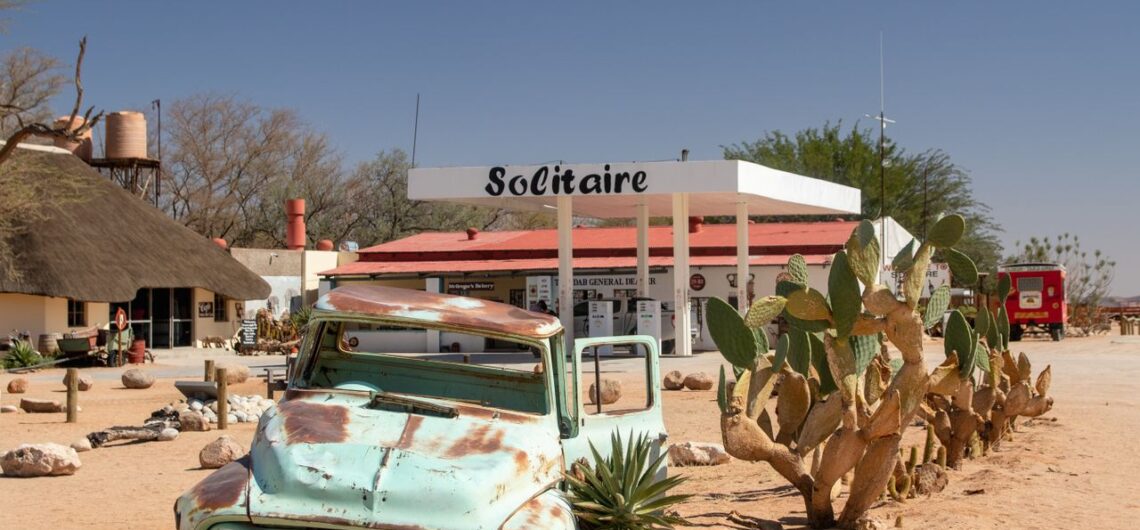
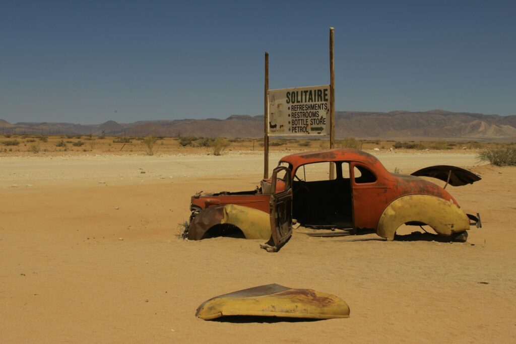
Solitaire

A self-drive Namibia road trip is the ultimate adventure, and it’s just the sort of experience that will have you finding yourself out there, in the wilderness of one of Africa’s most majestic places.

Not necessarily. If your route stays on the main tarred B-roads, a standard 2-wheel drive vehicle is sufficient. However, for gravel roads, remote destinations, and off-the-beaten-track routes, including Sossusvlei, Damaraland, and the Kaokoveld, a high-clearance 4×4 is strongly recommended. It extends your options considerably and gives you a far more comfortable drive on corrugated gravel.

Namibia is considered one of the safest self-drive destinations in Africa. Roads are generally well signposted, traffic is light outside of Windhoek, and the country has a stable infrastructure. The primary risks are wildlife on roads at dusk and dawn, tyre punctures on gravel, and the distances between fuel stops. Sensible preparation addresses all of these comfortably.

Namibia drives on the left-hand side of the road, the same as South Africa, the United Kingdom, and Australia. The speed limit is 120 km/h on open tar roads, 80 km/h on gravel roads, and 60 km/h in built-up areas.

For travel during peak season, which runs from June to October, booking three to six months in advance is advisable, particularly for 4×4 vehicles and fully equipped campers. These are in high demand, and the best-equipped vehicles are secured early. Outside of peak season, a shorter lead time is generally sufficient.

Yes. Namibia Safaris specialises in both guided and self-drive itineraries across Namibia. The team can recommend the most suitable route for your timeframe and interests, arrange pre-booked accommodation throughout, and provide detailed route notes so that every stage of the journey feels well supported, even when you are driving independently.

About the Authors African Travel Concept Namibia Team

At African Travel Concept Namibia, our team of experienced travel and safari professionals is dedicated to turning first-hand African expertise into clear, reliable advice. We research, review, and refine every article so you have the most current and accurate information when planning your trip.

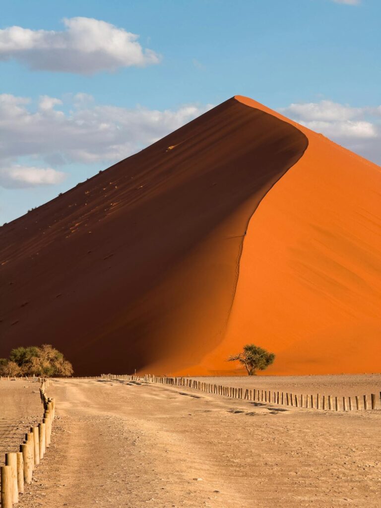
At its peak, the iconic Big Daddy Dune in Namibia is a whopping 325 meters above ground, easily making it one of the tallest in the world. The walk to the summit is thigh-burning and will have you huffing and puffing, but the views from the top, and the slide down make it well worth the effort.

Of all the natural attractions that have made Namibia famous, the country is arguably best known for its endless sea of sand.

The Namib Desert, the oldest on the planet, is the main attraction and all throughout the rolling sand sea, there are dunes, and some are more famous than others.

Big Daddy, along with Dune 45 and Dune 7, are quite literally mountainous in size.

Standing at the bottom of any of these dunes, with your toes in the sand, because it is an imperative part of the experience to kick off your shoes for a while, feeling the heated grains which are millennia old, is a soulful experience.

But a visit to this dune is not just able to stir the soul; it’s also a great place to have some fun, explore, and to just take your time to enjoy the great outdoors.

Deadvlei of Namibia

What Is Big Daddy?

Big Daddy is a dune in Sossusvlei.

The area in which it is found is full of numerous other spectacular dunes, but Big Daddy is by far the tallest, standing out from the rest, and it has become a must-see tourist attraction.

The dunes of Sossusvlei have been created by the ancient sands of the Kalahari Desert, which have been blown to and fro over the centuries, first carried out to the Atlantic Ocean by the Orange River, then washed up on the shores of Namibia and swept out into the desert, creating the dunes of Sossusvlei.

It is an ancient process, and the area in which the dunes have formed is also home to salt pans and a petrified forest of trees, with the combination of orange-red sand, brilliant blue skies, black trees and white pans making for some of the most surreal photo scenes.

Big Daddy is a star dune, which means it has 3 or more arms, and the process of its creation is one that is ongoing, with the shape and size of the dune constantly changing. In fact, these dunes are known to grow very tall due to the changing wind directions.

The dune is really just another of the fascinating things that you can see when exploring the Namib.

Where Is Big Daddy?

Big Daddy is found in Sossusvlei, within the Namib-Naukluft National Park, one of the largest conservation areas in Africa.

The park is also home to Deadvlei, the hauntingly beautiful clay pan that sits at the base of Big Daddy itself, as well as Hiddenvlei, a lesser-known pan that sees a fraction of the foot traffic and has a special atmosphere all of its own.

Sesriem Canyon, carved over millions of years by the Tsauchab River, and Dune 45, one of the most photographed dunes in the world and particularly spellbinding at sunrise, complete a collection of natural landmarks that make this corner of Namibia utterly unlike anywhere else on Earth.

If you are planning your route from the capital, Big Daddy sits southwest of Windhoek, roughly 350 kilometres from the city to the foot of the dune.

The drive itself is part of the experience as you’ll be treated to wide open roads, infinite skies, and the scenery that changes gradually from scrubland to the stark, ancient beauty of the Namib.

Most travellers break the journey with an overnight stay near Sesriem, the entry gate to the Sossusvlei area, so that an early morning departure to the dunes is possible.

And that is, without question, the right way to do it.

Dunes of Namibia

When is the Best Time to Visit Big Daddy?

Timing is very important when it comes to climbing Big Daddy dune in Namibia.

The Namib Desert is unforgiving in the afternoon heat, and attempting the ascent once the sun is high is both uncomfortable and, for some visitors, it can even be dangerous.

The ideal window that you should aim for is two to three hours in the morning after the gates to the park open, when the air is crisp, and the light is at its most photogenic.

The Sesriem gate, the entry point to the Sossusvlei area, opens as the sun comes up, so if you arrive as early as possible, you not only get cooler temperatures, but you also get the dune in its most serene state, before the day crowds gather and the sand surface begins to radiate heat.

If you are travelling as part of a guided group tour, then you can be sure that you will reach the dune well before most solo travellers.

What the Climb is Actually Like

Big Daddy is steep. It’s one heck of a climb, but every step is worth it.

The crest line, which is the ridge that forms the dune’s “spine”, is the recommended path up and during the busy season, you will be passing plenty of other tourists making their way up and down the dune.

Walking along Big Daddy can feel like taking two steps forward and a partial slide back, with the loose sand making every step a little slippery.

Most moderately fit adults can complete the climb in 45 minutes to an hour, though the pace you set should be what you are comfortable with, and there is no shame in resting as often as you need.

Shoes are optional.

Many visitors like to climb barefoot, for the grip, though before you decide to do the same, know that the sand can grow sharp and hot quickly as the morning progresses.

Lightweight trainers or trail shoes are a practical middle ground, and you can always carry a pair of shoes in your backpack should your feet start to burn.

You should also carry water, more than you think you need, and protect your skin. The desert light is beautiful, but it is also entirely relentless, and you’ll have a sunburn sooner than you realise.

The descent from Big Daddy will take you right into Deadvlei, and this is, for many travellers, a defining moment of the experience.

It might feel like a bit of a slog, reaching the summit, but the run or slide down is joyful and fast, the sand soft enough to cushion each plunging step and tumble, and then suddenly you are standing on the white clay floor of one of the most photographed landscapes in all of Africa.

Deadvlei is haunting in the most beautiful sense.

The ancient camel thorn trees, thought to be around 900 years old, stand petrified in the pan, their blackened forms set against the orange dunes and stark blue sky.

No new vegetation has grown here for centuries, as the pan receives too little rainfall to sustain life, and yet the dead trees remain, preserved by the dry desert air.

Dune Holidays in Namibia

Planning Your Visit to Big Daddy with Namibia Safaris

Experiencing the Big Daddy dune as part of a guided Namibia itinerary means the logistics are taken care of before you arrive.

Namibia Safaris designs Sossusvlei experiences around optimal timing, ensuring guests reach the dunes early, travel in appropriate vehicles for the sandy terrain, and have the support of knowledgeable guides who understand both the landscape and its conditions.

Whether your trip to the Big Daddy dune in Namibia forms part of a broader Southern Namibia safari or a focused Sossusvlei short break, the experience can cater to your pace and preferences.

Some guests prefer to linger at Deadvlei well after the descent. Others want to photograph the dune from multiple angles before committing to the climb.

There is no single right way to approach Big Daddy, only the way that feels right for you.

Big Daddy stands at approximately 325 metres above the Deadvlei clay pan, making it one of the tallest dunes in the Namib Desert and among the highest in the world. Its elevation varies slightly depending on wind and seasonal sand movement.

Most visitors take between 45 minutes and one hour to reach the crest, depending on fitness level and how frequently they stop to rest. The descent into Deadvlei is considerably faster, often taking as little as 10 to 15 minutes.

The climb is physically demanding and is best suited to adults and older children with a reasonable level of fitness. The loose sand and steep gradient make it challenging, and the heat intensifies quickly once the sun rises. Young children and elderly visitors may prefer to explore Deadvlei from the base rather than attempting the full ascent.

Light, breathable clothing and sun protection are essential. Many climbers go barefoot, though lightweight trainers offer better support. Carry more water than you expect to need, ideally at least one to two litres per person, and apply sunscreen before leaving your vehicle. A hat and sunglasses are strongly recommended.

Yes. Deadvlei is accessible via a short walk from the Sossusvlei 4×4 parking area and does not require a full dune ascent. Many visitors choose to experience the pan on its own, which remains a remarkable destination in itself. Namibia Safaris can arrange access to Deadvlei as a standalone experience within a broader Sossusvlei itinerary.

About the Authors African Travel Concept Namibia Team

At African Travel Concept Namibia, our team of experienced travel and safari professionals is dedicated to turning first-hand African expertise into clear, reliable advice. We research, review, and refine every article so you have the most current and accurate information when planning your trip.

Northern Namibia is a world apart from the country’s desert-covered southern expanses.

Characterised by numerous game parks (where you’ll have the very best safaris, the kind that are abundantly blessed with wildlife viewing), ancient landforms made of the most fascinating rock formations, and a collection of ancient cultures, northern Namibia is worth the remote roads you’ll need to trek along to reach it.

I still remember the first time I travelled through Northern Namibia. It felt to me as though the land itself was breathing, alive and inviting me to explore.

Northern Namibia is a place where time slows, where nature speaks in softly but boldly, and where every encounter, whether it’s with a rambling desert elephant or a Himba elder tending the sacred fire, leaves its mark on the soul.

Over the years, I’ve returned many times, chasing the seasons and the stories that have made this place what it is.

I also know that unless you have about 6 weeks in which to spread your holiday, you’ll find yourself having to choose between travelling through the north of the country or experiencing all of the sights and sounds of the south.

Both areas are just too big for a short tour to do much justice, but really, that just means that you have the perfect excuse to come back and back again to see all that Namibia has to offer.

If you’re dreaming of a luxury journey that takes you to the best of Namibia’s north, then you’ve come to the right place.

Let me guide you through everything you need to know for an out-of-this-world trip to Northern Namibia in 2026.

Cash in Namibia

The Best Time To Visit Northern Namibia

Northern Namibia is at its absolute best during the dry season, from May to October.

During this time, the waterholes in Etosha National Park draw elephants, lions, and the elusive black rhino in concentrated numbers, while the cooler temperatures make long days spent out exploring the bush a lot more comfortable.

The land, during this time of the year, tends to settle into a clear, golden light that sharpens every detail of the salt pan and surrounding bush, making it a wonderful season for wildlife photographers.

The green season, from November to April, is by no means a bad time to head north, as it brings dramatic skies and refreshing downpours that turn the terrain green.

Birdlife flourishes, wildflowers carpet the open areas, and the number of other travellers you’ll see drops, allowing you to have a more private experience.

Rainfall patterns tend to vary by sub-region, too.

The Zambezi Strip receives heavier showers that swell rivers and support an explosion in vegetation, while Kaokoland remains intensely hot and arid even in the wet months.

A month-by-month data shows that May and June are transitional months, with pleasant warmth and fairly good wildlife activity.

July to September deliver peak conditions with minimal rain and prime game viewing, while October stays dry but warms up noticeably.

November to April are greener, and a whole lot wetter, ideal for photographers chasing moody light and anyone who wants to deal with far fewer fellow travellers.

The Best Time for Safari in Namibia

Getting There – Flights, Self-Drive & Guided Tours

Most journeys into Northern Namibia start with an international flight to Windhoek, followed by a short regional charter flight to airstrips near Etosha or further north. These flights shrink distances, giving you more time to travel, and they also treat you to spectacular aerial views of the ever-changing scenery below.

Self-drive is also a wonderful option, and travellers head north from Windhoek along well-maintained tar roads to Otjiwarongo or Outjo before driving onto the more adventurous gravel roads.

The distances here demand careful planning, especially when it comes to fuel.

Fuel stops are often limited to larger towns, so before you take on a remote stretch of road, you’ll want to fill up both your tank and a spare jerry can.

The road conditions, for the most part, are reliable on main routes during the dry season, though Kaokoland tracks call for confident 4×4 handling and extra time.

If all of this sounds daunting, you can instead book a guided tour, which will remove these logistics entirely, while also treating you to expert knowledge that’ll make your experience all the more fulfilling.

What are the Visa and Entry Requirements?

Passport validity of at least six months beyond departure and three blank pages is Namibia’s standard for all visitors.

Since April 2025, several nationalities previously exempt from needing a visa now require one, and it is not a big logistical deal as visas can be obtained online in advance via the official portal or upon arrival at major airports and busy border posts such as Windhoek, Walvis Bay, or Katima Mulilo.

Fees apply for non-exempt travellers, and travellers are also required to have proof of accommodation, sufficient funds in their bank accounts, and a return ticket to support their visa applications.

Border crossings into Botswana via the Zambezi Strip or into Angola near the Kunene River are generally quick, provided you have your paperwork in order. These borders are also ideal, because you’ll be right in northern Namibia, no lengthy transfers needed.

A 4×4 vehicle is always recommended for those headed to Kaokoland and other remote routes where conditions can change quickly and without mercy.

It is always worth checking up on the current requirements directly with Namibian authorities or through a professional tour operator to ensure smooth entry in 2026.

Geological Wonders on a Damaraland Tour

What are the Must-See Destinations in Northern Namibia in 2026?

Northern Namibia is a cornucopia of experiences waiting to be enjoyed. The north has a variety of immensely fascinating must-see destinations that range from conventional safari stops to water safaris, and some of the greatest hikes you could ever have.

If I were you, I’d be penning these into my northern Namibia travel plans.

Etosha National Park

For wildlife, you must visit Etosha National Park.

The almost never-ending salt pan that gives so much life to Etosha creates an otherworldly stage where wildlife gathers around both natural and man-made waterholes.

Black rhino, lion, elephant herds, cheetah, and leopard are just a few of the animals which appear with rewarding frequency, especially during the dry months.

Okaukuejo, Halali, and Namutoni are popular bases, each with its own floodlit waterholes that extend viewing into the night.

Damaraland

Burnt ochre plains and dramatic geology define Damaraland, and the silence here, evening during the peak season, feels almost tangible.

Desert-adapted elephants and black rhino move through the terrain, which is best appreciated on foot with experienced trackers, and the Petrified Forest and Organ Pipes are geological wonders.

You can also visit Twyfelfontein, a UNESCO World Heritage Site, sheltering thousands of ancient rock engravings that speak of early hunter-gatherer life.

A Himba Woman Holding Her Baby

Kaokoland and The Kunene Region

Kaokoland ranks among Namibia’s most remote and beautiful corners of northern Namibia. There are plenty of sights to enjoy here, and most will more than likely humble you.

The Epupa Falls are also worth visiting. They tumble along the Kunene River in a setting of palms and mist.

While in the region, you can also pay a respectful visit to Himba communities. These trips can be arranged through knowledgeable local guides, allowing insight into traditions centred on the sacred fire and ochre-covered skin.

Something you might not know is that this region is also desert lion territory, and various dedicated conservation projects protect these iconic cats in the area.

The Zambezi (Caprivi) Strip

The Zambezi Strip is one of the few places in Namibia that will give you a water-filled break from the desert heat.

Bwabwata, Mudumu, and Nkasa Rupara National Parks, which are home to hippo, elephant, African wild dog, and Cape buffalo, which live along river systems, are worth visiting.

Here, you can partake in waterway safaris that’ll have you gliding past bird-rich wetlands and grazing herds.

Packing for Ecotours in Namibia

What Should You Pack for a Northern Namibia Holiday? (And some Practical Tips For 2026)

A well-paced 7-day itinerary might focus on Etosha with a Damaraland extension. Ten days allow time for Kaokoland highlights, while 14 days comfortably weave in the Zambezi Strip and cultural experiences.

I’m telling you this because knowing how much time you’ll be spending in each region, while you are touring northern Namibia, is going to dictate what you pack.

Packing clothing that you can layer is the go-to method when travelling anywhere in Africa, as is packing neutral tones for game viewing, sturdy walking shoes, a wide-brimmed hat, and high-factor sun protection.

Binoculars and a good camera are a must for capturing the memories you’ll be making, and malaria prophylaxis is advisable if you’ll be travelling through the Zambezi Strip and certain northern zones, alongside standard vaccinations.

In very remote areas, you should also be careful with the drinking water.

Namibian dollars or cards work in towns, though cash is the best option when you are travelling remotely.

Mobile connectivity is not always reliable, so having offline maps and a satellite device will give you peace of mind. By following basic precautions and lodge guidance, you’ll also stay safe and secure.

It is also a wonderful idea to book your luxury lodge stay well in advance if you are travelling during the peak dry season, as spots fill up fast.

Where To Stay in Northern Namibia?

Fly-in luxury camps in Damaraland and Kaokoland will treat you to exclusive access with conservation at their core.

Inside Etosha, you can stay at one of the various rest camps, each of which is known for excellent value paired with night drives that reveal the park after dark.

Boutique lodges on private conservancies are a great idea if you want an intimate service in prime wildlife areas.

Self-drivers appreciate well-positioned mid-range and comfortable options that still capture the essence of each region.

A Lion in Etosha National Park

Northern Namibia is Inviting You to Explore.

Namibia Safaris has a selection of exciting tour packages, all designed with intrepid travellers just like you in mind. If you’ve always yearned for an adventure, make 2026 the year you travel.

The dry season from May to October concentrates animals around water sources in Etosha and supports comfortable travel across the region.

A 4×4 is highly recommended for Kaokoland and remote Damaraland routes, while main roads to Etosha and the Zambezi Strip suit standard vehicles during the dry months.

Most travellers require a passport valid for six months with sufficient blank pages. Many nationalities can obtain a visa online or on arrival, following the 2025 policy updates; confirm requirements based on nationality.

Malaria risk exists primarily in the Zambezi Strip and certain northern areas, particularly during and after the rainy season. Prophylaxis, repellents, and consultation with a travel clinic are recommended.

Join guided experiences arranged through reputable local operators or conservancies. Always seek permission for photographs and approach interactions with openness and courtesy.

About the Authors African Travel Concept Namibia Team

At African Travel Concept Namibia, our team of experienced travel and safari professionals is dedicated to turning first-hand African expertise into clear, reliable advice. We research, review, and refine every article so you have the most current and accurate information when planning your trip.

There are plenty of things that make Namibia famous.

It is home to the oldest desert on the planet, the Namib. In fact, it has two deserts, with the Kalahari covering a sizeable portion of the southern half of the country.

It has some truly fascinating, ancient cultures

And it is home to all sorts of wildlife, many of which are able to survive in this harsh and unforgiving environment thanks to the existence of the Etosha Salt Pan.

Etosha Salt Pan Landscape

Why is the Salt Pan of Namibia Famous?

Some places on this spectacular earth of ours hardly seem to fit in with the landscapes they are found in.

The famous salt pan of Namibia is one of them. 

Namibia has a few salt pans, but the one that everyone knows about is the Etosha Pan, a glittering, white expanse of mineral-encrusted earth that stretches across 4 800 square kilometres in northern Namibia. 

The pan covers roughly 25% of the entire Etosha National Park, and it is so large that it is visible from space!

The name Etosha comes from the Oshindonga language, meaning ‘Great White Place’, and when you stand at its edge for the first time, we promise that the name is going to feel like an understatement. 

During the dry season, the pan turns a bright white and green-grey beneath an enormous, clear blue sky. The extreme dry weather cracks the surface into an unimaginable number of hexagonal patterns, in the same way the ancient clay has dried and fractured over millions of years. 

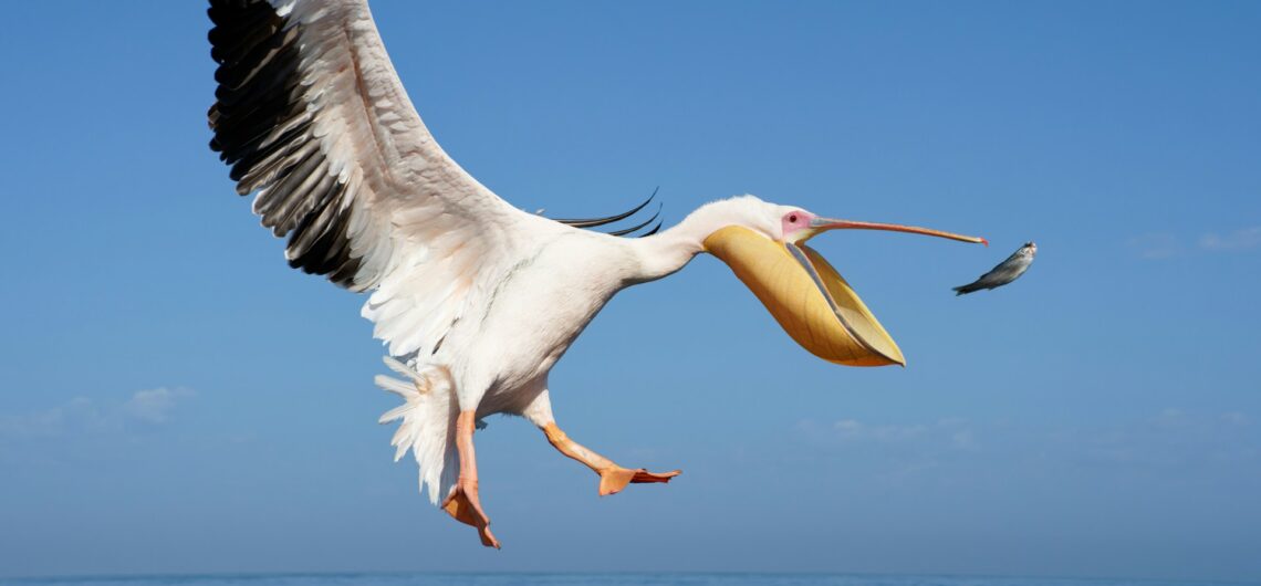
In the wet season, this famous salt pan in Namibia fills with water and turns into a shallow, silver lake, drawing huge flocks of flamingos and white pelicans, which will breed there in their thousands. 

It is this extraordinary duality, barren and then fertile, silent and then suddenly filled with life, that has made the famous salt pan of Namibia one of the most talked-about natural wonders in all of Africa.

Is the Salt Pan of Namibia a Good Filming Location?

This famous salt pan of Namibia has long been alluring to cinematographers and directors who are looking for landscapes that are, in a word, surreal.

The pan’s almost featureless horizon, its capacity to reflect light in the most unusual ways, and the scale of its emptiness make it a natural studio without walls.

Perhaps most famously, the Etosha Pan was used as a backdrop during the filming of Stanley Kubrick’s 2001: A Space Odyssey, which sort of tells you all you need to know about just how alien this landscape actually looks. 

But, aside from its movie star quality, this famous salt pan of Namibia also attracts wildlife filmmakers, documentary crews, and commercial productions who want imagery that is impossible to replicate anywhere else. 

The quality of light here is especially extraordinary, particularly at dawn and dusk when the pan takes on a rosy, amber glow. 

Add to that the surrounding Namib Desert, the Skeleton Coast, and the remarkable Sossusvlei salt pans further to the south, and Namibia becomes something of a filmmaker’s pilgrimage (and just the place for photographers too!).

etosha national park best time to visit

Is the Salt Pan Safe?

The famous salt pan of Namibia is safe to visit, and for most travellers, a guided luxury safari is the better option, because all of the logistics are arranged on your behalf, and you don’t have to do any of the driving.

Within Etosha National Park, the pan is fully protected, well-managed, and accessible via established game-drive routes. 

Visitors do not walk out onto the pan itself, both for conservation reasons and for practical ones, too.

The surface can be deceptively soft and unstable in places, particularly after rainfall. During the dry season, the hard clay crust is firm, and the landscape becomes a lot more stable. 

The pan has no trees and no shade, and the glare of the sun on any given day can hurt the eyes. When visiting the famous salt pan of Namibia, you’ll want to pack some sun protection and sunglasses. Dust devils are also not all that uncommon during spring and early summer, and the salt-laden air can be sharp on the senses.

What the famous salt pan of Namibia is not, however, is dangerous in the way a more traditional safari destination might be. 

The wildlife you are likely to encounter while visiting the pan includes elephant, lion, rhino, giraffe, and cheetah, which is precisely why having a knowledgeable guide alongside you can make the whole experience really something special.

Etosha National Park has managed accommodation camps, clearly marked roads, and rigorous safety protocols, making it an ideal introduction to the Namibian wilderness for first-time visitors (and a great place for a safari).

Elephant at the Etosha Salt Pan

What is the Salt Pan Made up of?

Beneath its pale, glittering surface, the famous salt pan of Namibia has a remarkable geological background.

The Etosha Pan began forming approximately ten million years ago through tectonic activity that gradually redirected the flow of the Kunene River.

What had once been a substantial inland lake slowly dried out as its water source was diverted toward the Atlantic Ocean, leaving behind an endorheic basin, meaning a closed system with no outflow to the sea.

The surface you see today is primarily made up of dried alkaline clay, which fractures into distinctive shapes as it contracts and cracks in the heat.

Now you probably wonder why it is called a salt pan, if the pan is actually filled with clay.

Well, this clay is rich in mineral salts, including sodium chloride and calcium carbonate, which give the pan its characteristic white and greenish colouring.

The green tint comes from blue-green algae living within the mineral crust, one of the very few organisms capable of surviving in such hypersaline conditions. Brine shrimp and other extremophile microorganisms also inhabit the pan.

When seasonal rivers such as the Ekuma and the Omurambo Ovambo carry water into the basin during good rainy years, the pan briefly becomes a shallow lake, no deeper than 10 centimetres, and its salinity rises to roughly double that of seawater.

There are also a number of salt springs scattered across the pan that have built up small clay and mineral hillocks over centuries, which wildlife use as natural salt licks. 

The Etosha Pan is a living geological record, and to this day, it is still shifting and reshaping, and it is still as extraordinary as it has been for millions of years.

Etosha Salt Pan Tour

Why did Top Gear and The Grand Tour Film in Namibia?

Now for something fun, especially if you’re a Top Gear fan.

Namibia’s reputation as a filming location is precisely what drew both Top Gear and The Grand Tour to film here.

Jeremy Clarkson, Richard Hammond, and James May first crossed Botswana’s Makgadikgadi salt pans in the beloved Top Gear Botswana Special, driving 1 000 miles in second-hand cars from the Zimbabwe border through to the Namibian border.

Then, when the trio reunited for The Grand Tour on Amazon Prime, they returned to southern Africa and headed directly for Namibia.

In the two-part special titled The Beach (Buggy) Boys, which aired over New Year’s 2016 as the seventh and eighth episodes of the show’s first series, Clarkson, Hammond, and May drove three custom-built beach buggies along Namibia’s Skeleton Coast, making their way across the Namib Desert in an attempt to prove their producer Andy Wilman wrong about beach buggies. 

The famous salt pan of Namibia played a big role in the ensuring drama.

Arriving at the Skeleton Coast’s edge, the trio found themselves blocked by the government-protected salt pans, which they were, understandably, strictly forbidden from crossing, and they were forced to race the incoming Atlantic tide back down the beach. 

The wreck of the Eduard Bohlen, a German cargo ship that ran aground on the Skeleton Coast in 1909, also featured hauntingly in the opening scenes. 

For any fan of the show, watching it back with a Namibia itinerary in hand is a surprisingly fun and creative way to plan a trip.

Come and see the famous salt pan of Namibia for yourself!

Namibia Safaris specialises in guiding guests on curated, luxury journeys through Namibia’s most extraordinary landscapes, with itineraries customised to your pace, your style, and your sense of wonder. 

Start planning your Namibia safari today.

The most famous salt pan in Namibia is the Etosha Pan, a 4,800-square-kilometre expanse in northern Namibia whose name means ‘Great White Place’ in the Oshindonga language. Namibia is also home to the celebrated Sossusvlei salt and clay pans in the Namib Desert.

The dry season, from May through October, is the best time to visit the famous salt pan of Namibia, when wildlife gathers at waterholes, and the pan gleams at its most dramatic. For flamingo sightings, the wetter months of January through March can be equally rewarding.

Visitors are not permitted to walk out onto the Etosha Pan, which is a protected conservation area with an unstable surface in places. All game-viewing is conducted from vehicles along designated roads within the park.

Etosha National Park is home to lion, elephant, black and white rhinoceros, leopard, cheetah, giraffe, zebra, and gemsbok, alongside over 340 recorded bird species. In wetter seasons, the famous salt pan of Namibia draws flamingos and great white pelicans to breed in their thousands.

The Etosha Pan formed over approximately ten million years after tectonic activity redirected the Kunene River toward the Atlantic, cutting off a large inland lake and leaving behind mineral salts and alkaline clay. It is an endorheic basin with no outflow to the sea, still shaped by seasonal flooding and wind erosion today.

About the Authors African Travel Concept Namibia Team

At African Travel Concept Namibia, our team of experienced travel and safari professionals is dedicated to turning first-hand African expertise into clear, reliable advice. We research, review, and refine every article so you have the most current and accurate information when planning your trip.

A Kalahari Desert map doesn’t do this exquisite place much justice.

The Kalahari Desert is one of the most exquisite places to travel, and like most of Southern Africa, it is one of the most unforgiving for those who don’t know enough about it.

Situated right on the Tropic of Capricorn, with temperatures averaging well above 40°C (104 °F) during the summer months and barely a drop of rain (although enough for the desert to not strictly speaking be a desert), the Kalahari is largely inaccessible to most travellers.

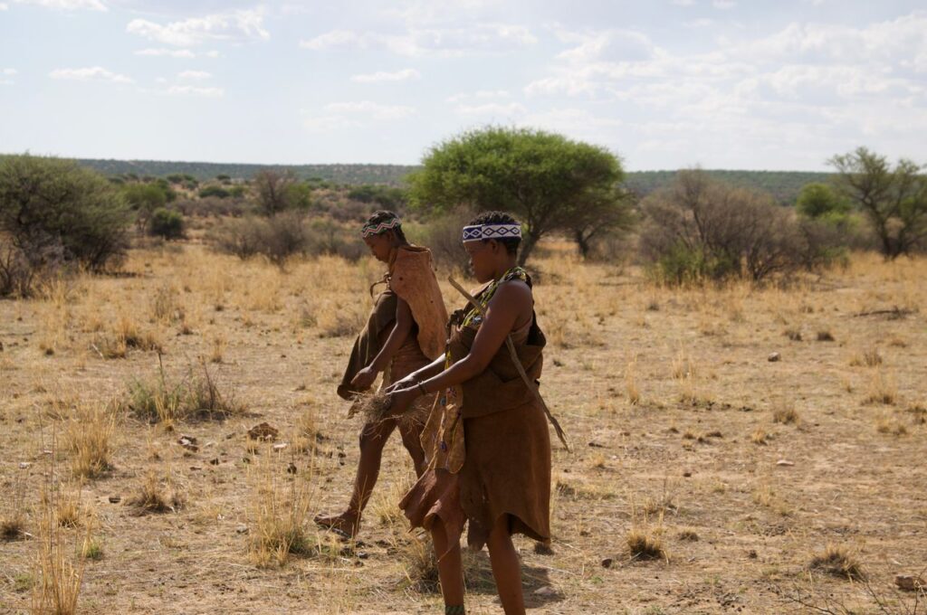
But for those who do take the leap and book a tour of the Kalahari Desert, its red dunes, its resident black-maned lions, and the San people who have called it home for twenty thousand years, make a holiday here unlike any adventure you’ll ever have.

How Big is the Kalahari Desert?

The Kalahari Desert covers a massive 930 000 km². This makes it the world’s largest continuous stretch of land.

The Kalahari is about 4 times the size of the UK, and it is bigger than the US state of Texas.

The broader Kalahari Basin, which includes the semi-arid regions surrounding the desert, extends to over 2.5 million square kilometres, spanning across southern Africa.

Its longest north-to-south span stretches approximately 1 600 kilometres, and its greatest east-to-west width reaches around 1 000 kilometres. It is, in other words, a place that takes some time to properly explore.

As a desertscape, the land is rather featureless in that it doesn’t have mountains or deep valleys, though it does have rocky kopjes, where the sand has given way to bedrock, and vleis. The entire area sits about 900 meters above sea level, and most of the ground is characterised by dunes.

While the Kalahari Desert might not be the biggest, it does have a bit of a reputation for being uninhabitable and remote. Those who plan a trip to see this fascinating destination have to think really carefully about every detail, down to the last shred of toilet paper.

For this reason, and due to the wide swaths of nothingness between camps and entrances, it’s always a better idea to book a guided excursion. This way, you’ll get to see all of the best sights, while having to deal with very little of the logistics!

Kalahari Desert Map
Kalahari Desert Map

Is the Kalahari Only in Namibia?

That the Kalahari Desert is only in Namibia is one of the most common misconceptions about the region.

A Kalahari Desert map will show you that it actually spreads across three countries.

It covers the majority of southern Botswana, it spreads out across the eastern third of Namibia, and reaches into the Northern Cape province of South Africa.

The broader Kalahari Basin extends further still, with fingers reaching into Angola, Zambia, and Zimbabwe.

Because the desert spreads out across so many borders, a trip to see it is a great way to have a cross-border adventure, one that will take you to places so many other travellers simply don’t get to see.

Starting your journey in the middle of Botswana, guided by “bushmen” (it’s not a slur, but rather an endearing way of giving a nod to the incredible indigenous people whose knowledge about this land is inimitable), is a wonderful way to get travelling.

From there, you can venture further south, visiting Namibia first.

Namibia’s portion of the Kalahari Desert is characterised by those iconic deep red and terracotta dunes that have made the region so immensely popular with landscape photographers.

It is also home to part of the Kgalagadi Transfrontier Park, a conservation area that is also shared between Namibia, Botswana, and South Africa and covers over 38 000 square kilometres of protected semi-desert wilderness.

Those planning a Kalahari Desert safari, and who are looking at a Kalahari Desert map, will see that the Namibian section provides some of the most dramatic and rewarding landscapes the region has to offer, but it is still best experienced by visiting all three of the regions that the desert spreads out across, as each is unique.

Driving Through the Kalahari Desert

How Hot Does the Kalahari Desert Get?

What a Kalahari Desert map can’t show you is that this part of the world can get blisteringly hot, but it’s a lovely dry heat, not that suffocating humidity that you experience when travelling along the eastern part of Africa, in places like the Kruger.

Summer is naturally the hottest time of the year, with temperatures across the Kalahari regularly reaching 40 degrees Celsius (104 degrees Fahrenheit) and can climb higher in particularly intense seasons, or when the area is in the grips of El Niño or drought.

The driest, sunniest parts of the desert record well over 4 000 hours of sunshine every year, placing it among the most solar-intense environments on earth.

What makes the Kalahari a particularly dramatic destination, in terms of the weather, however, is that the temperatures have a bit of a mood swing between day and night.

After a punishing day where the heat exceeds 40 degrees, the nights, especially during the winter, can drop to zero degrees Celsius or below.

Even frost is not unheard of in the lower-lying areas during June and especially July, when winter is at its coldest.

And in the middle of summer, December through February, you’ll not only have peak heat but also a brief and theatrical rainy season, when afternoon thunderstorms roll in fast and drench the landscape before passing just as quickly.

The result, in the days that follow, is a flush of green across the red sand that disappears almost as quickly as it arrives.

Rainy Season in Namibia

Is There Rainfall in the Kalahari Desert?

On a precipitation Kalahari Desert map, you’ll see that the region gets far more rain than a true desert would receive, which is precisely what makes the Kalahari such an ecologically interesting place.

The driest areas in the south and southwest receive as little as 110 and 200 millimetres of rain per year.

Because the Kalahari’s sandy soils absorb rainfall almost immediately, leaving the surface bone dry even after a downpour, the area can maintain its classification as a desert despite the precipitation it receives.

Technically, it is a fossil desert, with its dunes being a reminder of the Kalahari’s much drier geological past.

The north and the east of the desert are a little wetter, getting more than 500mm of rain every year. Comparing this to the eastern part of Africa, which can get as much as 600mm or more, you can see that 500mm is actually quite a lot.

Because of this delightful extra rainfall, much of the northern Kalahari looks nothing like a desert at all!

When driving up here, it’s all open woodlands, tall swaying grasses that turn green after the rain, baobab trees, and, in the extraordinary case of the Okavango Delta in Botswana, a permanent inland river delta that supports one of the richest wildlife ecosystems on the continent.

The Okavango is, in fact, the only permanent river that flows through the Kalahari.

The Kalahari also has a few ancient dry riverbeds known as omuramba, which cross the central and northern areas. When the seasonal rains fall, these riverbeds briefly come back to life, giving the animals a source of water.

Meerkats in the Kalahari Desert

Why is the Kalahari Desert Famous?

You would think that its looks alone would be more than enough to make the Kalahari famous, but while its sweeping red dunes, the pale grasses, the camelthorn acacia trees that cast long shadows across orange sand have given it a name, there’s much more to the desert than its appearance.

It is the kind of place that photographs beautifully and, in person, it is even more extraordinary than the images suggest.

It is also famous for the San people, one of the oldest continuous cultures on earth, who have lived in the Kalahari for at least 20 000 years and whose knowledge of the landscape, its plants, its water sources, and its animals is genuinely encyclopaedic.

The Kalahari is also known for the Kgalagadi Transfrontier Park, which has been consistently rated among Africa’s finest safari destinations for its predator sightings and its remote camps.

And beneath its sands lies Dragon’s Breath Cave, home to the largest documented non-subglacial underground lake on earth, a body of water so huge it was only fully explored in the 1980s!

Kalahari Desert Lions

What Animals Are in the Kalahari Desert?

Although the desert is a dry and unforgiving place, the Kalahari is far from being barren and is home to a variety of animals.

Large predators include lion, leopard, cheetah, spotted hyena, brown hyena, and African wild dog.

The black-maned Kalahari lion is among the most exciting and sought-after sightings in the desert. These lions are larger and darker-maned than their counterparts in other ecosystems, and they have become adapted to the harsh conditions of the semi-desert.

Gemsbok (oryx) can also be seen here, and they are the quintessential Kalahari herbivore, built for extreme heat and able to allow their body temperature to rise to 45 degrees Celsius without organ damage.

Springbok, red hartebeest, blue wildebeest, eland, and kudu can also be seen here, and in good numbers too!

Meerkats are another quintessential Kalahari animal with their upright sentinel posture against a red dune, creating some of the most iconic images in African wildlife photography.

Smaller residents include the honey badger, Cape fox, black-backed jackal, aardvark, and the ground squirrel, whose tail doubles as a portable parasol.

And if you are visiting for the birds, you’re in luck!

200 bird species have been recorded in the Kgalagadi alone, including the sociable weaver, whose enormous communal nests weigh up to a ton and house hundreds of birds in a single structure.

Kalahari Desert Landscapes

Pack your bags, pick up a Kalahari Desert map and see why so many travellers rave about this incredible destination.

The Kalahari sits in the centre of southern Africa, spanning eastern Namibia, most of Botswana, and the Northern Cape of South Africa. On a Kalahari Desert map it appears as a vast inland plateau bordered by the Namib Desert to the west, the Limpopo River system to the east, and the Orange River to the south. It lies between approximately 17 and 29 degrees south latitude.

Yes. The Kalahari is a well-established safari destination with a range of lodges, camps, and guided experiences suited to different budgets and travel styles. Travelling with a reputable operator such as Namibia Safaris ensures all logistics, safety, and wildlife encounters are expertly managed.

The dry season from May through September is generally considered the best time for game viewing, when animals concentrate around water sources and the vegetation is lower, making sightings easier. The green season from November through March brings dramatic skies, newborn wildlife, and far fewer other visitors.

Technically, no. On a Kalahari Desert map, the region might look arid, but it receives significantly more rainfall than a true desert by geological definition, and much of it supports abundant grass, shrubs, and woodland vegetation. It is more accurately classified as a semi-arid savanna or fossil desert, its ancient dune landscape a remnant of a much drier geological period around 60 million years ago.

Not all five in the traditional sense. The Kalahari is home to lion, leopard, and buffalo, but elephant and rhino are not naturally resident across most of the desert, though some private reserves have reintroduced them. The Kalahari’s real wildlife draw is its predator density and the remarkable adaptations of its resident species, from black-maned lions to gemsbok to meerkats.

About the Authors African Travel Concept Namibia Team

At African Travel Concept Namibia, our team of experienced travel and safari professionals is dedicated to turning first-hand African expertise into clear, reliable advice. We research, review, and refine every article so you have the most current and accurate information when planning your trip.

It has a reputation for being one of the driest countries on earth. But once a year, during the rainy season in Namibia, the heavens open and the land is doused in life giving water.

Namibia receives just 285mm (just 11 niches) of rain, and most of it falls in the north east corner of the country, on the border of Botswana.

By comparison, the United States gets about 760–890 mm (30 to 35 inches) and the UK gets well over 1,000 millimetres!

Despite the lack of rainfall, Namibia’s wildlife and plant life have perfectly adapted to the arid conditions and not all of the moisture comes from rain.

The desert’s switch between intense heat during the day and intense cold at night creates a great deal of dew, just enough to sustain life.

The rainy season in Namibia is a great time to plan a trip, because you’ll be treated to both sides of this incredible, lesser-visited places.

The Namib Desert

What is the Rainy Season in Namibia?

The rainy season in Namibia runs from approximately November through to April, with the intensity building through December and peaking between January and March.

Rain rarely falls as a prolonged downpour.

Instead, it arrives in the late afternoon as short, dramatic thunderstorms that roll in quickly, drench the landscape, and pass just as fast as they came.

By morning, the sky is clear and the air has a freshness to it that the dry season cannot match.

The northeast, including the Zambezi Region (formerly the Caprivi Strip), receives the heaviest rainfall, up to 700 millimetres annually.

Central areas such as Windhoek average around 370 millimetres per year, with the bulk falling between January and March.

The Namib Desert coastline receives almost nothing at all, sometimes under 20 millimetres in a full year, making it one of the driest places on the planet.

What the rainy season in Namibia produces is absolute beauty.

After months of dryness, the occasional showers, turn the parched red and ochre landscapes a little green, bringing the plants back to life.

For many seasoned travellers, this version of Namibia is their favourite.

Windhoek thunderstorm

What is the Wettest Month in Namibia?

February consistently ranks as Namibia’s wettest month, with rainfall levels across both the central and northern regions at their highest.

In Windhoek, February averages about 80 millimetres of rain, the most of any month, and in the far northeast, the Zambezi Region sees an average of eight to ten rainy days per month through midsummer.

The season of 2025 saw rather high February rainfall, the wettest in sixteen years according to climate records, and a good reminder that the rainy season in Namibia, while broadly predictable in its timing, remains beautifully unpredictable in its intensity from one year to the next.

January runs a close second to February in terms of total precipitation, and the two months together represent most of the wet season.

By March, the rains are still hanging about but will usually begin to ease, and by April, the skies begin to clear, and the land stays green.

What is the Best Month to Visit Namibia?

For most travellers, the dry season months of May through October are the most popular time to visit, and for good reason.

Game viewing at this time of the year is at its finest. The lack of rainfall dries out the land to such a degree that the vegetation dies back and thins completely, and animals start frequently the last of the permanent waterholes, particularly in Etosha National Park.

If you are travelling at this time of the year, you can expect cool weather and no rain at all. The roads are more accessible, and the clarity of the light is extraordinary, making it just the time to visit if you are a keen photographer.

June through August is midwinter, with cool days and cold nights, while September and October bring the start of spring, warmer days, and excellent wildlife sightings alongside spectacular dusty sunsets.

That said, the green season between November and April can be a great time to see Namibia, particularly for birdwatchers.

Over 600 bird species have been recorded in Namibia, and the majority of the migratory species arrive with the rains.

How to Choose a Safari Company to See Wildlife

Does Namibia Get a Lot of Rain?

Namibia is the second driest country in sub-Saharan Africa, after the Sahara.

Over 70 percent of the country receives less than 400 millimetres of rainfall annually, which is considered the minimum threshold for dryland agriculture in a hot climate.

The Namib Desert, one of the oldest deserts on earth at an estimated 55 million years old, receives almost none. Even during the rainy season, much of the south and west of the country remains dry.

What rain does fall is strongly seasonal, concentrated to the summer months, and often erratic from one year to the next.

As you could imagine in a desert nation, prolonged droughts are not unusual, and the country’s water security relies heavily on dams and groundwater reserves rather than rainfall alone.

This scarcity is, paradoxically, part of what makes Namibia such an exciting place to visit.

The absence of water quite literally determines the landscape, the wildlife behaviour, the quality of the light, and the stark, sculptural beauty that photographers travel from across the world to capture.

Etosha Salt Pan Landscape

What Sort of Climate Does Namibia Have?

Namibia has a predominantly arid to semi-arid climate, though the country is so big that it has plenty of regional variation.

The Namib Desert coastline, home to the Skeleton Coast and beautiful towns like Swakopmund and Walvis Bay, is cool, frequently foggy, and almost entirely dry, and its kept that way by the cold Benguela Current that flows northward along the Atlantic shore.

Namibia’s central plateau, where Windhoek sits at 1 700 metres above sea level, is semi-arid. It has delightfully warm to hot summers, and mild winter days and cold winter nights with occasional frost in lower-lying areas.

The far north and northeast, including Etosha and the Zambezi Region, are warmer and wetter, with more tropical characteristics during the rainy months.

One thing that is consistent across the country, though, is the sunshine!

Namibia averages around 300 days of sunshine per year, making it one of the sunniest countries on earth, regardless of season. For travellers, this means that even during the rainy season in Namibia, most days begin and end in full, clear light.

Etosha is one of the Best Places for Namibia Safaris in 2026

The rainy season in Namibia is an unforgettably beautiful time to travel, and at Namibia Safaris, we can help you plan the ultimate trip so that you can make the most of this time of the year.

Yes, for the right traveller. During the rainy season in Namibia, plains that appear almost monochrome during the dry months soften into shades of sage and emerald, and the quality of light during this time is quite extraordinary for photography. Birdlife is at its most abundant, with migratory species arriving in impressive numbers, and rates at lodges and camps are often significantly lower than during peak dry season. The trade-off is that some roads, particularly in remote areas, become difficult or impassable, and game viewing requires considerably more patience than it would in the drier months.

It does change the character of it, though not necessarily for the worse. During the rains, animals no longer need to congregate at waterholes because water is widely available, so sightings require more searching and a slower pace. However, predator activity is often higher as prey is more widely dispersed, making encounters exciting because they are less predictable. This time of year is also the newborn season, which brings plenty of young animal sightings from around January onwards, which in turn attracts predators and creates some of the most dramatic wildlife moments of the year. Namibia’s big cats, in particular, are well worth looking for during this period.

Etosha is usually most popular during the dry season, when thousands of animals gather at the pan’s waterholes in great concentrations. During the rains, the pan can partially flood and with more water sources the wildlife disperses across the wider reserve, making sightings less predictable. That said, the park remains open year-round and can be stunning during greener months. Birdwatching, particular, is at its very best, with flamingos sometimes appearing on the flooded pan in large numbers.

Light, breathable clothing is essential for getting through those hot and humid days, but packing a good waterproof layer for afternoon storms is equally important as showers can be sudden and heavy. Temperatures drop nicely after the rain showers, so it’s a good idea to pack a light fleece or a wrap. Insect repellent is non-negotiable during the wet months, as mosquito activity increases significantly across many regions. You should consult a travel health professional about malaria precautions well before departure. Finally, you’ll want to pack comfortable, closed-toe shoes with good grip, as paths and lodge grounds can become slippery after rain.

The rains ease up significantly by April and have typically stopped altogether across most of the country by early May. April itself is often a beautiful month to visit. The land is still green and fresh, the air is remarkably clear, and temperatures have dropped pleasantly from their January and February peaks. Roads are drying out, wildlife is beginning to concentrate again as water sources diminish, and the lodges are noticeably quieter than they will be, come the dry season rush. It is one of Namibia’s most underrated travel windows.

About the Authors African Travel Concept Namibia Team

At African Travel Concept Namibia, our team of experienced travel and safari professionals is dedicated to turning first-hand African expertise into clear, reliable advice. We research, review, and refine every article so you have the most current and accurate information when planning your trip.

Mysterious and strange things are not reserved for the movies.

All around the world, there are unique landforms that seemingly have no explanation for their origins or purpose, and for travellers, stumbling across such fascinating features really adds that special something to a tour.

Within Namibia’s extensive, almost moonlike landscapes, the mysterious and unusual are abundant, but one stands out as a constant source of intrigue.

Local stories shared by the Nama people say that dragons once breathed their poison into the desert floor, leaving behind lifeless circles where nothing could grow.

And scientists, through their research, have proposed less theatrical theories, but the truth is still debated about what exactly created the fairy circles of Namibia.

Scattered across the Namib Desert are thousands of these strange, barren circular patches, and they continue to challenge everything we think we understand about Namibia’s ecosystems.

What are the Fairy Circles of Namibia?

The fairy circles of Namibia have long enchanted scientists, locals, and curious travellers in equal measure.

Although the name sounds whimsical, the fairy circles are essentially bare, circular patches of earth, perfectly devoid of grass, that appear in their millions across the desert grasslands.

They range from two to fifteen metres in diameter, and they hold their shape with an almost unsettling precision.

Edged by a fringe of taller, lusher grass, each circle looks as though it has been placed there, as though the land itself is making art.

The San people, indigenous to this region, have their own explanation. They believe that the circles are the footprints of the gods. Scientists, on the other hand, have been less poetic, but no less fascinated, and neither group has fully closed the case.

The fairy circles of Namibia are not the only place such a phenomenon has been spotted. In 2016, similar formations were identified in Western Australia, adding to the mystery.

Where are Fairy Circles Located?

Fairy circles of Namibia stretch along a narrow coastal strip of the Namib Desert, running roughly 2 000 kilometres from central Namibia down into the Northern Cape of South Africa.

The most spectacular concentrations of the circles are found in the NamibRand Nature Reserve, one of Africa’s largest private nature reserves and one of the most remote and spectacularly beautiful places on earth (it is also the best place to go stargazing!).

In the reserve, the circles seem to go on forever, spreading out across the savannah in patterns so consistent and precise that you might think that they were engineered.

If you are looking for a place to stay so that you can spend your time exploring the circles, then the small desert town of Sesriem, with all of its oddities, is just the place.

Fairy circles of Namibia
Image sourced from Wikipedia

What Causes Fairy Circles in the Desert?

For decades, the cause of fairy circles of Namibia inspired one of science’s most spirited debates, meaning, they just didn’t have an answer as to what created them.

The first theories to be made public ranged from a rather worrisome radioactive soil theory to poisonous gases being released by unknown underground plants.

Then came the termites.

In 2013, a study by Norbert Juergens proposed that sand termites (Psammotermes allocerus) created the circles by killing the vegetation above their nests, and creating water-retaining bare patches that would sustain their colony throughout the dry season.

The theory generated plenty of interest, and the research was rigorous, but it was not the last word on the origin of the circles.

In 2017, a competing study suggested something entirely different: self-organisation.

According to this model, plants experiencing water stress, particularly droughts, compete for the limited resources and naturally space themselves out into patterns, creating the bare patches as a by-product of their survival strategy.

The most current thinking, published in 2022, actually leans towards both forces working in tandem.

Termites and vegetation dynamics appear to reinforce each other, producing the remarkable regularity that makes fairy circles of Namibia so interesting.

What is the Most Visited Place in Namibia?

Sossusvlei, the iconic salt and clay pan surrounded by some of the world’s tallest sand dunes, is widely considered the most visited destination in Namibia.

The apricot and crimson dunes of the Namib-Naukluft National Park, where you’ll find Sossusvlei, attract photographers, nature lovers, and luxury travellers from across the globe, and for good reason: it is a landscape that is guaranteed to stop you in your tracks.

Nearby, you’ll find the haunting dead trees of Deadvlei that rise from a bleached white pan, creating one of the most photographed scenes on the continent.

Not far from this iconic stretch, the NamibRand Nature Reserve places you in prime fairy circle Namibia territory, where guided walks and sundowners will give you the most memorable encounters with this phenomenon.

Other places in Namibia that are rather popular include Etosha National Park, which remains one of Africa’s greatest wildlife sanctuaries, Swakopmund, perched where the desert meets the Atlantic, and the Skeleton Coast.

Flying Safaris in Namibia

What to do in Namibia as a tourist?

Namibia is popular for slow, considered travel, the kind where you wake before dawn to watch a dune turn gold, or stay up late enough to count more stars than you thought could possibly exist.

As a tourist visiting Namibia, these are just a few of the things you can do:

Walk among the fairy circles of Namibia.

A guided excursion into the NamibRand Reserve will allow you to see these perfect, barren circles that are scattered across the ochre grassland and have baffled scientists and enchanted visitors for decades.

Climb the dunes at Sossusvlei.

Dune 45 and Big Daddy are bucket-list moments, best experienced at sunrise when the light is golden and the air is still cool. The dunes here are among the tallest in the world, their deep terracotta flanks shifting in colour as the morning progresses from pale blush to vivid amber.

The descent, running or sliding through the soft sand, will fill you with a childlike, feel-good joy that will hang around for the rest of your trip.

Nearby, you’ll see the bleached trees of Deadvlei rising from a white clay pan, creating one of the best photo opportunities.

Go on a game drive in Etosha.

Elephants, lions, rhinos, and giraffes all gather at Etosha’s waterholes, delighting everyone on safari.

The park is built around a massive salt pan that is visible from space, and the contrast of pale, mineral white against the green-tinged bush is like nothing else in Africa.

Etosha is also one of the best places in Africa to spot the endangered black rhino, and a sighting, even a distant one, will become one of the best parts of your Namibia safari.

Sleep under the stars in the desert.

Namibia has some of the darkest skies in the world, and the NamibRand Reserve, an International Dark Sky Reserve, is the best place to do a little stargazing.

With almost no light pollution for hundreds of kilometres, the Milky Way appears as a vivid, sweeping arc of dazzling light overhead.

Many lodges in the region have open-air sleeping decks, star beds set away from the main camp, or guided night walks that include telescopes.

Explore Swakopmund.

This coastal town, with its German look and cold Atlantic ocean breezes and excellent restaurants, is a wonderful place to stop for a while.

The air is cool and salt-tinged, a welcome relief from the heat of the interior. While it is a town known for its vibe and excellent seafood, Swakopmund is also an adventure hub, with dune boarding, quad biking, and kayaking with seals all on offer.

For those who don’t want the adrenaline rush, the town’s independent boutiques, art galleries, and coffee houses are all great spots to spend an afternoon.

Seals on the Skeleton Coast

Visit the Skeleton Coast.

Few places on earth carry a name as evocative or, quite honestly, as accurate.

This remote stretch of Atlantic coastline is strewn with the bleached bones of whales, the rusted hulls of shipwrecks, and a seal colony that numbers in the hundreds of thousands.

It is windswept and profoundly beautiful, but access is restricted, keeping it among Africa’s most pristine wilderness areas.

See the ancient rock engravings at Twyfelfontein.

One of Africa’s greatest concentrations of rock art can be seen at Twyfelfontein, a UNESCO World Heritage Site where thousands of engravings have been carved into sandstone over the past 6 000 years.

Giraffes, elephants, lions, and human figures are etched softly into the rock surface, showing the deep relationship between the San people and the land they called home.

A guided walk through the site is the best way to see it.

Take a scenic flight over the dunes.

Seeing Namibia from the air is like seeing it with new eyes.

A light aircraft or helicopter flight over Sossusvlei will show you the true geometry of the dunes; the way their crests curve and the shadows that pool between them.

Flights over the Skeleton Coast or the Hartmann Valley in the remote northwest will also show you the real scale of these places, something that ground-level travel simply cannot provide.

Quiver Trees and Stars

Some Places You Have to See to Believe

Namibia is one of those places, and the fairy circles are just the beginning.

Let Namibia Safaris design a journey as extraordinary as the land itself.

Book your tour today, and let us take care of the rest.

Not at all. Fairy circles in Namibia are entirely safe to walk through and around. Visitors exploring the NamibRand Nature Reserve can stand in the circles, observe them up close, and even lie in the centre looking up at the desert sky. The only thing you need to be mindful of is the sun.

Fairy circles in Namibia are visible year-round, but the green season (January to April) brings the surrounding grasses to life, making the contrast between the bare circles and the lush edges particularly striking. The dry winter months (May to October) offer clearer skies and cooler temperatures, which is ideal for walking and game viewing.

Fairy circles in Namibia are visible year-round, but the green season (January to April) brings the surrounding grasses to life, making the contrast between the bare circles and the lush edges particularly striking. The dry winter months (May to October) offer clearer skies and cooler temperatures, which is ideal for walking and game viewing.

Yes, and it is one of the most extraordinary ways to experience them. Scenic hot air balloon flights and light aircraft trips over the NamibRand Nature Reserve offer a bird’s eye view of the fairy circle of Namibia patterns stretching endlessly across the desert floor. Seen from above, the regularity and scale of the formations are truly breathtaking.

The NamibRand Nature Reserve is approximately one to two hours’ drive from Sossusvlei, depending on your starting point. Many luxury lodges in the area position guests perfectly to visit both destinations as part of a seamless desert itinerary.

Yes. Since 2016, scientists have documented similar circular formations in the arid grasslands of Western Australia, near the town of Newman. However, the most famous, most studied, and most visually dramatic examples remain the fairy circles of Namibia.

About the Authors African Travel Concept Namibia Team

At African Travel Concept Namibia, our team of experienced travel and safari professionals is dedicated to turning first-hand African expertise into clear, reliable advice. We research, review, and refine every article so you have the most current and accurate information when planning your trip.